First major storm of the season drops up to a foot of snow in Montana

- Share via
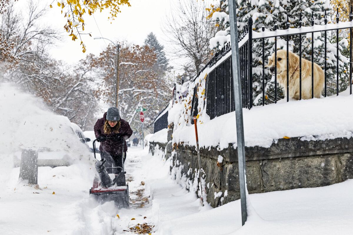
HELENA, Mont. — The first major snowstorm of the season dropped up to a foot of snow in the Helena, Mont., area by Wednesday morning, canceling some school bus routes on the western side of the city as snow continued to fall throughout the morning.
Residents woke up to swirling snow, the sound of shovels on sidewalks and snowplows on pavement just days after temperatures rose into the lower 80s. Trees with orange leaves and Halloween decorations were weighed down with snow.
The National Weather Service warned of hazardous travel on snowy mountain passes and ice on some highways when snow initially melts and then freezes as road temperatures drop.
The storm was forecast to come in waves, beginning with precipitation that fell Tuesday as rain at lower elevations in Washington state and as snow in the mountains. The snow was then forecast to spread across northern Idaho, Montana, northwestern Wyoming and North Dakota into Friday.
The first winter outlook from the National Oceanic and Atmospheric Administration predicts that a strong El Niño will remain in place through at least the spring, bringing warm, wet conditions to California and large swaths of the U.S.
Cold air moving down from northwestern Canada has combined with a moist Pacific weather system, leading to freezing temperatures and expected snowfall amounts up to 14 inches in Washington’s northern Cascade Mountains and up to 18 inches in the mountains of Montana, the National Weather Service forecasts. Some higher elevations in the northern Rockies could see snow totals of 2 feet or more.
Central Montana will see the worst of the snow, said Matt Ludwig, a meteorologist with the National Weather Service in Great Falls.
“We kind of are the bull’s-eye,” he said Tuesday.
The first snowfall of the season “is always the most dangerous because people just aren’t used to it yet” after driving for months on mostly dry pavement, Ludwig said. Drivers aren’t used to dealing with less traction, slower speeds and longer stopping distances, he said.
After the first 16 hours of the storm, it was Helena that saw the most accumulation. Some towns in central Montana reported 10 inches of snow, while other areas along the Rocky Mountain Front had 6 to 8 inches of snow.
The first wave of snow was forecast to continue falling through midday Wednesday, with a second round starting Wednesday night into Thursday morning, the National Weather Service said.
A strong El Niño could augur yet another wet winter for California, as well as drive the global average temperature to a record high, experts say.
Helena Public Schools canceled six school bus routes Wednesday morning and said it would keep its website and Facebook page updated.
Helena tied record temperatures in the lower 80s late last week, which is about 25 degrees above average for this time of year, Ludwig said. Great Falls also had a day in the low 80s late last week, and now those cities could see 8 inches of snow by Wednesday.
“If that’s not a shock to your system, I don’t know what is,” Ludwig said.
The Walmart store in Helena still had a display of kayaks outside, their prices nearly covered in snow.
The snow had also moved across northwestern and north-central North Dakota by early Wednesday, creating difficult travel conditions.
The area of Williston, Watford City and Minot, in North Dakota’s oil field, could receive the heaviest snowfall, potentially 8 inches to a foot, said Nathan Heinert, a meteorologist with the National Weather Service in Bismarck. Bismarck could see 4 to 6 inches of snow late Thursday after rain on Wednesday, he said.
More to Read
Sign up for Essential California
The most important California stories and recommendations in your inbox every morning.
You may occasionally receive promotional content from the Los Angeles Times.


