Punchbowl Trail Leads to Devil’s Chair
- Share via
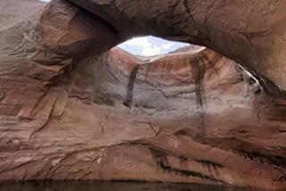
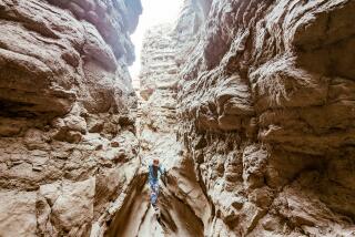
Southern California has many faults and the mightiest of these is the San Andreas. It’s responsible for many a crack and crevice and much slipping and sliding in the Southland. Nowhere is the presence of the fault more obvious than in Devil’s Punchbowl County Park. The dun-colored rocks have been tilted every which way and weathered by wind and rain. They are a bizarre sight to behold.
Punchbowl Trail takes you into the devil’s domain, a satanically landscaped rock garden on the desert side of the San Gabriel Mountains. The trip offers views of what seismologists call the San Andreas Rift Zone. If you’re superstitious, you’ll want to carry a good-luck charm in your day pack when you hike to the monstrous mass of white rock known as the Devil’s Chair.
The Right Time
“Bowl season” is a fine time to visit the Punchbowl. Winds scour the desert clean and from the Devil’s Chair, you can get superb views of this land, as well as the seemingly infinite sandscape of the Mojave.
Bring warm clothing. At this time of year, the devil’s domain can get very chilly.
Note that 6-mile-long Punchbowl Trail may be hiked from two directions. For aesthetic and logistical reasons, I prefer the route from the Forest Service’s South Fork Campground to Devil’s Chair.
The leg-weary or families with small children may wish to proceed directly to Punchbowl County Park. A one-third-mile nature trail, Pinyon Pathway, introduces visitors to park geology and plant life and a one-mile loop trail offers grand views of the Punchbowl. A picnic area is perched on the rim of the Punchbowl.
Directions to trailhead: From Pearblossom Highway (Highway 138) in Pearblossom turn south onto Longview Road, then briefly left on Fort Tejon Road and right on Valyermo Road. Follow Valyermo 3 miles to Big Rock Creek Road. Two and a half miles past this junction turn right on a signed dirt road to South Fork Campground and proceed one mile to the special day use/hiker’s parking lot below the campground. The road is suitable for passenger cars, but on occasion Big Rock Creek may be too high for a low-slung car to ford; you might have to walk an extra mile to the trailhead. The signed trail departs from the parking area.
If you want to go directly to Devil’s Punchbowl County Park, turn south on County Road N6 from Highway 138 in Pearblossom and follow it to Devil’s Punchbowl County Park. Punchbowl Trail begins near the picnic area.
The hike: Join the signed trail from the parking area below South Fork Campground. Almost immediately you’ll reach a trail junction. (The steep South Fork Trail follows the canyon cut by the South Fork of Big Rock Creek up to the Angeles Crest Highway at Islip Saddle. Save this fine trail, which ascends from cactus to pine, from desert to alpine environments, for another day.) Stay on the Punchbowl Trail and boulder-hop across the creek. If your imagination has already run away from you, perhaps the mythological Charon the Ferryman (who conveyed the dead to Hades over the River Styx) will carry you across this watercourse. The trail climbs through manzanita and heat-stunted pinyon pine to a saddle, where there’s a view of the park and its faults. Descend from the saddle, sloping down chaparral-covered slopes and over to Holcomb Canyon. Along the way, notice the strange dovetailing of three plant communities: yucca-covered hills, oak woodland, and juniper and piney woods.
You may wish to take a break near Holcomb Creek crossing. Oaks and big cone spruce shade the creek.
From Holcomb Creek, the trail ascends steeply up another ridge through a pinion pine forest to the Devil’s Chair. From a distance, those with fanciful imaginations can picture the devil himself ruling over this kingdom of fractured rock. Below the chair, there’s an awesome panorama of the punchbowl and its jumbled sedimentary strata. The somersaulted sandstone formation resembles pulled taffy. If you look west to the canyon wall, you can see the vertical crush zone of the fault, marked by white rocks.
Product of Erosion
The Punchbowl itself may have been the work of the devil or more likely it was a deep canyon cut by streams running out of the San Gabriel Mountains. Over millions of years, the streams tore at the sedimentary rock and eroded the steep and cockeyed rock layers of the Punchbowl formation. Originally horizontal, these layers of siltstone and sandstone were folded into a syncline (U-shaped fold) by the pincer action of earthly forces.
While visiting the Devil’s Chair, stay behind the protective fence; people have taken a plunge into the Punchbowl. Return to the trailhead the way you came or continue on the Punchbowl Trail to county park headquarters.
Above Devils Chair, the trail contours west and offers good close-up views of the Punchbowl. One and a half miles from the Chair, your route crosses Punchbowl Creek, briefly joins a dirt road, then bears right on the trail leading to the Punchbowl parking area.
Punchbowl Trail
South Fork Campground to Devil’s Chair: 6 miles round trip, 1,000-foot elevation gain.
South Fork Campground to county park headquarters: 12 miles round trip, 1,000-foot elevation gain.
More to Read
Sign up for The Wild
We’ll help you find the best places to hike, bike and run, as well as the perfect silent spots for meditation and yoga.
You may occasionally receive promotional content from the Los Angeles Times.


