Rim-of-the-World-Class View of San Gorgonio Wilderness
- Share via
Rim of the World Highway offers the traveler a fine view of Big Bear Lake. A better view, a hiker’s view, is available from Pine Knot Trail, which climbs the handsome, pine-studded slopes above the lake and offers far-reaching panoramas of the San Bernardino Mountains.
Big Bear Lake is a great place to escape the crowded metropolis, and Pine Knot Trail is a great way to escape sometimes-crowded Big Bear Lake.
The idea for Big Bear Lake came from Redlands citrus growers, who wanted to impound a dependable water source for their crops. Farmers and city founders formed Bear Valley Land and Water Co. and in 1884, at a cost of $75,000, built a stone-and-cement dam, thus forming Big Bear Lake. In 1910 a second, larger dam was built near the first one. This second dam is the one you see today.
Pine Knot Trail takes its name from the little community of cabins, stores and saloons that sprang up when Rim of the World Highway was completed. After World War II the town of Pine Knot changed its name to Big Bear Lake Village.
While Pine Knot Trail offers grand views of the lake, this hike’s destination--Grand View Point--does not overlook the lake. The grand view is a breathtaking panorama of the San Gorgonio Wilderness and the deep canyon cut by the Santa Ana River.
Directions to trailhead: From California 18 in Big Bear Lake Village, turn southwest on Mill Creek Road and proceed about a half-mile to Aspen Glen Picnic Area on your left. The signed trail departs from the east end of the picnic area by Mill Creek Road.
The Hike: From Aspen Glen Picnic Area, Pine Knot Trail climbs a low, lupine-sprinkled ridge. The lower part of the trail is popular with equestrians. The path follows a fence line for a short distance, then dips into and out of a willow-lined creek bed. You will get great over-the-shoulder views of the south shore of Big Bear Lake.
Ascending through Jeffrey pine and ponderosa pine forests, the trail meets and joins a fire road; after a short distance, it again becomes a footpath. Now your over-the-shoulder view is of the north shore of Big Bear Lake.
Pine Knot Trail passes near one of the runs of the Snow Forest Ski Area, then meanders through an enchanted area of castellated rocks. About 2 miles from the trailhead the trail intersects dirt Forest Service Road 2N17. Before you is a meadow, a rather amusing-looking landscape decorated with boulders, ponderosa pine, Indian paintbrush and skunk cabbage. Bear left on the dirt road for just 50 feet or so, then pick up the signed footpath again.
Passing black oak and willow, Pine Knot Trail skirts the moist meadow and soon arrives at Deer Group Camp. Benches and tables suggest a picnic or rest stop.
From the camp, continue on Pine Knot Trail, which crosses and then parallels another dirt Forest Service road. Ahead of you are tantalizing views of San Gorgonio Wilderness peaks--just a hint of things to come when you reach trail’s end.
About a mile from Deer Group Camp, the trail intersects dirt Forest Service Road 2N11. Cross the road and follow the signed trail on a quarter-mile ascent to the top of a ridgeline.
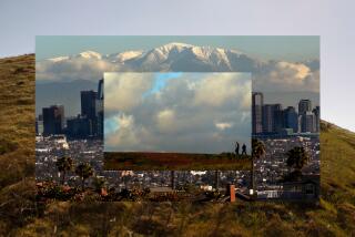
From Grand View Point, enjoy the views of the San Gorgonio Wilderness, a panorama of Southern California’s highest peaks.
Pine Knot Trail, Aspen Glen Picnic Area to Grand View Point: 6 1/2 miles round trip; 1,200-foot elevation gain.
More to Read
Sign up for The Wild
We’ll help you find the best places to hike, bike and run, as well as the perfect silent spots for meditation and yoga.
You may occasionally receive promotional content from the Los Angeles Times.


