Utah’s Picture-Perfect Kodachrome Basin Park
- Share via
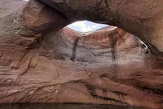
There is little doubt how this basin in the slickrock country southeast of Bryce Canyon National Park got its name. The colors of the rocks range from white to gray, with several shades of red. Tints vary dramatically depending upon weather conditions and the angle of the sun.
Utah’s Kodachrome Basin State Park is a delightful destination for photographers and hikers--even more delightful for hiking photographers, who can get up-close views and wide panoramas of the basin from park trails.
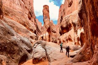
The most dramatic--and most-photographed--of the park’s rock formations are its many colorful spires or “sand pipes” that poke skyward from the floor of the basin.
Sand pipes, geologists speculate, were formed by a rare process known as seismically induced sediment liquefication. In more simple terms, the formations are mineralized rock remnants of underground springs that were created long ago by earthquakes. These ancient springs dried up, leaving behind solidified minerals, particularly calcite. Over the years, the softer sandstone of Kodachrome Basin eroded away, while the harder minerals--cemented together with calcite--were left standing.
Sixty-seven sand pipes, standing 6 to 160 feet high, tower above the basin; they are found here and nowhere else in the world. Grand Marshal, Dinosaur, Chimney Rock, Broken Geyser, Fred Flintstone and Ballerina Spire are some of the imaginative names.
The sand pipes became a popular tourist stop and picnic spot in the 1930s when a Civilian Conservation Corps crew built a road into the area that locals named Thorley’s Pasture after a local rancher. A 1949 National Geographic Society expedition was so taken by the colorful rock formations that it renamed the area Kodachrome Flat.
At first, the Kodak Co. objected to naming a region after its popular slide film, but when the locals began lobbying for state park status for the area--calling it Chimney Rock State Park--the company had a change of heart. Kodachrome Basin State Park was established in 1963.
The park offers a day’s worth of hiking and a very pleasant campground. A small store, Trailhead Station, offers food, supplies and film from April through September.
Hikers can choose from half a dozen trails. A short nature trail interprets the flora and geology of the region. Eagles View Trail (1 1/4 miles), which begins at the campground, is an old cattle-drive and pack trail that was reworked by local Boy Scout troops. The steep path offers a commanding, eagle’s-eye view of the basin.
Your best look at the main part of the park, including the majority of spires, is from the path that begins just down the road from Trailhead Station. You’ll hike past Sherlock Holmes Towers and other colorful spires, then join Panorama Trail to well-named Panorama Point. Figure about four miles round trip.
To visit Kodachrome Basin, you’ll turn off Utah 12, one of the most scenic byways in America, at Cannonville, 12 miles southeast of the Bryce Canyon National Park turnoff. Drive south seven miles on paved Cottonwood Canyon Road to the park.
Not to be missed is Grosvenor Arch, another 10 miles southeast of Kodachrome Basin down Cottonwood Canyon Road. This intricate double arch is one of Utah’s most impressive.
*
Take a hike with John McKinney’s guidebook: “Day Hiker’s Guide to Southern California” ($16.95). Send check or money order to Los Angeles Times Syndicate, Dept. 1, Times Mirror Square, Los Angeles 90053.
Utah
Panorama, Eagle’s View, Arch Trails
WHERE: Kodachrome Basin State Park, Utah.
DISTANCE: 3/4-4 miles round trip.
TERRAIN: Cliffs and basin; just as colorful as nearby Bryce Canyon.
HIGHLIGHTS: Vividly colored rocks and “sand pipes,” spires found only in this park.
DEGREE OF DIFFICULTY: Moderate.
PRECAUTIONS: Prepare for desert hiking, rapid temperature changes.
FOR MORE INFORMATION: Contact Kodachrome Basin State Park, P.O. Box 238, Cannonville, Utah 84718, (801) 679-8562.
More to Read
Sign up for The Wild
We’ll help you find the best places to hike, bike and run, as well as the perfect silent spots for meditation and yoga.
You may occasionally receive promotional content from the Los Angeles Times.


