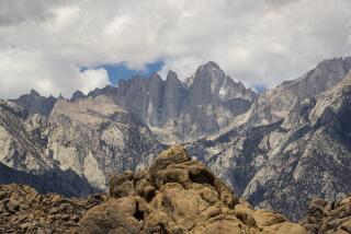
Walking Whitney
- Share via
I read John McKinney’s article about the Mt. Whitney trail (Aug. 29) with much interest, since I have climbed Whitney dozens of times.
Some factual errors: The trail was moved in 1977, making it 11 miles from the trail head to the top, as indicated on the sign at the bottom of the trail, as well as numerous recent guidebooks. Trail Crest is at an elevation of 13,777 feet, not 13,714. The actual trail head is at 8,360 feet, some 500 feet higher than Whitney Portal Camp.
These errors may seem a bit picayune, but the extra 1/3 mile and few hundred feet of elevation make a big difference to a tired hiker, particularly at 14,000 feet. Other than that, a fine article.
JIM LUX
Westlake Village
*
John McKinney replies: Sources differ on the exact distance to the summit, from a low of 10.5 to a high of 11 miles. The latest guesstimate comes from authors Karen and Terry Whitehill in their perhaps mistitled guidebook, “ Best Short Hikes in California’s Southern Sierra”; they say it’s 10.9 miles to the top of Whitney.
Anyone who wants to call it 11 miles to the top won’t get any argument from me, despite my estimate of 10.7 miles.
I have just finished reading the nice article on climbing Mt. Whitney, but I would like to say that John McKinney and (map maker) Helene Webb were not paying too close attention.
First of all, one does not leave California 395 at Lone Pine. It’s U.S. 395, which starts at Hesperia and goes to Canada.
Then Helene Webb made U.S. 395 an interstate highway. There are some four-lane stretches on U.S. 395, but the road is not up to interstate standards.
GLYNN REAVIS
Fresno
More to Read
Sign up for The Wild
We’ll help you find the best places to hike, bike and run, as well as the perfect silent spots for meditation and yoga.
You may occasionally receive promotional content from the Los Angeles Times.


