A Redwood Forest and an Oak-Shaded Creek Near the Russian River
- Share via
Armstrong Redwoods State Reserve/Austin Creek State Recreation Area, near Santa Rosa, is one place on the map, but two distinct environments on the ground.
Armstrong Redwoods is a 700-acre tall-tree preserve, a cool and dark forest. Austin Creek, in contrast, offers open, sun-drenched, grassy hillsides dotted with oaks.
Both parks are a welcome respite from the Russian River resort traffic and all those wine country tourists in the flatlands below.
Both parks offer good hiking--a gentle saunter through Armstrong Redwoods, a moderate-to-vigorous hike through the Austin Creek foothills. Armstrong Redwoods is a place to cool off in the summer; it’s so shady and shadowy that Native Americans considered it a “dark hole” and avoided it. Austin Creek’s exposed slopes are a bit too hot in summer; hiking there is far more pleasant in spring and fall.
Armstrong Redwoods was set aside as a preserve by mega-logger Col. James Armstrong, surely one of the few 19th-Century timber barons who recognized both the beauty and the commercial value in California’s redwood groves.
Best hike through the redwoods is the self-guided nature trail. As you wander among the trees past interpretive displays, you’ll visit the 310-foot Parson Jones Tree and the 14-century-old Col. James Armstrong Tree. After you walk the short mile along Fife Creek to the picnic area, loop back to the trail head via East Ridge Trail.
For the most part, Austin Creek’s 20 miles of trail follow creeks--East Austin, Gilliam, Schoolhouse and Fife--through an environment of alder, big leaf maple and Oregon ash. Paths also traverse slopes forested with Douglas fir, oak and madrone.
Three back-country camps--Tom King, Manning Flat and Gilliam Creek--suggest that Austin Creek State Recreation Area would be an ideal location for a weekend getaway or family backpacking trip.
My two favorite hikes in this park are a short (four-mile) and a longer (nine-mile) loop that head down Gilliam Creek and climb back to the trail head along Austin Creek.
Whichever loop you choose, it’s downhill first, uphill last; save some energy for the return trip.
Directions to trail head: Exit U.S. 101 on River Road, four miles north of Santa Rosa, and drive west some 16 miles to Guerneville. Turn north on Armstrong Woods Road and drive two miles to Armstrong Redwoods State Reserve. Continue up the steep park road to a fork; the main park road continues to Bullfrog Pond, but you veer left to parking for the signed Gilliam Creek Trail.
The hike: Descend north into a mixed forest of oak, Douglas fir and redwood. Half a mile out, you’ll climb a bit and see some coastward views of the multiple ridges rolling to the west.
The trail turns west and descends through woods, then grassland, to Schoolhouse Creek, about a mile from the trail head. You’ll cross the creek and one of its forks as you descend another mile to a trail junction, near the meeting of Gilliam and Schoolhouse creeks.
Those opting for the four-mile hike will go right at this trail junction, cross Schoolhouse Creek again, then follow the banks of Gilliam Creek up-creek a short distance to meet Austin Creek Trail (a fire road). Hike the fire road back toward the trail head.
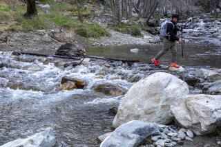
Those in the mood for a longer hike will continue along Gilliam Creek, crossing and recrossing the stream a couple of times as the path leads past ferns, flowers (in spring), cascading water and quiet pools.
Three miles out you’ll cross Gilliam Creek for the last time, then climb gently above the north bank and descend again. A short side trail leads to Gilliam Creek Camp.
Near the confluence of Gilliam and East Austin creeks, you’ll ford the latter and climb briefly, but steeply, to meet a fire road. Turn right on the fire road, which climbs gradually north through a forest of oak, madrone and fir.
Five miles out you descend to cross East Austin Creek and meet East Austin Creek Trail (another fire road). To visit Manning Flat Trail Camp, head left to the shady camp perched on the west bank of the creek.
Turn right on the road, which follows its namesake East Austin Creek and passes a great swimming hole. Soon after, your path begins an earnest half-mile ascent, passes the side trail leading to Tom King Trail Camp, and leaves Austin Creek behind.
Next comes a half-mile descent and meeting with the short spur connecting to Gilliam Creek Trail. Returning from here to the trail head involves a stiff climb, regardless of which way you go.
One way back is to retrace your steps on the Gilliam Creek Trail. Or you can continue a “killer climb” on East Austin Creek Trail toward Bullfrog Pond Campground. It’s a long mile with a 1,000-foot elevation gain. When you reach the paved park road half a mile from the campground, pick up a short footpath on your right that leads to the trail head.
Gilliam Creek, East Austin Creek Trails
WHERE: Armstrong Redwoods State Reserve/Austin Creek State Recreation Area.
DISTANCE: 4-mile loop, with 800-foot elevation gain, or 8-mile loop, with 1,000-foot elevation gain. Longer options possible.
TERRAIN: Maple-shaded creeks, oak- and fir-forested slopes.
HIGHLIGHTS: Contrasting environments of cool redwood groves and open slopes seasonally sprinkled with wildflowers.
DEGREE OF DIFFICULTY: Moderate to strenuous.
PRECAUTIONS: After first losing elevation, the return to trail head is very steep.
FOR MORE INFORMATION: Contact Armstrong Redwoods State Reserve/Austin Creek State Recreation Area, 17000 Armstrong Woods Road, Guerneville, Calif. 95446, or call (707) 869-2015.
More to Read
Sign up for The Wild
We’ll help you find the best places to hike, bike and run, as well as the perfect silent spots for meditation and yoga.
You may occasionally receive promotional content from the Los Angeles Times.


