Play, Play, Play on Lake Oroville
- Share via
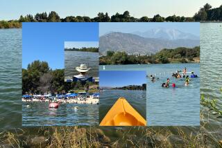
Boating, water-skiing, fishing and swimming are popular forms of recreation on Feather River-fed Lake Oroville, while camping, picnicking, hiking and horseback riding keep Oroville’s lengthy (167 mile) shoreline active.
The lake, about 75 miles north of Sacramento, was created by higher-than-Hoover Oroville Dam in 1967. While it provides many thousands of Californians with a place to play, its main purpose is to hold water for distribution to the San Joaquin Valley, San Francisco and the Southland.
To learn about the lake and surrounding environs, check out the displays and observation tower at the visitor center. Here you’ll find exhibits about Western water-seekers, California’s gigantic water system and the role of water today. From Lake Oroville’s visitor information center, you can join the Chaparral Trail (an interpretive nature trail) and then follow the Kelly Ridge Trail to a lookout point above the lake; this lots-to-see loop is 2 3/4 miles.
Outside the park, in Plumas National Forest, is the Feather Falls Trail (7 1/2 miles round trip) which leads to a most impressive waterfall. The 640-foot high waterfall is the sixth highest in the United States.
The state recreation area has a couple of short hiking trails that can be linked to provide a two-mile jaunt or a more ambitious 4 3/4-mile loop.
Directions to trail head: From California 70 (Business), otherwise known as Oroville Dam Boulevard in Oroville, head east to California 162 (Olive Highway) and continue five miles to Kelly Ridge Road. Turn left and drive a half-mile. Just after the turnoff to the water treatment plant, turn right on the dirt road leading to a parking area.
The hike: Head back toward the water treatment plant and small dam. Ignore the signed trail beckoning you to hike to the visitor information center, and walk across the dam to the signed trail head on the other side.
Take the “Brooks Orchard” leg of the loop trail and begin a modest climb through a woodland of oak and digger pine.
After a mile, the trail forks. A left means you loop back another mile to the trail head. The right fork crosses the Loafer Creek Campground Road, then gently travels a mile to Brooks Orchard, a popular resting and watering place for the many horses and riders on Oroville’s trails.
A quarter-mile past this rest stop, you’ll cross a creek, then meander down toward the lake shore. You’ll skirt Loafer Creek Campground, then ascend oak- and ponderosa pine-covered slopes.
When you meet up with Loafer Creek Loop Trail, you’ll swing right, hiking over grass slopes on a mellow descent back to the trail head.
Loafer Creek, Roy Rogers Trails
WHERE: Lake Oroville State Recreation Area north of Sacramento.
DISTANCE: 2-mile loop or 4-mile loop.
TERRAIN: Chaparral-oak-pine dotted hillsides.
HIGHLIGHTS: Intimate view of lake and monument to state water system.
DEGREE OF DIFFICULTY: Easy to moderate.
FOR MORE INFORMATION: Lake Oroville State Recreation Area, 400 Glen Drive, Oroville, Calif. 95966; tel. (916) 538-2200.
More to Read
Sign up for The Wild
We’ll help you find the best places to hike, bike and run, as well as the perfect silent spots for meditation and yoga.
You may occasionally receive promotional content from the Los Angeles Times.


