Amid Mists and Mystics in Ojai
- Share via
Ojai, nestled in a little valley backed by the Topa Topa and Sulphur mountains, has meant tranquillity to several generations of settlers and citrus growers, artists, musicians and mystics. Ojai Valley was the setting for Shangri-La in the 1937 movie “Lost Horizon.”
Ojai Valley Trail explores the town and valley. From the path, hikers get great views of the harmonious Spanish architecture of Ojai, sweet-smelling citrus groves and the sometimes misty, sometimes magical Ojai Valley.
The trail, a paved walking-cycling path, paralleled by a dirt bridle trail, extends nine miles southwest from Soule Park on the eastern outskirts of Ojai to the hamlet of Casitas Springs.
Ojai Valley Trail is a “rails-to-trails” conversion of a century-old railroad line that hauled trainloads of oranges from local growers.
At times the trail meanders near downtown Ojai and at other times drops behind a ridgeline to give walkers a sense of getting away from it all.
The trail is popular with fast-striding fitness walkers, parents pushing their offspring in jogger-strollers, cyclists, guests at Ojai’s spas and spiritual retreats, and lots of locals.
First stop for walkers should be the Chamber of Commerce Visitors Center at 338 E. Ojai Ave. (Hours: Monday-Friday 9:30 a.m.-4:30 p.m.; Saturday and Sunday 10 a.m.-4 p.m.) Ask for a copy of the “Ojai Valley Business and Shopping Map.” Also pick up a schedule of the Ojai Trolley Service (805-640-2562); leg-weary hikers can hop on the trolley (a 25-cent fare--what a deal!) to ease the return to downtown Ojai or the trail head.
Ojai Valley Trail begins at the eastern end of Ojai at Soule Park. Take Ojai Avenue (County 150) through downtown to Soule Park on Fox Road. Park along Fox Road near the signed beginning of the trail.
My favorite part of the path extends from Soule Park to the intersection of county highways 33 and 150. It’s a bit over six miles round trip (about a 10K walk).
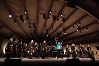
The path heads west a mile and a half back to downtown and Libbey Park, home of the Ojai Music Festival. The park is a lovely, kid-friendly place to play or to picnic.
Another mile and a half brings you to the intersection of highways 33 and 150. For the walker, Ojai Valley Trail loses some of its charm beyond this point because for the next couple of miles it closely parallels County 33. (The trail’s last leg leaves the highway behind and is more walker-friendly.)
(BEGIN TEXT OF INFOBOX / INFOGRAPHIC)
Ojai Valley Trail
WHERE: Ojai, Ventura County.
DISTANCE: 9 miles one way; shorter walks possible.
TERRAIN: Gentle rolling hills; the “valley of Shangri-La.”
HIGHLIGHTS: Tranquil town and valley, excellent walking path.
DEGREE OF DIFFICULTY: Flat and easy.
FOR MORE INFORMATION: Ojai Valley Chamber of Commerce, P.O. Box 1134, Ojai, Calif. 93024; tel. (805) 646-8126.
More to Read
Sign up for The Wild
We’ll help you find the best places to hike, bike and run, as well as the perfect silent spots for meditation and yoga.
You may occasionally receive promotional content from the Los Angeles Times.


