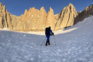
To the Top of the White Mountains
- Share via
A compelling combination of glacially carved notches, thick forests, bold granite summits, frisky brooks and quiet ponds, the White Mountains are New England’s most rugged peaks.
The hiking is simply superb, by New England standards--or any standards. More than a thousand miles of trail, from family-friendly stream-side paths to challenging mountaineer routes, traverse the White Mountains.
Vistas from Mt. Washington, New England’s highest point at 6,288 feet and its most famous summit, are magnificent. Circus master P.T. Barnum, perhaps with tongue firmly in cheek, pronounced the view, “the second greatest show on Earth.”
And though the summit can be conquered via auto toll road and cog railway, a hike is an adventure to remember, undiminished by the fact that others take easier ways up.
The view from the top takes in the Atlantic Ocean to the east, Vermont and New York’s Adirondack Mountains to the west, Massachusetts to the south, Canada to the north.
Weather conditions are extreme, to say the least, and have been documented since 1870, when the Mt. Washington Observatory was built. Mt. Washington lies in the path of three major storm fronts, so bad weather bears down on the mountain in a hurry. Because of this often brutal weather, few mountaineers would argue with the Appalachian Mountain Club’s assessment of Mt. Washington as having “a well-earned reputation as the most dangerous small mountain in all the world.” Hikers must be prepared for almost instant changes in the weather, as well as high winds and below freezing temperatures at any time.
Mt. Washington’s weather is infamous: awesome snowstorms, gale-force winds, torrential rains, the densest of fogs. These weather extremes can even occur on a summer’s day. In 1934 Mt. Washington Observatory recorded winds of 231 mph--to this day the highest winds ever recorded there. Even on a fair, cloudless “nice” day on the peak, hikers often must walk stooped into the wind.
A steam-driven cog railway and an auto toll road approach the summit from opposite directions. The cog railway, second-steepest tracks in the world, climbs Jacob’s Ladder at an incredible 37% grade. Locomotives each consume a ton of coal and a thousand gallons of water while pushing a single passenger car up Mt. Washington.
Pinkham Notch is the Appalachian Mountain Club’s command post for its hut system. Many tons of food and supplies are channeled through the notch’s warehouse. More than 100 overnight guests can be accommodated at the lodge, whose dining room offers great food and awesome mountain views. The club provides recreation and weather information and sells maps, hiking equipment and clothing for the trail.
Pinkham Notch is home base for the AMC hiker shuttle that travels to trail heads throughout the surrounding area. With a good map and shuttle schedule, you can design memorable one-way day hikes or overnights.
Tuckerman Ravine Trail is widely recognized as the most magnificent pathway to the top of Mt. Washington. The trail traverses the ravine, a huge glacial cirque, surmounts the cirque’s head wall, then climbs the summit via the mountain’s southeastern ridge.
In the spring, Tuckerman means skiing, not hiking. For skiers, the ravine is the happy repository for massive snows blowing off the heads and shoulders of the neighboring peaks. About 70 feet or more of snow may accumulate, earning Tuckerman its reputation for the best spring skiing in the East.
From Pinkham Notch, Tuckerman Ravine Trail climbs a quarter-mile to a side path leading to Crystal Cascade, a lovely waterfall. Continuing, the trail is joined by several side trails as it ascends to Hermit Lake overnight shelters, 2.2 miles from the trail head.
Marching up steep talus slopes, hikers skirt the sometimes dangerous (early in the season) Snow Arch and climb above timberline to Tuckerman Junction. Here the summit path, marked by painted rocks and cairns, veers right and ascends to the summit.
A path known as Tuckerman Crossover leads to the AMC’s Lake of the Clouds Hut, largest of the hike-in hostelries, with accommodations for 90.
Access: Pinkham Notch Visitor Center is on Route 16, about 10 miles north of Jackson and 11 miles south of Gorham.
(BEGIN TEXT OF INFOBOX / INFOGRAPHIC)
Tuckerman Ravine Trail
WHERE: Mt. Washington.
DISTANCE: From Pinkham Notch to summit is 7.8 miles round trip with 4,300-foot elevation gain.
TERRAIN: Rugged White Mountains.
HIGHLIGHTS: New England high point, one of America’s most famed peaks.
DEGREE OF DIFFICULTY: Strenuous.
PRECAUTIONS: Prepare for high winds, freezing temperatures.
FOR MORE INFORMATION: White Mountain National Forest, P.O. Box 638, Laconia, NH 03870; tel. (603) 528-8721.
More to Read
Sign up for The Wild
We’ll help you find the best places to hike, bike and run, as well as the perfect silent spots for meditation and yoga.
You may occasionally receive promotional content from the Los Angeles Times.


