A Freelance Forecaster Goes Looking for Trouble
- Share via
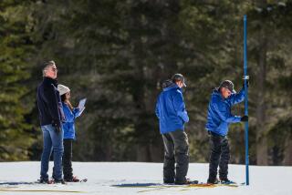
MAMMOTH LAKES, Calif. — Sue Burak stuffs 25 pounds of gauges and tools into her blue nylon rucksack, straps on cross-country skis and heads for her workplace: the snow-loaded slopes of the eastern Sierra.
Burak is a freelance avalanche forecaster, and she needs to study the snow firsthand before deciding if she should issue a warning that conditions are right for a dangerous slide.
She glides half a mile up a groomed tourist trail behind Tamarack Lodge, then cuts cross-country toward the summits, to a snow bowl at a place called Red Cone, where local skiers and tourists go to practice their back-country technique.
She chooses a likely mountainside--north-facing slopes of 30 degrees and steeper are the most avalanche-prone--and starts digging a “snow pit.”
With a folding plastic shovel, she cuts away a 6- by 6-foot wall to expose a cross-section of the snowpack, a timeline of recent storms stacked like a layer cake.
After sweeping the wall smooth with a paintbrush, she pulls out a folding ruler and sets it against the wall to measure the strata. Some of the layers are packed tight. Some of these packed slabs are separated by thin, grainy, weak layers.
Burak places small metal thermometers into the layers to see whether there’s a difference in temperature between sections, another sign a slope could give way and unleash an avalanche.
She studies the shape of snow crystals with a small magnifying lens, and measures the grains on a black card marked with a grid. She uses small saws to cut out blocks of snow to check its bond. She drops a weight or has a skier stomp on the snow slope above the wall to see if any layers drop.
Back at the office, she will combine her field study with weather data and reports from other back-country travelers to make her forecast.
Avalanche danger is rated on a five-level scale: low, moderate, considerable, high and extreme.
Burak is a private forecaster who hires out to deliver forecasts to resorts and private residents. Government forecasters put out public advisories through recorded messages on telephone hot lines, local media, faxes and the Internet.
*
Here are excerpts from a typical forecast, this one from the Colorado Avalanche Center in Denver for Feb. 1. It ends with a call for personal responsibility:
“On Monday snow showers left between 1-4 inches of new snow for most mountain areas, but late Monday strong winds at higher elevations probably redeposited this snow into shallow wind slabs. Later today increasing winds will cause additional blowing snow, and I suspect these new, shallow slabs are tender and prone to triggered release from steep slopes. Today the back-country avalanche danger for the N&C; mtns is rated an overall MODERATE, with pockets of CONSIDERABLE on leeward slopes 35 degrees and steeper, especially those facing N-E. In the S mtns less snow fell and winds were lighter, so the danger remains MODERATE near and above tree line and generally LOW well below tree line. . . .
“Use this information for guidance only. You may find different conditions in the back country and should travel accordingly.”
More to Read
Sign up for Essential California
The most important California stories and recommendations in your inbox every morning.
You may occasionally receive promotional content from the Los Angeles Times.


