Sunny With a Chance of Wild Unpredictability
- Share via
Long stretches of sunny calm might make it easy to forget that variety and volatility are hallmarks of Los Angeles weather.
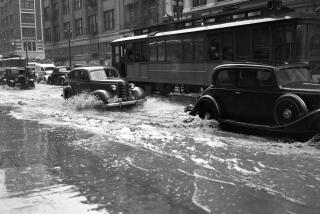
The storms of recent weeks delivered deadly proof of that. And for all the rainfall records set, the onslaught of destructive cloudbursts -- even the small tornados that hit Inglewood and Whittier -- were not out of character for the area, experts say.
Ruinous weather here might be infrequent, but it isn’t freakish.
“L.A.’s basically got every climate the West has to offer,” said Dan Keeton, the National Weather Service’s meteorologist in charge of the region. “We get lulled into a false sense of security.”
Southern California’s mountainous geography, hard by the sea, is tailor-made for dramatic swings in wet weather and for smaller but troublesome changes in conditions such as coastal fog and canyon winds.
The latest storms dumped more than 30 inches of rain in the eastern San Gabriel Mountains and nearly half that in some hillside communities. In an average year, rainfall totals in the eastern San Gabriels exceed 40 inches, greater than Seattle’s.
“You have this huge transverse range of mountains, kind of like the Rockies’ Front Range turned on its side,” said Keeton, running his hand over a wall map at the weather service’s Oxnard office, which covers four counties. “The mountains are a big deal.”
Summer to spring, the office’s 14 meteorologists are kept busy around the clock.
Staying more than a few days ahead of the weather can be tricky for L.A. forecasters because of a shortage of tracking data from the Pacific.
Weather typically moves from west to east -- in L.A.’s case, from the ocean onshore. Because the open water is not dotted with the weather-monitoring devices found on land, forecasters often don’t have a complete picture of what’s heading this way.
“In general, it is more difficult to forecast in the Western United States than in the east because of the huge data void,” said Jim Hoke, director of the weather service’s Hydrometeorological Prediction Center in Maryland.
The mountains can compound the difficulty. Near the coast, they trap cold, moist air coursing in from the ocean. In summer, they prevent that air from cooling the high desert and inland valleys. They intensify storms by forcing air up their slopes until it condenses to produce rain or snow.
In the sparsely populated San Gabriels, the sky tends to empty in gushes. The results include suddenly engorged rivers and creeks that are dry much of the year, as well as flash floods and mudslides at lower elevations.
Giant catch basins at the foot of the mountains keep most of the mud and rocks from crashing into neighborhoods. Dams capture a large amount of the cascading rainwater, which is stored in reservoirs or diverted to flood channels.
“The system worked really well,” Ken Pellman, a spokesman for the Los Angeles County Public Works Department, said after last week’s deluge.
It helps that L.A. isn’t hit by the steady diet of thunderstorms that afflicts the East Coast, a benefit of California’s cool ocean waters.
In the Atlantic, heated currents run along the East Coast on their trip north. The warmer the water, the more prone it is to producing major storms. A hurricane, for example, requires an ocean temperature of about 80 degrees.
The waters off L.A. normally top out in the high 60s or low 70s, Keeton said. Pacific currents flow from the warm equatorial latitudes to Asia, then turn chilly as they range to the Arctic. They remain cold as they curve south to California, where prevailing winds also pull up deep, cooler waters on the outer coast. But L.A. must contend with the “Pineapple Express” and the related El Nino phenomenon.
The Pineapple Express is a ribbon of heated air that migrates north from Hawaii and spawns storms as it mixes with cooler air. The broader El Nino effect, which triggered epic rainfall in the 1997-98 season, sends unusually warm ocean waters to the equatorial Pacific, where they brew thunderstorms that feed the Pineapple Express.
Rain isn’t the Oxnard office’s only headache. L.A.’s colder ocean waters churn out fog and haze that settle against the mountains in spring and summer, shrouding the coast in its so-called “May gray” and “June gloom.”
Fog forecasts are central to the office’s mission, because reports of limited visibility can sharply reduce landings at Los Angeles International Airport.
A backup in flights ripples across the nation’s aviation lanes, tallying costs in delays and extra fuel. “You’re talking huge amounts of money,” Keeton said.
“They do a great job,” Donn Walker, a Federal Aviation Administration spokesman, said of the Oxnard forecasters. “You may think forecasting the weather in Southern California is pretty easy, but it’s actually pretty complex.”
Wind forecasts are also crucial to airports, not to mention firefighters. The notorious Santa Ana winds occur when the desert air that the mountains bottle up escapes as it cools. The winds heat up and accelerate as they squeeze down through the canyons.
“It’s like a thumb in a garden hose,” Keeton said.
The Santa Anas dry brush to tinder before fanning the inevitable wildfires. The Oxnard office generates fire-weather forecasts year-round and gets high marks for them.
“We have a pretty good handle on when the Santa Anas develop and how strong they will be,” said Robert Fovell, associate professor of atmospheric and oceanic sciences at UCLA.
Fovell noted that the Oxnard meteorologists begin with forecast “models” from the weather service’s national prediction centers, then adjust and update them for local zones.
“They use their intimate knowledge of this area to fine-tune the models,” he said.
The forecasts issued from the office’s white, bunker-like building in a breezy industrial park were pretty much on point for the recent downpours, although heavy rains predicted for last Tuesday did not materialize.
“It was an example of a forecast that didn’t come through,” said Keeton.
He estimated his staff’s accuracy rate at 85%, on par with or better than those for the weather service’s other 121 offices. “When you think about it, it’s amazing how often we get it right, because there are so many things that could go wrong,” he said.
The Oxnard office is responsible for San Luis Obispo, Santa Barbara and Ventura counties, in addition to L.A.
Bill Patzert, an oceanographer at the Jet Propulsion Laboratory in Pasadena, said nailing an L.A. forecast might not be tough nine days in 10, when the weather is predictably mild.
“The joke is that the easiest job in the world is weather forecaster in L.A.,” he said. “Well, there’s some evidence for that.... But when they have a storm, they definitely earn their money.”
More to Read
Sign up for Essential California
The most important California stories and recommendations in your inbox every morning.
You may occasionally receive promotional content from the Los Angeles Times.


