Moisture from Tropical Storm Fausto fuels Northern California storms

- Share via
Another round of thunderstorms is likely overnight in the San Francisco Bay Area and Northern California, the National Weather Service said.
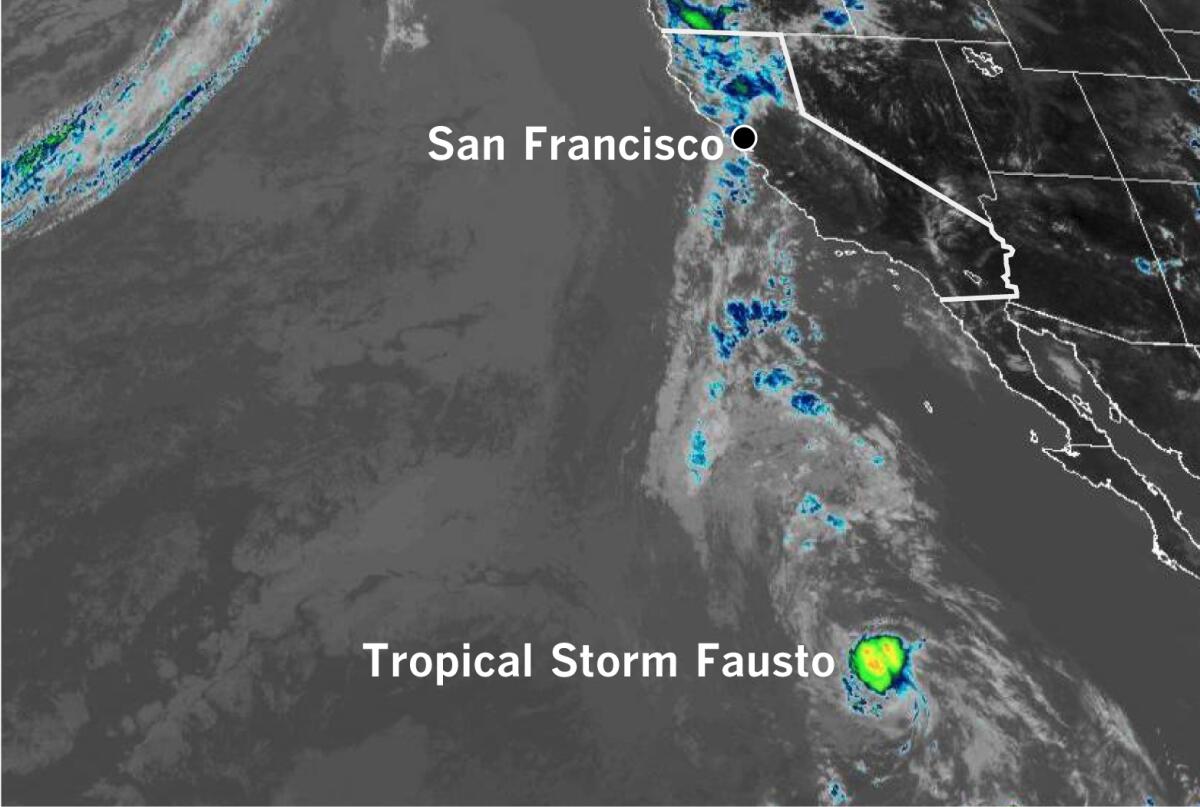
A plume of moisture fueling the storms can be traced to Tropical Storm Fausto in the Pacific southwest of Baja California.
Red flag warnings for dry lightning are widespread in Northern California, along with excessive heat warnings and heat advisories.
By late Sunday morning, isolated showers and thunderstorms were shifting northward, but another — possibly wetter — round of thunderstorms was expected, peaking in the overnight hours and into Monday morning, the weather service said.
About 2,500 cloud-to-ground lightning strikes were recorded during a 12-hour period into Sunday morning over the Bay Area and the Central Coast, although many of those were over the ocean, the weather service reported. Cloud-to-cloud lightning activity was nearly constant.
The lightning sparked dozens of fires in the northern, eastern and southern parts of the Bay Area and and the Santa Cruz Mountains down to Monterey. Rain was mostly light, but there were numerous reports of gusty winds in excess of 50 mph and wind damage, according to the weather service. Las Trampas, in the hills in the eastern portion of the Bay Area, reported a gust to 75 mph. Small hail also was reported in some locations.
Red flag warnings remain in effect through Monday morning.
More to Read
Sign up for Essential California
The most important California stories and recommendations in your inbox every morning.
You may occasionally receive promotional content from the Los Angeles Times.


