New atmospheric river rolls into California, and the evacuation warnings pile up

- Share via
Another massive storm began rolling into California on Thursday, a system that’s expected to bring rainfall, winds and more snow to an already drenched and snowbound state.
The inbound storm — sometimes called a Pineapple Express — is the result of a northern pressure ridge linking with subtropical moisture moving up from Hawaii. Such systems are known to drop heavy precipitation.
The storm has prompted a flurry of evacuation warnings and orders, especially in Northern California, which is in line to receive the brunt of the system.
The atmospheric river began to hit Northern and Central California on Thursday morning, with the peak of the storm expected to last through Friday morning, according to the National Weather Service in San Francisco.
Much of Northern California, from the Bay Area to the Central Coast, is also under a wind advisory, with gusts as strong as 50 miles per hour expected during the storm.
Gov. Gavin Newsom on Thursday requested a presidential emergency declaration to authorize federal assistance supporting the state and local response to the storms.
The governor also has proclaimed a state of emergency in 21 counties to support disaster response and relief efforts.
“California is deploying every tool we have to protect communities from the relentless and deadly storms battering our state,” Newsom said. “In these dangerous and challenging conditions, it is crucial that Californians remain vigilant and follow all guidance from local emergency responders.”
Mountains east of Sacramento are set to receive several inches to several feet of snow. The National Weather Service issued a winter storm warning Thursday evening for Southern Trinity County with up to 8 inches of snow possible at elevations above 2,500 feet.
The storm warning is set to expire at 10 a.m. Friday.
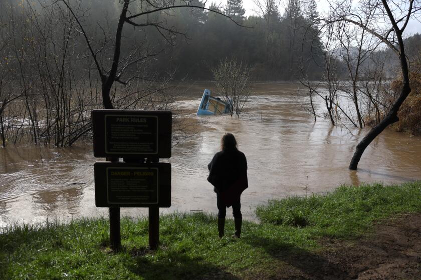
But the main concern is flooding.
“The ground is already saturated and streams/rivers are already swollen,” the weather service wrote in a forecast report. “When additional heavy rainfall falls on an already saturated ground the only thing it can do is run off.”
The Santa Cruz Mountains could see up to 8 inches of rain, with other parts of the region receiving between 1 and 6 inches of rain, the weather service reported.
The city of Watsonville issued evacuation orders for areas along the Pajaro River at 5 p.m. Thursday with shelters opened at Watsonville Veterans Memorial Building and the Cabrillo College gymnasium.
The area under the evacuation order includes Bay Village, a senior community that sits near Salsipuedes Creek.
As yet another atmospheric river barrels toward California, residents brace for the threat of engorged rivers and overtopped reservoirs.
According to the National Weather Service, other rivers that could see flooding include the Russian River at Hopland; the Salinas River at Bradley and Spreckels; the Merced River at Stevinson; the Tuolumne River at Modesto; the Cosumnes River at Michigan Bar; the Mokelumne River at Benson’s Ferry; and Bear Creek at McKee Road.
Nearly two dozen additional river locations across the state may surge above their “monitor stage” — meaning they could potentially overflow their banks and cause minor flooding in low-lying areas. That includes multiple locations along the Sacramento and San Joaquin rivers.
Officials in Fresno and Madera counties have issued evacuation warnings for residents in their areas, warning of potentially serious flooding from the incoming storm. Fresno County Sheriff’s Office spokesperson Tony Botti said officials were particularly concerned about flooding around Pine Flat, as well as Millerton Lake, which feeds into the San Joaquin River and flows west toward Mendota, Tranquility and other communities.
At Oroville Dam — which suffered a near-catastrophic failure amid a series of atmospheric rivers in 2017 — state operators said they could begin releasing water down the dam’s rebuilt main spillway as early as Friday.
In San Jose, police will be enforcing evacuation orders of local creeks that have been in place since January. Police will be announcing the orders to homeless people residing in the creekbeds.
Low-lying regions of Santa Cruz County, including Felton Grove, Paradise Park, Soquel Village, Rio Del Mar Flats and areas along Corralitos Creek, were placed under evacuation warnings ahead of the storm.
“If you flooded in January, you are likely to flood again,” the county said Thursday on Twitter. “Please be prepared to leave if necessary. This is a warning not an order, but leave now if you feel unsafe.”
Across Santa Cruz County — from low-lying river valleys to the mountains — road crews and emergency responders were preparing for the incoming storm.
Jason Hoppin, communications manager for the county, said a code red alert was sent out Wednesday, warning people about the potential for flooding, with evacuation orders likely.
“We have evacuation advisories up in a number of places,” he said.
“They’re probably going to go into an order before too long here,” he said. “Our concern is again with the flooding on the major rivers,” including the San Lorenzo and Pajaro, but also smaller creeks such as Aptos and Soquel.
He said the forecast was calling for the Pajaro River to crest around 30 feet, which is just below flood stage, but “once we get over toward that number, even underneath that number, we’ll start to get concerned about the levees because they’re old and earthen.”
‘A potentially significant and very likely warm atmospheric river event’ is set to hit California later this week, forecasters say.
“So we’re gonna have people out there monitoring that,” he said, adding that the old levees “have been a longtime, forever issue in Santa Cruz County. … They were built ages ago, and while we’ve got federal funding to fix them, they’re not done yet.”
In the town of Planada — an impoverished community of farmworkers in Merced County that was almost entirely flooded in January when a levee broke — many residents watched the rain fall and the creeks rise Thursday with growing levels of trauma and fear, according to county Supervisor Rodrigo Espinosa.
The town is under an evacuation warning, and the Army Corps of Engineers is predicting that flood control dams in the area will reach capacity by 9 p.m. Friday, at which point water will be released to bypass channels, the county said.
On the night of Jan. 9, nearby Miles Creek burst over its brush-clogged banks and rushed through the town’s streets. More than half the homes in the community of 4,000 were damaged, and many have not yet been rebuilt.
Ever since, residents have been complaining that county officials did not provide enough warning of the flood, and that government officials have been slow to respond to the disaster left behind when the waters receded.
After the town flooded and about half its homes were damaged, residents of this farming community struggle to find temporary housing and rebuild.
Additionally, many residents are undocumented, making it more difficult to qualify for some government relief.
“People are full of fear,” said Espinosa, who spoke from his car as he drove to Planada from nearby Bear Creek, where he watched crews lay sandbags in an attempt to keep the stream from overflowing its banks and causing more flooding.
This time, however, county officials have been more proactive, residents said.
County officials went door to door to many homes Wednesday and Thursday, warning of possible disaster.
Espinosa, the county supervisor who represents the area and has been calling on his colleagues to do more for the town, said officials this time were “preparing for the worst.”
But he added that they hoped some of the infrastructure improvements that had happened in the last two months would protect people.
Debris has been cleared from creeks, he said, making them less likely to flood. And workers have been out in force laying sandbags.
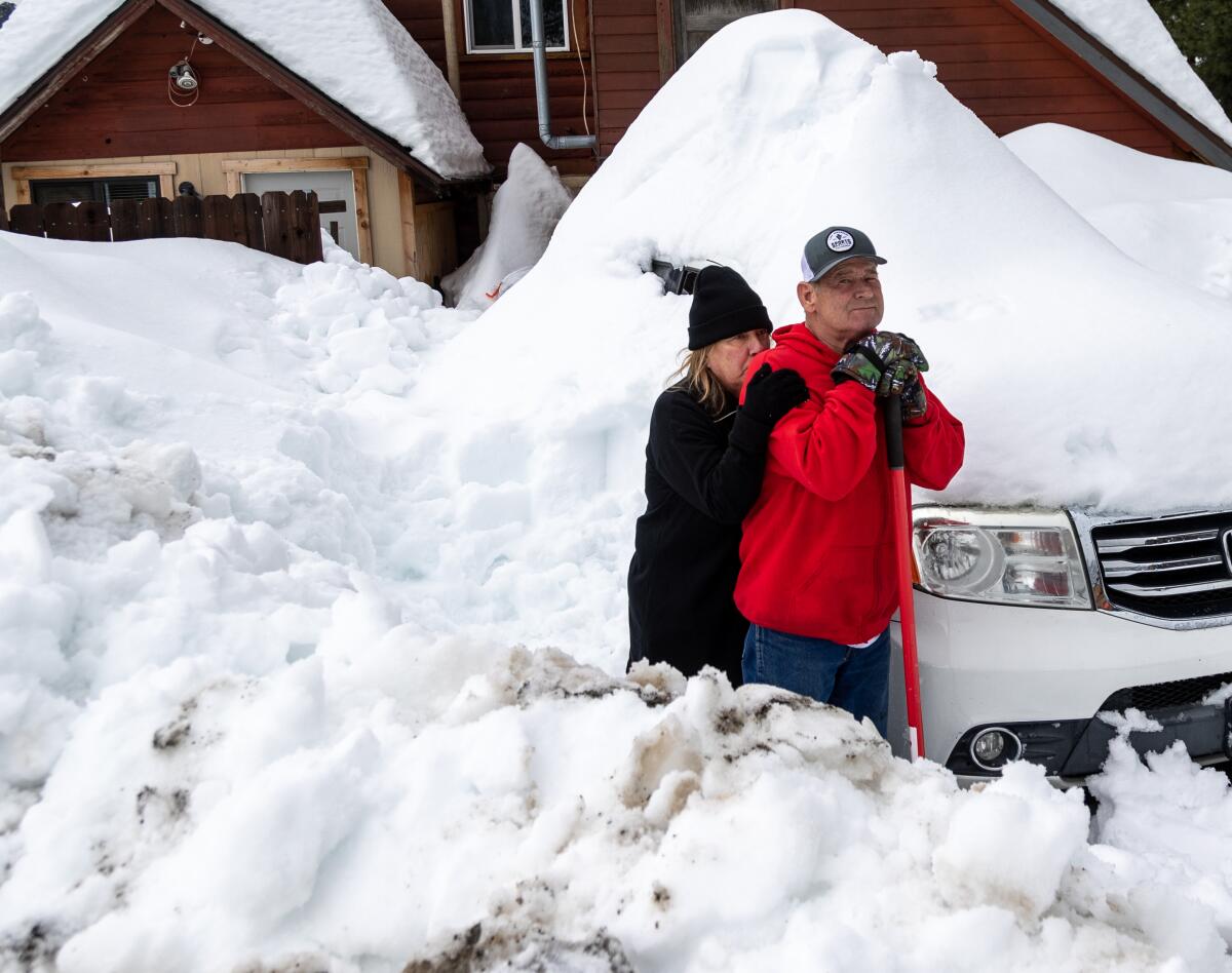
Meanwhile, in Southern California, most of the concern is around mountain towns such as Big Bear where the rain could melt the feet of snow that accumulated during the most recent storms.
In the San Bernardino County mountains, where some residents still remain trapped by snow after the historic blizzard conditions dropped more than 100 inches of fresh powder in the area, officials are warning that rain could increase the weight of snow atop structures, potentially leading to roof collapses or other issues. Residents and authorities already have reported several roof collapses from mounting snow, including a grocery store providing critical supplies in Crestline last week.
Up to 8 inches of rain is possible in the coastal foothills from Morro Bay north, while the rest of San Luis Obispo and Santa Barbara counties could see up to 4 inches. In Ventura County, rainfall of up to 2 inches is possible, while the Los Angeles metropolitan area could get up to 1.5 inches. Temperatures across the Ventura and L.A. County coasts and valleys will be mostly in the mid- to upper 60s, with a chance of 70 degrees in the warmest valley location.
More to Read
Sign up for Essential California
The most important California stories and recommendations in your inbox every morning.
You may occasionally receive promotional content from the Los Angeles Times.


