The sog slog continues: Forecast calls for even more rain through March

- Share via
Californians shouldn’t put the rain gear away quite yet. March is expected to continue roaring like a lion beyond mid-month.
Models are pointing to another potential atmospheric river in the first half of next week, forecasters say, the 12th of California’s wet season. An upper-level low-pressure system in the Gulf of Alaska is expected to move over the West Coast, and there’s a 60% chance that a plume of atmospheric river moisture could affect the California coast, the National Weather Service said.
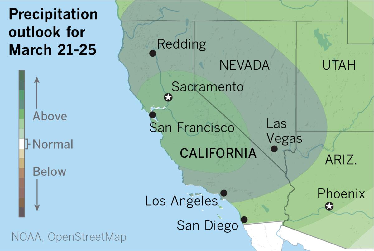
The six- to 10-day precipitation outlook issued by the National Oceanic and Atmospheric Administration on Wednesday shows well above normal precipitation for most of the state, with a 70% chance that precipitation will be above normal in the central portion of California.

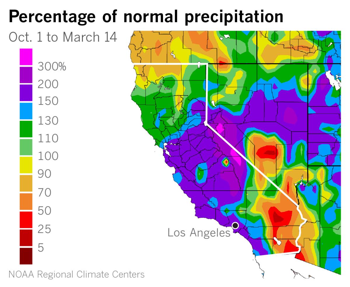
A look at the percentage of normal precipitation since the beginning of the water year on Oct. 1 shows the footprint of the 11 atmospheric rivers that have hit California so far this season. Parts of the state from the Bay Area south to Point Conception and northeastward into the Sierra Nevada have received 150% to 200% or more of normal precipitation. The area of above-normal precipitation continues along the Southern California Bight to the Mexican border. In the southeastern California deserts, precipitation is below normal.
California, with its Mediterranean climate, depends heavily on moisture stored in the state’s deep freeze — the snowpack in the high Sierra — during the dry summer months. As of Wednesday, the average snow water equivalent — a measure of water available in the snow — is 56 inches, which is 223% of normal for this date.
California’s wet season isn’t over. And March might not go out like a lamb because the eight- to 14-day precipitation outlook through March 29 shows most of the state north of L.A. with above-normal chances of precipitation. From L.A. southward, the outlook is for normal precipitation, but extended outlooks show below-average temperatures across the state through the end of the month.
The latest maps and charts on the California drought, including water usage, conservation and reservoir levels.
More to Read
Sign up for Essential California
The most important California stories and recommendations in your inbox every morning.
You may occasionally receive promotional content from the Los Angeles Times.


