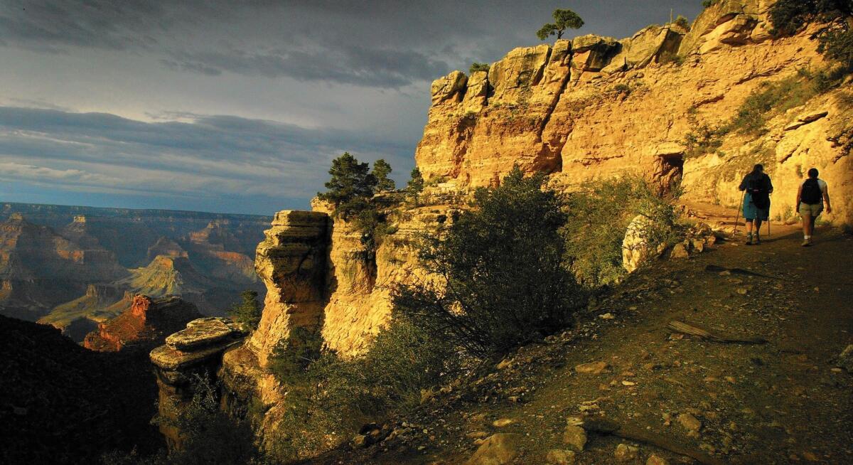
Column: He hiked the Grand Canyon in a day, on the lookout for blisters and ooh-aah views

- Share via
Hiking the Grand Canyon was not on my bucket list. A marathon, yes. Bike 200 miles in a day, yes. Ironman triathlon, absolutely. But for some reason, a mere day hike, even in one of the world’s most spectacular natural wonders, was never on my radar. I’d been to the Grand Canyon several times as a kid and a parent, taken pictures of the awesome views, bought a refrigerator magnet, and left. And I’m not unusual. Only 10% of park visitors hike at all, says the National Park Service, and a fraction of those actually go all the way to the bottom — the Colorado River — and back.
But then a friend invited me to do just that.
And when our epic 11-hour, 15.1-mile trek down and up nearly 5,000 feet was done, I realized something: This otherworldly journey into a land before time, with its stunning rock formations, famous river, an oasis and astonishing, incomprehensible vastness, is no mere walk in the park. It’s a true bucket-list adventure. And the beauty of it: It’s practically next-door.
Hundreds hike the Grand Canyon every day, but it seemed as if most of them were like the seven men and women in my group: middle-aged and well-organized. You don’t need to be a super athlete — a couple in our group had never hiked before or even went to the gym. But you do need water and food in the backpack, hiking poles to assist the legs, roomy shoes for swelled feet, lube and Band-Aids to stop blisters, and hat and sunscreen to beat the heat. (And don’t even think about doing it in summer when temperatures are brutal.)
Like mountain climbing in reverse, Grand Canyon hikes go down, then up. This one, the safest and most popular route, is a loop linking the park’s two “superhighway” trails: The 7.1-mile South Kaibab, which starts at an elevation of 7,200 feet and descends 4,800 feet to the Colorado, and the 8.0-mile Bright Angel, which climbs back 4,380 feet to the South Rim, elevation 6,860 feet. The former has views; the latter has water. We took the crowded free shuttle bus from our South Rim hotel to the trailhead and began the steep descent at 7 a.m.
The South Kaibab trail is a revelation, a ridge-line route with unobstructed 360-degree vistas that evoked oohs and aahs for 3.5 hours. In fact, its first official lookout is Ooh-Ahh Point, which showcases the stunning O’Neill Butte, a massive, bright-orange sandstone formation glistening in the distance like a temple in the Holy Land.
Dodging mule trains carrying overnighters who’d camped at the bottom, we homed in on O’Neill for the next 90 minutes like bugs to a bright light, then stopped to snack and bandage blister hot-spots at the Skeleton Point overlook. Dehydration clearly inspired the name as there’s no drinking water on the South Kaibab.
The first water is at the bottom. Invisible from the South Rim, the Colorado River grew from a tiny blue dot halfway down the Kaibab into a pond and finally into a bend in a wide river by the time our endless switchback descent was done. When we arrived about 10:30 a.m., it was decorated with colorful inflatables and paddlers on rafting expeditions. It was getting hot — the river’s only 2,480 feet above sea level — but swimming is out; people have died in the strong, frigid current.
Ready for lunch, we crossed and recrossed the Colorado on two suspension bridges, tracked the south bank of the river for an hour, then found picnic tables at the River Resthouse, one of several toilet- and water-equipped rest houses along the Bright Angel Trail.
Known as the Grand Canyon’s best, most-used trail, Bright Angel was our home for the next six hours of relentless ascent. Pretty but lacking awesome Kaibab-ish views because it’s nestled in a canyon, it offers a welcome respite halfway up: Indian Garden, a lush, green oasis with a running stream, a cool pond, toilets and crowds of half-day hikers coming down from the South Rim. It can easily turn into an hourlong foot bath and nap, which proved useful. I woke up refreshed and ready for the hardest part of the day: 3,000 feet of climbing in about four miles.
Planting my poles like a Norwegian cross-country skier, I plowed past the crowds of backpackers, kids and families struggling on the ridiculously steep grades. As cool afternoon shadows from the towering South Rim walls draped the endless switchbacks, the pace quickened. I caught my friends near the top just before 6 p.m.
After 11 hours, the eight of us gazed at the postcard view from the fast-chilling South Rim, 6,860 feet above sea level.
Below, Indian Garden was a tiny green smudge.
The Colorado was nowhere to be seen.
And a worthy adventure was crossed off the bucket list.


