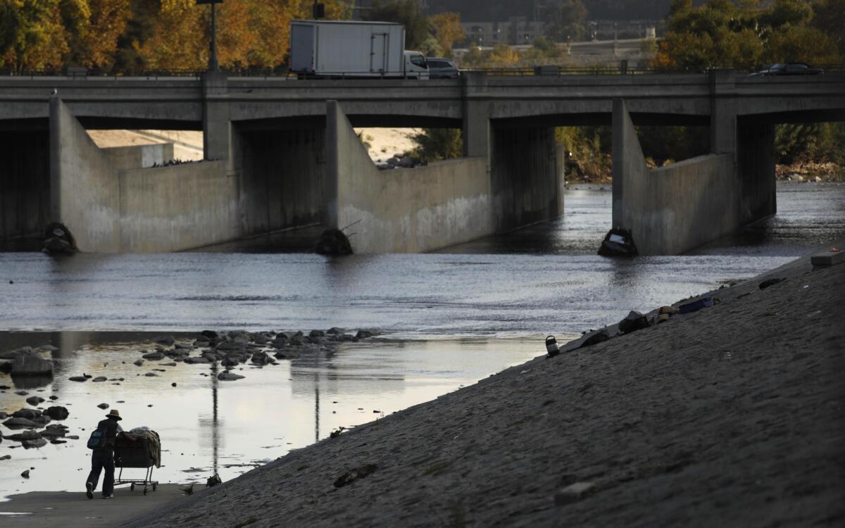
County wants authority over L.A. River flood-control channels owned by U.S. government

- Share via
Los Angeles County officials are proposing to take ownership of 40 miles of flood-control channels along the Los Angeles River from the federal government in order to expedite maintenance and water conservation improvements as climate change increases the frequency of extreme weather.
The move was spurred by concerns that the Army Corps of Engineers’ World War II-era channels, including a lush soft-bottom stretch of the Los Angeles River between Griffith Park and downtown, have not been adequately maintained because of dwindling federal funds, county officials said on Sunday.
For the record:
12:15 p.m. Feb. 25, 2019An earlier version of this article said that Los Angeles County supervisors were expected to vote on a flood-control channel motion on Wednesday. That vote is expected to occur on Tuesday.
It comes at a time when new research suggests that flood-control systems more than 50 years old were based on 20th century assumptions and hydrological records that do not take into account “whiplashing shifts” in extreme weather caused by climate change.
“Our desire is to have the county solely in charge of maintenance and expediting improvements up and down the river,” Mark Pestrella, director of the Department of Public Works, said in an interview. “That would really help because the corps requires congressional approval to do anything at all.”
“We could complete the study and transfer in five to 10 years,” he said. “We have the funding to keep this river system running efficiently and safely.”
The corps’ mission, he said, does not include myriad issues his agency’s County Flood Control District regards as essential: water conservation, movement of sediment, graffiti removal, ecosystem friendly vegetation, homeless encampments and recreational opportunities.
Bringing the channels under the authority of the county, officials said, could expedite groundwater storage projects, as well as efforts to restore areas for habitat, recreational amenities and residential, commercial and office development.
“Right now,” Pestrella said, “graffiti and weeds are good indications of which flood control channels are under the control of the corps.”
Transfer of ownership, he added, “would require turning over the facilities in a decent state of repair.”
On Tuesday, the Los Angeles County Board of Supervisors is expected to vote on a motion urging local congressional representatives to support the possible divestiture of the corps’ channels and transfer of ownership to the Department of Public Works.
The motion written by Supervisor Hilda Solis says that the corps “needs approximately $193 million annually to address deferred maintenance, but only receives about 10 to 15 percent of that in any given year.”
“In the current federal fiscal environment, this trend is expected to continue indefinitely,” it says. “The increased risk puts millions in peril while increasing resident’s flood insurance costs.”
Frequent catastrophic flooding prompted civic leaders and the corps a century ago to begin taming the river system with infrastructure. Nearly the entire 51-mile river bottom was sheathed in concrete except a few places where the water table was too high.
They include an eight-mile stretch of quiet pools draining into chutes strewn with trash and shaded by cottonwood trees and invasive cane forests near Griffith Park known as the Glendale Narrows. That area has been targeted for an array of habitat and civic projects.
The corps and the county flood-control district have worked collaboratively to operate their respective networks of water management channels and other infrastructure.
The district’s portion includes 14 dams and 500 miles of open channels that manage flood risk for about 10 million residents and roughly 2 million parcels with a value of about $1 trillion, officials said.
The corps is responsible for four dams and 40 miles of open channels.
Concerns about flood risk recently prompted local officials and federal lawmakers led by U.S. Rep. Grace F. Napolitano (D-El Monte) to urge the corps to expedite needed safety repairs at Whittier Narrows Dam, about 13 miles southeast of Los Angeles, their highest budgetary priority.
The corps built the spillway and 56-foot-tall earthen dam in 1957 to control flooding and recharge a critically needed groundwater basin along the occasionally tempestuous San Gabriel and Rio Hondo rivers.
The corps recently found, however, that the dam would fail if water were to flow over its crest or if seepage eroded the sandy soil underneath. In addition, unusually heavy rains could trigger a premature opening of the dam’s massive spillway on the San Gabriel River, releasing more than 20 times what the downstream channel could safely contain within its channels.
The corps used computer models to estimate the effects of 900-year, 7,500-year and 18,000-year storm events. In each case, catastrophic flooding could hit 25 cities downstream with water as much as 20 feet deep.
“Millions of people live directly downstream from the dam,” Napolitano, the chairwoman of a subcommittee that has jurisdiction over the Army Corps, said in a recent letter to the federal agency, “and the human and economic impact of possible dam failure due to potential seepage and hydrological issues in an extremely rare weather event is unacceptable.”
The corps’ proposed structural modifications aim to reduce the potential for the dam to fail during mega-storms such as the one that hit California during the rainy season of 1861-62. That’s when a series of storms dropped 36 inches of rain on Los Angeles. So much rain fell that it was impossible to cross the Central Valley without a boat.
Until recently, it was thought that a flood of that magnitude was likely to occur every 1,000 to 10,000 years. New research, however, suggests the chances of seeing another flood of that magnitude over the next 40 years are about 50/50.
The corps estimates that its repair project at the dam could cost up to $600 million, and be completed by 2026.
More to Read
Sign up for Essential California
The most important California stories and recommendations in your inbox every morning.
You may occasionally receive promotional content from the Los Angeles Times.


