Chasing waterfalls: Eight watery L.A. hikes to explore this spring
- Share via
Editor’s note: This story has been updated because some sites may have limited access because of overcrowding during the coronavirus pandemic.
Hear that? It starts gently, like a trickling stream, and grows steadily louder as you approach, finally becoming a thunder of white noise. You find yourself coated in cool mist. A pool awaits your tired feet.
It’s a waterfall, beckoning you forward.
Get The Wild newsletter.
The essential weekly guide to enjoying the outdoors in Southern California. Insider tips on the best of our beaches, trails, parks, deserts, forests and mountains.
You may occasionally receive promotional content from the Los Angeles Times.
Local waterfalls are flowing with majesty this spring, thanks to near-record-setting rains this winter that also fed an epic wildflower bloom. Los Angeles County has about two dozen falls — not counting seasonal gushers that make surprise appearances — in the Angeles National Forest, Santa Monica Mountains and other spots.
One hitch: You have to lace up your boots to find them. Here are eight hikes that will lead you to spring’s most soothing sensations.
Water swirls into fast moving pools away from the gushing San Antonio Falls at the base of Mt. Baldy. The recent heavy rains have created extreme water flows at local waterfalls.
San Antonio Falls, Mt. Baldy
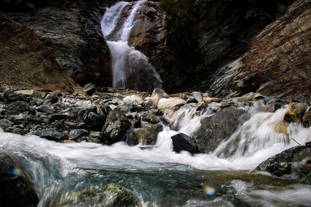
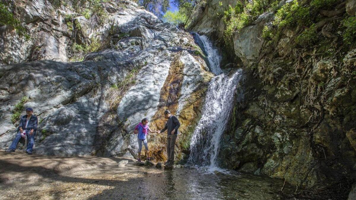
Compared to the steep winding drive up Mt. Baldy Road to the trailhead, this one-hour hike is a breeze. Hike half a mile up the paved Falls Road, then take a dirt trail to the big show. The two 75-foot falls begin a few feet apart and intersect about halfway down the rock face for an extra strong gush. Wear a swimsuit if you’re in the mood for a cold shower, or admire from afar on one of many rocks.
Trail conditions: 1.3 miles round trip. The trail is clearly marked and mostly smooth, but be careful when traversing some loose rocks near the falls. There’s little shade. Leashed dogs are OK.
Info: From Mt. Baldy Lodge or Mt. Baldy Visitor Center, drive 12 miles up Mt. Baldy Road to park near the trailhead at Falls Road. You’ll need to buy a $5 Adventure Pass in advance.
Escondido Falls, Malibu
The multi-tiered 150-foot Escondido Falls are the tallest and most popular in the Santa Monica Mountains. They’re much more impressive after a rainy season, so expect to have lots of company on the trail.
Walk uphill just shy of a mile along the paved Winding Way, admiring grand Malibu homes, on the way to the trailhead. Cool off with a descent into a shady canyon, where you’ll find twisty oak trees, sage scrub, a few easy creek crossings and, eventually, the 50-foot limestone lower falls.
You’ll be happy sitting by the pool and standing in the showers of the lower falls. Be content to gaze up at the upper falls; they’re off limits to hikers because the trail is dangerous and located on private property, according to the conservation authority.
Trail conditions: About four miles round trip on a clearly marked trail. Some shade. Leashed dogs are OK.
Info: Escondido Canyon Park, 27200 Winding Way, Malibu. Park along Pacific Coast Highway near Winding Way or in the parking lot ($8). Maps and directions are available on the Mountains Recreation and Conservation Authority website, MRCA.ca.gov.
The Grotto, Malibu
This downhill hike from Circle X Ranch in the Santa Monica Mountains National Recreation Area ends at the Grotto: a mysterious cave with a modest 10-foot fall and a shallow pool. It’s a cool ending point, but you’ll find better waterfalls along the journey.
A few minutes into the trail, you’ll cross the shallow West Fork of the Arroyo Sequit Creek to your right. Just a few feet away, the creek drops down a 20-foot rock face, and the view opens up to grassy hillsides speckled with white, purple and yellow flowers.
Another half a mile in, look to your far left for a bonus 30-foot waterfall that park guide Scott Sharaga said came to life in the last few weeks. Continue along the Grotto Trail, and you’ll arrive at a somewhat confusing clearing where the marked trail ends. Head left to follow the creek downstream, scramble down a few boulders, and you can take a dip at the Grotto.
The trail was free of trash and people at on a recent Wednesday afternoon. Choose this hike if you like solitude, and consider getting there the longer way via Deer Creek Road. You’ll see eclectic homes and diverse topography: trees charred black from the Woolsey fire, contrasting with rolling green hills covered in wildflowers and rocky Sandstone Peak.
Trail conditions: Three miles round trip. It’s well marked until the last stretch. You’ll hike downhill on the way to the Grotto, but it’s challenging on the way back up. There’s some shade. Leashed dogs are OK along the trail but not at the Grotto.
Info: There’s free parking in a small lot and trail maps available at Circle X Ranch Ranger Station, on Yerba Buena Road, 5.4 miles from Pacific Coast Highway, or download a map before you go at bit.ly/GrottoTrail.
Paradise Falls, Thousand Oaks
(The falls have been temporarily closed; check here for updates).
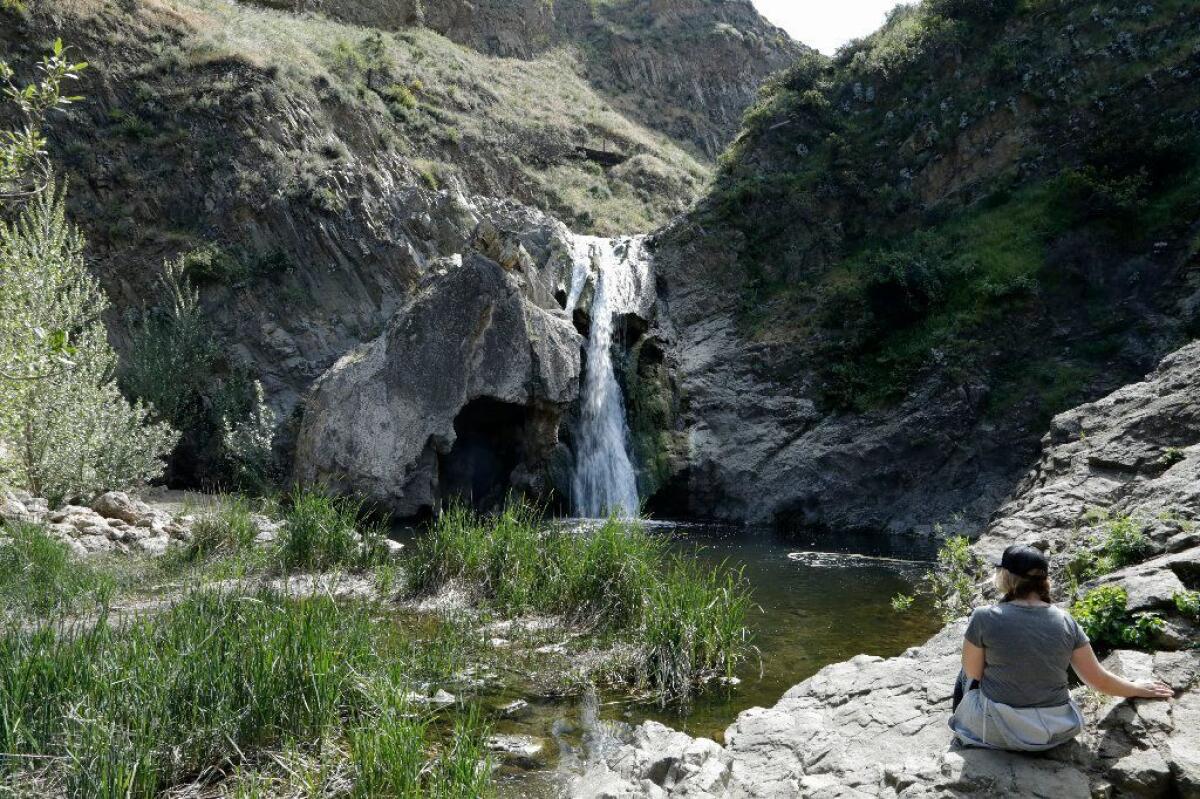
Set off for 40-foot-tall Paradise Falls in Wildwood Regional Park on wide Mesa Trail, flanked by deep green hills, cactus and sage. You’ll pass a wooden tepee with a fountain and seating area and take a left onto a significantly narrower trail, where you’ll be shoulder to shoulder with bright yellow wildflowers this time of year. It’s tight, but give it a chance. You’ll soon hear the unmistakable sound of rushing water.
Swimming at the falls is prohibited, but you can spot ducks as you walk along a fenced trail that follows the creek upstream, or you can relax with snacks at picnic tables or rocks at the pool. Enjoy the break; the hike back to the parking lot is mostly uphill.
On a recent Friday afternoon, the trail was clean and quiet, save for crickets chirping and tall grasses rustling in the breeze.
Trail conditions: 2.1-mile round trip hike with clear signage, and no shade, so make sure you wear sunscreen. There are no water crossings along the route. Dogs on leashes are OK.
Info: Wildwood Regional Park, 928 W. Avenida de los Arboles, Thousand Oaks. Free parking is available at the lot on Avenida de los Arboles and Big Sky Drive. You can view trail maps online at bit.ly/paradisewaterfalls and near the parking lot.
Eaton Canyon Falls, Pasadena
(Visitors need to get free timed tickets in advance to hike to the falls. Check rules here.)
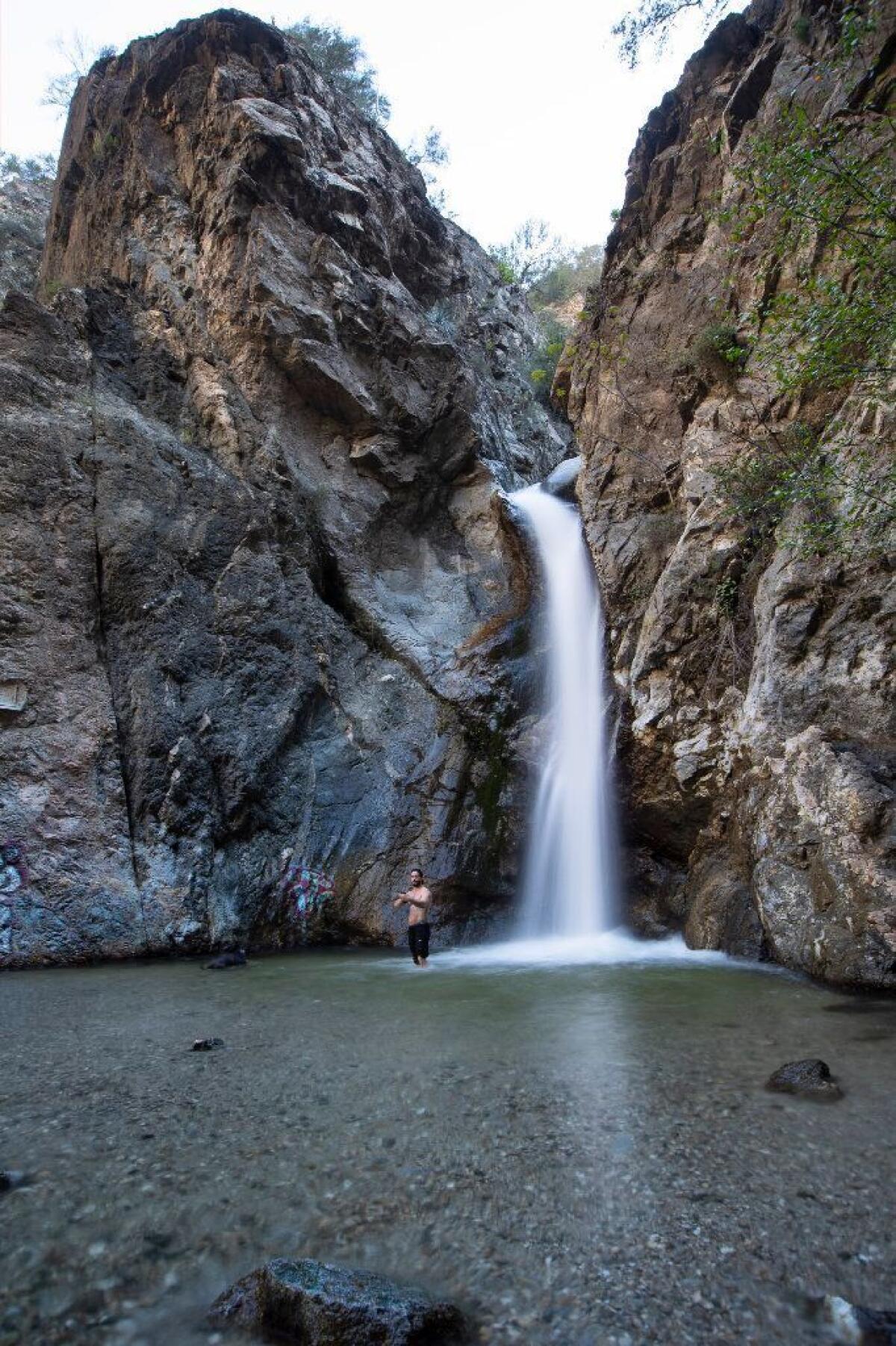
Prepare to get your feet wet on the adventurous hike to this 40-foot waterfall in Eaton Canyon Natural Area Park, which is among the most crowded waterfall spots in the L.A. area. You’ll cross a wide, sometimes knee-deep stream — using slippery rocks and logs as steps — about 10 times there and back, so practice your rock-hopping skills, and choose your footwear wisely.
The first mile of Eaton Canyon Trail is smooth, mostly flat and wide open to views of sunflowers and the San Gabriel Mountains. The rest of the hike isn’t so laid-back, but the view is worth the trek. “It’s been a good season, and the water is deep,” said George Yenoki, a docent at the park’s nature center. “All the waterfalls in the San Gabriel foothills are definitely flowing harder than normal.”
The parking lot and trail were crowded at 8 a.m. on a recent Saturday morning. No one swam in the chilly water, but hikers took selfies and played music on speakers while lounging on the rocks. The trail was relatively trash-free, but there was significant graffiti on the rock face of the waterfall (bummer).
Trail conditions: 3.5 miles round trip with little shade. Signage is clear. Some parts of the trail are steep and very rocky, so tread carefully. Dogs on leashes are OK.
Info: Eaton Canyon Natural Area Park, 1750 N. Altadena Drive, Pasadena. Free parking (often full, so get there early) at the main lot and overflow parking area. Details at the park’s website, ECNCA.org.
Monrovia Falls, Monrovia
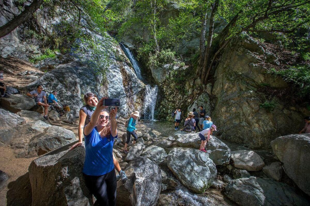
A narrow waterfall plunges 30 feet down two steep rock slides in Monrovia Canyon Park all year, but preserve supervisors say it’s most impressive in the spring.
You’ll enjoy shade along most of Falls Trail, thanks to a lush canopy of oak trees and alders. Depending on your starting point, you’ll have to traverse the stream just a couple of times. These crossings are only a few feet wide and a couple of inches deep, according to supervisors, so they’re easy practice for challenges like Eaton Canyon.
When you reach the falls, dip your feet into the shallow stream or simply lie back on a big rock to soak up the white noise. The trail is crowded on weekends; go on a weekday morning to have the falls to yourself.
Trail conditions: From 1.5 to 3 miles round trip depending on your starting point along a well marked trail. Dogs on leashes are OK. .
Info: Monrovia Canyon Park, 1200 N. Canyon Blvd., Monrovia. $5 to $6 to park at any of the park’s three lots. Lots are closed Tuesdays, but you can park along Canyon Boulevard. Maps and more information are available at bit.ly/monroviafalls.
Sturtevant Falls, Arcadia
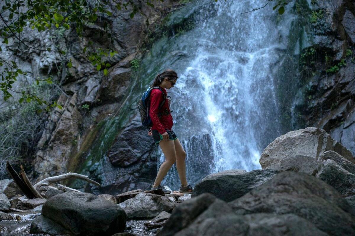
(The area is open only during the week as of mid-June.)
Sturtevant Falls in the Angeles National Forest tumbles 75 feet down mossy rocks into an especially clear pool, where hikers and furry companions stand to soak up the mist. Sturtevant is one of the county’s better known falls, and one of the most reliable year-round, so expect crowds whenever you go.
From Chantry Flat, you’ll walk three-fifths of a mile along a steep paved road. Don’t worry: You’ll feel farther from the city when you arrive at an old campground and follow signs for Sturtevant Falls. The trail is mostly flat and shady from there, and you’ll rock hop across the Santa Anita Creek a few times before reaching the falls.
Trail conditions: About 3.5 miles round trip. The trail is clearly marked. There’s some shade. Leashed dogs are OK.
Info: Take North Santa Anita Avenue until it turns into Chantry Flat Road. Park in the main lot (with a $5 Adventure Pass) or Adams’ Pack Station ($5). Lots fill up early, and hikers often wind up parking on the road.
Switzer Falls, above La Canada Flintridge
If you enjoy wet shoes and rock hopping at Eaton Canyon, you’ll like this challenging trek, which offers views of the nearly 50-foot Switzer Falls from two perspectives in the San Gabriel Mountains.
From Switzer Picnic Area in the Angeles National Forest, follow the Gabrielino Trail as it winds through oaks and alders and crosses the Arroyo Seco stream. About 1.5 miles in, the trail steepens up to Bear Canyon; you’ll see the falls from the top. Follow Bear Canyon Trail back to the creek and upstream, traverse the wash a few more times and watch from below as the two-tiered Switzer Falls thunder down.
Trail conditions: 4.3 miles round trip. The trail is clearly marked and mostly shaded. Be careful when crossing the river. Leashed dogs are OK.
Info: From Angeles Crest Highway, take Switzer Truck Trail, which takes you to park at the Switzer Picnic Area, where the hike begins.
Reminders
Hikers heading to waterfalls are reminded to obey all posted warnings about climbing, diving and swimming — and be careful when crossing streams and walking on wet rocks. Also, make sure you know exactly where you are going.
- Contact visitors centers to get up-to-date trail conditions and tips on the best routes.
- Pick up a regional hiking map at outdoor stores such as REI and A16.
- Read up on your intended route at websites such as ModernHiker.com and HikeSpeak.com.
More to Read
Sign up for The Wild
We’ll help you find the best places to hike, bike and run, as well as the perfect silent spots for meditation and yoga.
You may occasionally receive promotional content from the Los Angeles Times.


