This Northern California hike features massive waterfalls and deep swimming holes
- Share via
Whenever I’m feeling stressed out, heartbroken or scared over the state of our nation, the one place where I can find solace, however fleeting, is in the outdoors.
I’ve taken several mental vacations this past week back to the most beautiful hike I’ve ever traversed in California. I can close my eyes and feel the sun on my skin as I sit next to a massive waterfall, its roar filling my ears as my face turns misty from its blast. I’d like to take you there with me now and explain how, when and why you must go too.
You are reading The Wild newsletter
Sign up to get expert tips on the best of Southern California's beaches, trails, parks, deserts, forests and mountains in your inbox every Thursday
You may occasionally receive promotional content from the Los Angeles Times.
In mid-May, I traveled three hours north of Sacramento to the Trinity Alps Wilderness so I could write a guide on how to explore the region. You’ll find everything you need to start planning your trip.
The Trinity Alps are about 540,000 acres, which is about 100,000 acres larger than the San Gabriel Mountains National Monument, and they feature massive waterfalls, crystal-clear rivers and creeks, and dozens of turquoise alpine lakes.
The Canyon Creek trail is the most popular in the Trinities, and for good reason, as it has each of those things.
Backpackers often take the path 8.5 miles to the Boulder Creek lakes or nine miles to the Canyon Creek Lakes. (Note: If you’d like to backpack the trail, please visit the Weaverville Ranger Station beforehand to gain clarity on where you should camp, as there are certain areas that have been damaged by overuse and should be avoided.)

I took a 16-mile, round-trip day hike, ending my journey at the upper falls, but you certainly don’t have to go that far to see tremendous beauty here, as seemingly every mile traveled offers a new delight.
To reach the trailhead, you’ll take California 299 to Canyon Creek Road, a narrow two-lane thoroughfare that includes two one-lane bridges. You’ll pass through a rural community where signs request you to kindly watch your speed. It’s a good idea regardless of where you’re driving in the Trinity Alps, as deer are easy to spot on the highway (including eating in the middle of the road, which I couldn’t figure out).
You’ll need to arrive early if hiking the Canyon Creek trail on a weekend, as the parking lot can fill up. I went pre-season and had one of three vehicles in the large lot.
From the trailhead, you’ll hike past an information board — during my visit, the forest service staff was warning of two food-motivated bears — and then past a large wooden Trinity Alps sign, a good selfie spot.
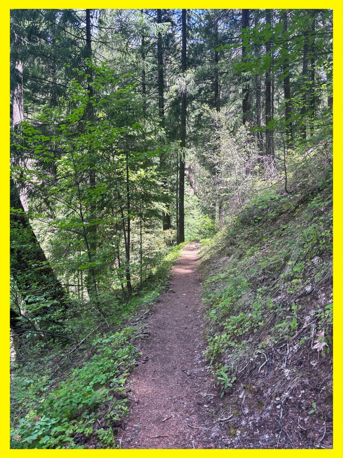
From here, you’ll start down a narrow mostly flat dirt path shaded by massive conifers and bigleaf maples. The path runs parallel to its namesake channel and includes several water crossings of varying sizes, so plan accordingly (i.e. pack extra socks!).
I visited before the Trinity Alps season starts, as it typically runs from June to October, but still noticed several flowering plants in this first mile of my hike, including western starflower, baldhip rose, longtube iris and some type of inside-out flower.
About a mile in, you’ll come to your first major water crossing. On my way back, I did a great job letting the river’s current ram my toes into a boulder, so please take good care as you cross. This is a great turn-around spot if you’re hiking with little kids, as it has a few spots where you can splash around without getting pummeled by the river, along with rocks covered in bright green moss.
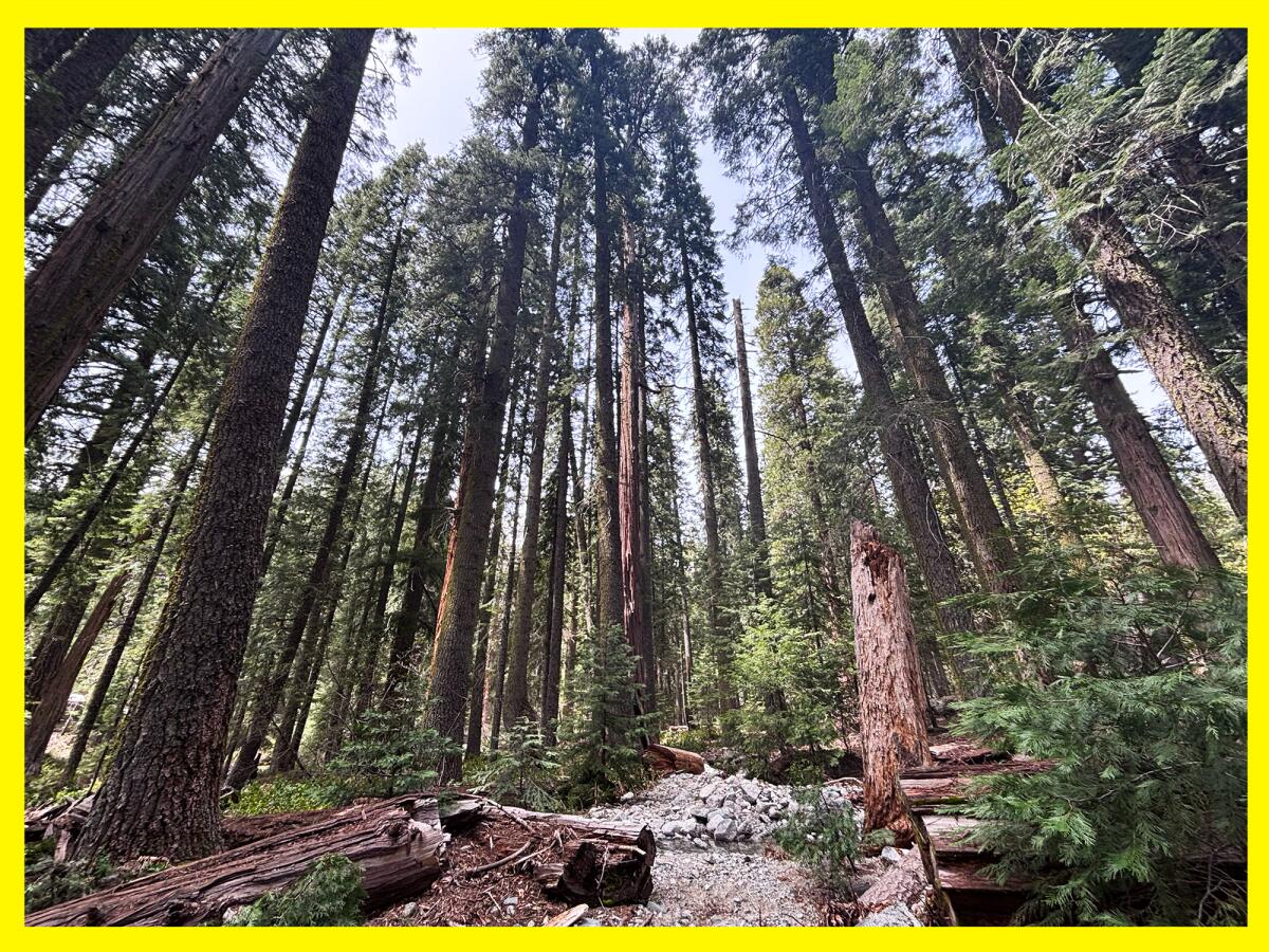
After the crossing, the trail started to remind me a bit of the Switzer Falls hike or the Valley Forge area of the Gabrielino trail, but with way more water and much taller trees. I spotted several deer tracks, and maybe smelled bear urine. I loved seeing the large white blooms of the dogwood trees.

About three miles in, I reached a fork in the trail where I headed down to the Sinks for a short side trip. This area has nice, clear pools where you can take a dip, relax and explore.
It is another great turn-around spot, as you could easily spend the day lounging in the river, napping in a hammock and enjoying the sound of native birds and the river around you. I was almost pulled by the river siren’s call to just stay there. But I really wanted to see all three waterfalls!

Shortly after leaving the Sinks, I walked over a landslide. Alone, happily bored and a big Fleetwood Mac fan, I did sing as I crossed over it (but I did not see my reflection in the snow-covered hills). I later spoke to a forest service worker who said these obstacles were being cleared. So fingers crossed the landslide won’t be there when you arrive.

This segment of the trail felt like it was teeming with life. Several rocks I passed had dens beneath them for snakes, frogs and other creatures. The trees had holes where woodpeckers had or will store food. Also, several conifers had bark covered in furry moss. I am always reminded when in nature about our interconnections and how we can all support each other.
Soon, I ascended from the forested area onto a rockier part of the trail where I had clear views of the jagged canyon walls. You’re at just over 4,000 feet while the tops of the canyon walls are easily more than 2,000 feet higher in elevation. Also, this is a sunnier portion of the trail, so you’ll want to make sure to reapply sunscreen.
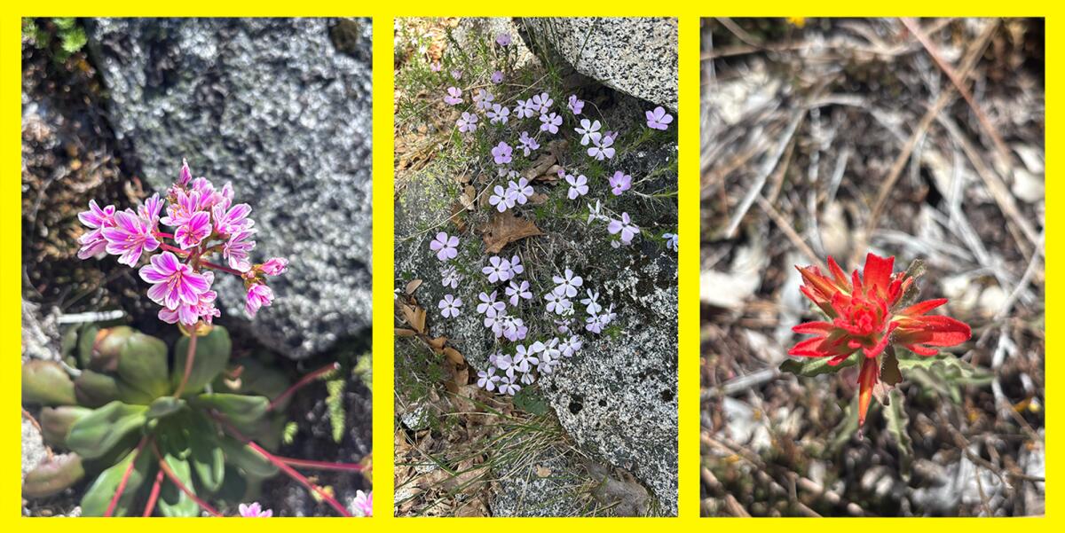
As you hike, I hope you’ll spot even more wildflowers than I did! I passed by large boulders covered in moss and bright pops of spring color, including a yellow small-leaved monkey flower, light purple spreading phlox, red paintbrushes and pink cliff maids.
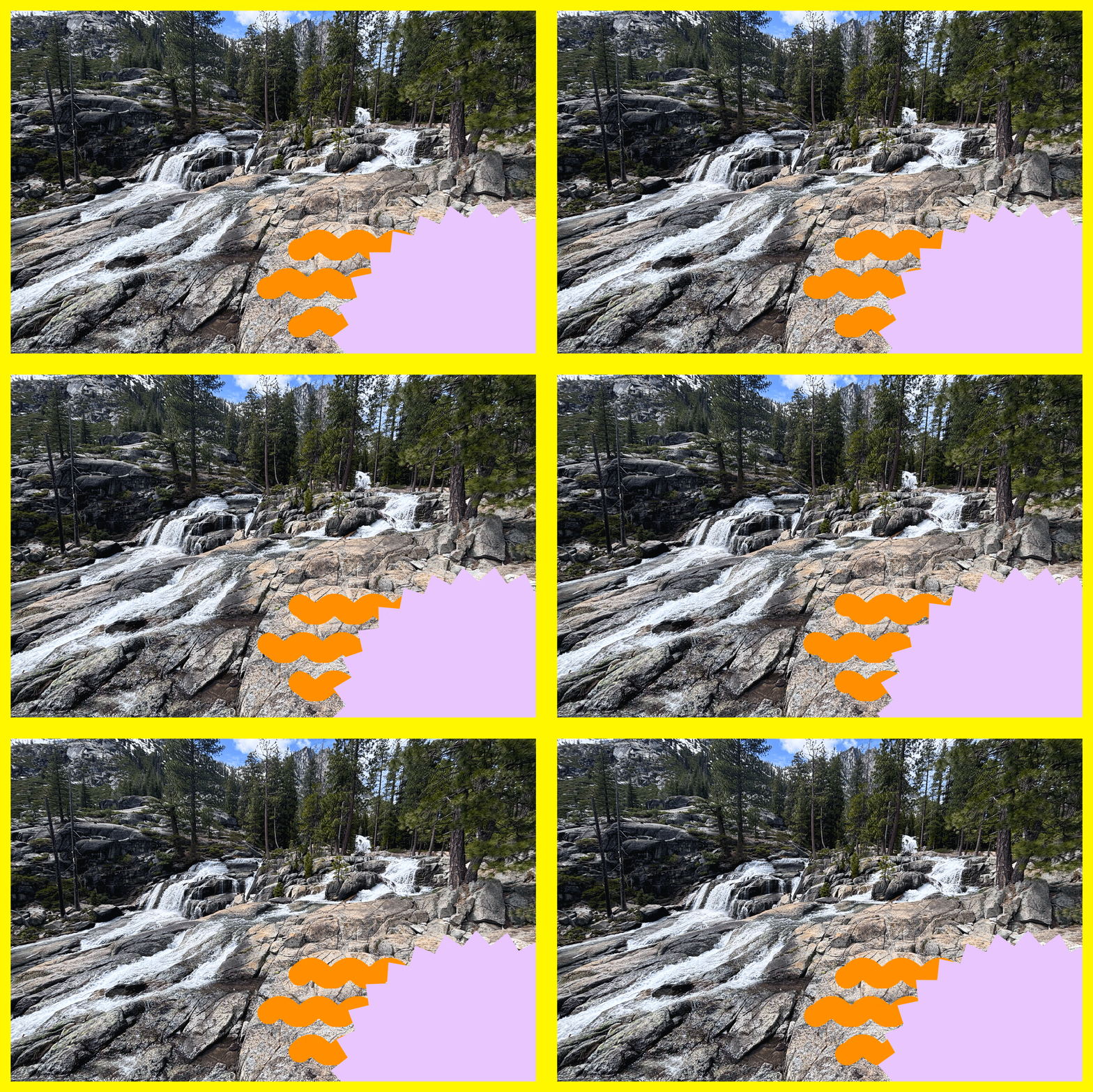
I could hear Canyon Creek Falls, or the lower falls, long before I arrived, calling to me like a music festival starring Mother Nature. And then, four miles in, I screamed in delight and briefly wondered if I’d somehow made it to the upper falls because of the size of the cascade before me. I stood in awe of the wide multi-story waterfall, watching hundreds of gallons of water rush over boulders into a deep turquoise plunge pool.
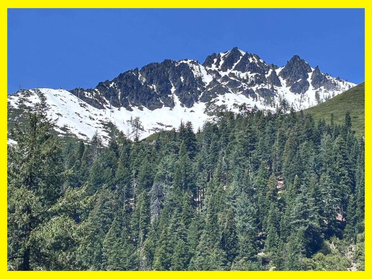
I talked to three backpackers from Northern California, one of whom was celebrating a birthday, as they debated where they’d camp. I saw a total of eight people all day.

As I gained elevation, I reentered another forested area with boulders at least 12 feet tall. About 4.5 miles in, you’ll pass by Upper Canyon Creek Meadow. Part of it appeared to be part wetlands, part meadow, looking like an ideal place for fish to hide if they can make it there. There was a substantial amount of bear scat in this area, so on the way back when I spotted a small cave nearby, I snapped a quick photo and skedaddled.
The trail was harder to find five miles in. I ended up off-trail multiple times, but it was usually easy to see where I’d gone wrong. Please download a map before heading out so you can check your outdoors app. And, yes, carry a paper map too just in case.

At six miles in, you’ll find yourself standing mouth agape at the middle falls. This website claims this waterfall, which is easily more than 100 feet high, is “great for whitewater enjoyment.” This sounds terrifying to me, but I’m not going to yuck anyone’s yeehaw. There is a short trail (about 400 feet) you can take to the base of the middle falls. Please use caution as it’s crumbly and a bit technical.
I did not spend too much time here because, as mentioned, I had tunnel vision for the upper falls. But stopping here would provide you with a splendid 12-mile, round-trip hike where you would get to see two massive waterfalls, an absolutely stunning river with several pools, the Sinks, mountain views and wildflowers (and probably deer because they’re everywhere in the Trinity Alps).

But if you want to keep going, a striking reward remains about a mile ahead. I knew I was getting tired, so I ate my favorite trail gummies and other snacks and headed past ancient trees and over rocky steps, reminding myself how lucky I was to be on the clock in the woods.
Near a large rock that resembled the Mandalorian’s helmet, I checked my map and found I’d almost made it. When I took my final turn, I could see rushing water past a stand of trees. I forged ahead and found myself standing (alone!) before 10 short cascades rushing over various sized boulders. I thought this was the upper falls, and I was impressed.

But I heard a loud roar of water and I couldn’t help myself. I carefully traveled around the rocky area and realized that those waterfalls were only the upper portion of the upper falls. The water continued racing down the mountain. In total, the upper falls are easily hundreds of feet.

I sat near the waterfall, enjoying what tasted like the best peanut butter and jelly sandwich I’d ever had, given the scenery and the journey I’d made to get there. I briefly toyed with the idea of hiking the additional 1.5 miles to the Canyon Creek Lakes, pulled by the allure of the larger of the two, which spans 25 acres and reaches a depth of 86 feet. But I knew that was foolish. I wanted to get back to my car before nightfall. And after falling deeply in love with the landscape, I know I will return to the Trinity Alps (hopefully many times).
On the hike back, I had to go slightly off trail through dense weeds to avoid some stagnant water pooled on the trail, which I’d already done once. This time, though, as I lifted my foot, one of the springy plants shot back up and slapped me right in the middle of my face. Stunned, I wondered whether my lip was bleeding. It felt a bit karmic, like the universe saying, “Hey, watch it!” I hope you’re laughing as much as I was.
It was impossible to bring my mood down after hiking in one of the most beautiful places in California and arguably the West.

3 things to do

1. Celebrate California State Parks Week across L.A.
State parks across L.A. County (and California) are hosting events through Sunday to celebrate California State Parks Week. At Topanga State Park, the Santa Monica Mountains Task Force of the Sierra Club will host an introductory trail maintenance course from 8:30 a.m. to 12:30 p.m. Saturday. At Santa Susana Pass State Historic Park, visitors can attend a morning mindfulness hike from 9 to 11 a.m. or an evening hike from 5 to 7 p.m., both on Saturday. Find events near you at castateparksweek.org.
2. Sashay down the trail in Glendale
A group of local nonprofits will host Pride Outside: San Gay-briel Mountains from 5 to 8 p.m. Saturday at Deukmejian Wilderness Park in Glendale. Organizers will offer a one-mile hike at 5 and 7 p.m. to prevent overcrowding on the trail. In between, the group will hear from local organizations and watch drag performances. Register at eventbrite.com.
3. Cut the mustard in La Crescenta
The Arroyos & Foothills Conservancy needs volunteers from 8 to 10 a.m. Saturday at its Rosemont Preserve in La Crescenta. Participants will yank invasives like black mustard, water newly planted native plants and perform trail maintenance. Volunteers are welcome to bring shovels, spades, loppers, hatchets and clippers. Other tools will be provided. Register at arroyosfoothills.org.

The must-read
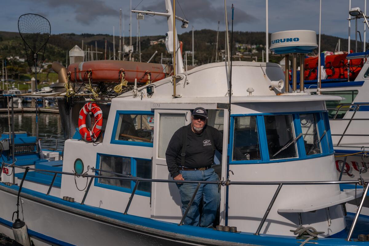
This past weekend, Californians were allowed to fish in the ocean for Chinook salmon, the first time the state allowed recreational fishing of the species since 2022. Times reporter Ian James spoke to William “Captain Smitty” Smith, who was busy preparing his charter fishing boat Riptide at Pillar Point Harbor in Half Moon Bay. Smith said the moment news broke in April that the state would allow a limited amount of fishing of Chinook salmon in the ocean, his regulars called and his boat was booked up. His plan was to take out 18 people both days. California Department of Fish and Wildlife is allowing up to 7,000 of the fish to be caught. If that quota wasn’t met this past weekend, then salmon fishing will be allowed until the limit is reached, likely on July 5-6, July 31-Aug. 3 and Aug. 25-31. Given the progress the state has made on improving the salmon’s environment (although climate change has more than made it challenging), Smith told James that he’s hopeful about what the future holds. “I want there to be a fishery for my grandson,” said Smith, who has worked in the charter boat industry for 50 years. “I want him to be able to experience the thrill of catching a fish in the ocean.”
Happy adventuring,

P.S.
L.A. County Parks and Recreation is hosting family campouts through the summer, including this month where participants can learn about fishing in our local lakes at four county parks. At Kenneth Hahn State Recreation Area, campers can participate in a night hike, and at Castaic Lake Recreation Area, kayaks will be available. Each event is $15 per person. Children 13 and younger are free. Register at bit.ly/OvernightCamping.
For more insider tips on Southern California’s beaches, trails and parks, check out past editions of The Wild. And to view this newsletter in your browser, click here.
Sign up for The Wild
We’ll help you find the best places to hike, bike and run, as well as the perfect silent spots for meditation and yoga.
You may occasionally receive promotional content from the Los Angeles Times.


