Heading south in Steinbeck’s footsteps, with a Prius and a plan
- Share via
ARAVAIPA CANYON WILDERNESS, ArIz. — Soon the beauty of fall will be gone, the festive holidays a memory. The snow will have outstayed its welcome, and the world outside will be pale and cold. For those of us in the Mountain West, February, the shortest month, can be 28 long days of despair.
That’s when the road south calls.
I heard the call while reading “The Log from the Sea of Cortez,” John Steinbeck’s account of cruising the sea in a sardine boat, dropping anchor in Mexican villages and collecting marine specimens along the way.
I didn’t have a boat, but I did have a Prius. And a plan. I would set out from my home near Denver, steering a course south into Arizona to investigate a strangely lush canyon, then head into Mexico to explore the driest place in North America and finally alight on the Sea of Cortez.
It all seemed a world away as I motored down icy Interstate 25, hugging the eastern side of the Rocky Mountains through sprawling Colorado Springs, gritty Pueblo and charming Trinidad, once dubbed “the sex change capital of America” for the number of gender reassignment surgeries performed there.
The car labored up 7,800-foot Ratón Pass through forests of pinyon pines into New Mexico. Snow flurries flecked the air.
Somewhere around Albuquerque, chill winds gave way to balmy breezes. I drove by a church where I once met a Catholic priest wrestling with the results of a genetic test showing he was of Jewish ancestry. The next morning he showed up at Mass wearing a crucifix and a Star of David.
“Somewhere around Albuquerque, chill winds gave way to balmy breezes.”
I’ve chased so many stories throughout the Southwest that road trips feel less about the destination than the rush of memories they evoke: I met an old woman living in a boxcar here. You can get cremated on a pyre there. There’s a sanctuary for troubled parrots here. You can drink peyote tea there. Hungry? The waitresses at that diner carry guns. Try the M-16 burrito.
After 14 hours, I hit the outskirts of Tucson. The setting sun illuminated swaths of desert marigolds along the road. I found a cheap hotel and turned in for the night.
Sonoran slash
The next morning, I drove 90 minutes north on Arizona 77 through the Catalina Foothills, past the tiny town of Mammoth and onto a winding 12-mile road, eight of them dirt, leading to the Aravaipa Canyon Wilderness.
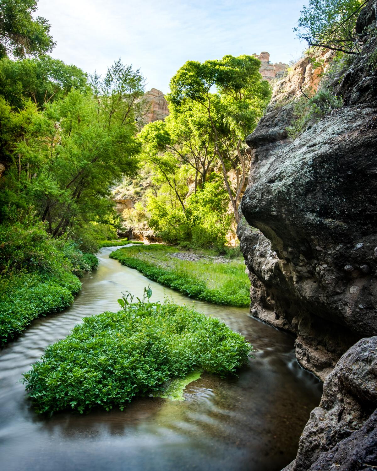
The canyon is a rare, watery slash through the Sonoran Desert. Twisted saguaro cactuses line the parched clifftops while a broad creek rolls through the narrow rock walls below.
Most of the hike is through water. Sometimes it’s knee-high, sometimes thigh-high, sometimes deeper.
“I’ve chased so many stories throughout the Southwest that road trips feel less about the destination than the rush of memories they evoke”
I followed a trail from the parking lot to the canyon floor and plunged into the creek, using a stick to balance and judge depth. After a while, houses and ranches began to appear. I checked the map. I had gone right at the trail head. I should have gone left.
The canyon rang with expletives. I found a dirt road and trudged three miles back to the parking lot.
“How was the hike?” asked a passing Bureau of Land Management ranger.
“Took a wrong turn,” I replied.
“You went right?” she asked, as if she couldn’t believe her ears.
“You’d figure there’d be a sign or something,” I said, feeling slightly defensive.
“You go upstream on the way in and downstream on the way back,” she explained.
Of course.

I retraced my steps and went left.
This was more like it. Water churned around broad sandbars. Sheer rock faces a thousand feet high loomed ahead. The walls closed in, then broadened. Blue herons fed in the shallows; minnows darted around my feet.
Side canyons emerged, including Horse Camp Canyon dotted with sycamores and cottonwoods. It began getting dark, so I headed back. A half-dozen javelinas, a kind of peccary, scampered in the thick undergrowth. I used a small flashlight to locate a rock cairn leading to the trail out.
It was raining when I left Tucson the next morning, bearing west on Arizona 86 through the 2.8 -million-acre Tohono O’odham Nation, which stretches into Mexico. After three hours, I hit Arizona 85 at tiny Why, turning south through Organ Pipe Cactus National Monument to the border crossing in Lukeville.
Peaks and dunes
I’ve crossed from Arizona to Mexico many times.
A Mexican guard waved me into Sonoyta. I carefully observed the 40-kilometer-per-hour speed limit (about 25 mph) to avoid trouble from the vigilant local police. The torrential rain continued as my low-slung car gingerly crept through deepening puddles before I steered south onto Highway 8.
A few minutes later, the heavy clouds began to lift, revealing the austere mountains of the Gran Desierto de Altar, considered the driest place in North America — though not on this day — and a UNESCO Biosphere Reserve.
After about 24 miles, I turned at a sign for Pinacate Peaks, volcanic peaks, cinder cones and enormous craters within the biosphere reserve. But the gate was locked. An employee told me it had been closed because of a dispute between the landowner and the government. As of now, it remains closed. (There is a way in from the north, but I’m told it requires good route-finding skills and a four-wheel-drive. Not a Prius. Talk to the folks at the gate before trying it.)
So I continued south to the Schuk Toak Visitors Center, part of the reserve that showcases the cultural and natural history of the region. A mile-long dirt road behind it led to a collection of magnificent sand dunes, some more than 600 feet tall. It is the largest active dune field in North America and the only erg, a vast area of desert covered in windswept sand.
I climbed the knife edge of a high dune that resembled a sculpted wave in a trackless sand sea. The dramatic, slate gray Pinacate Peaks rose in the distance.
It began raining again. I was drenched by the time I reached the car. Then I bottomed out on a slab of volcanic rock. The Prius began making strange thumping sounds. I pulled off Highway 8 — pushed this, pulled that — drove 200 feet more, and it thumped again.
I crawled under the front tire, rain pelting my face, and repeatedly punched the rubber casing above it. A truckload of masked, gun-toting solders slowed down to look at me. I smiled and waved from beneath the car and they kept going.
When I drove off, the car was silent. How? I have no idea. Twenty miles later, I pulled into Puerto Peñasco, or Rocky Point as it’s also known.
The streets were now rivers. A pharmacist stood outside his shop.
“It hasn’t rained like this in years,” he said with delight.
He tried selling me knock-off Viagra for $2.50 a pill, claiming “you can’t do better than that” before pitching condoms. What kind of town was this?
It’s actually a fishing village and a popular destination for Arizonans and spring breakers. Though no Cancún, it was nevertheless appealing.
Here, the desert met the sea. The intersection of bliss. For me, at least.
The rain stopped, and the sun emerged. I walked to the harbor, bobbing with red, green and white fishing boats. Two men with weathered hands scaled bonito on the dock.
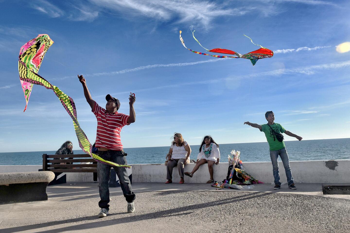
The Sea of Cortez shimmered just ahead. Waves pounded massive rock outcroppings. I waded into the blue water. A pack of boys scurried past, hunting octopuses in the abundant tide pools.
Back home a hurricane-force blizzard had paralyzed much of Colorado.
I considered heading deeper into Mexico. Maybe spend another week, see some of those places Steinbeck visited — Loreto, La Paz, Guaymas.
Next time.
If you go
Aravaipa Canyon Wilderness. Permit required year-round.
More to Read
Sign up for The Wild
We’ll help you find the best places to hike, bike and run, as well as the perfect silent spots for meditation and yoga.
You may occasionally receive promotional content from the Los Angeles Times.


