Get a turkey vulture’s view of Big Sur glory
- Share via
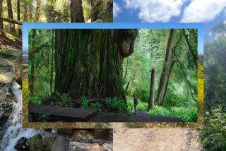
Hikers can experience nearly every facet of Big Sur’s terrain on the Buzzard’s Roost Trail, which follows the Big Sur River, meanders through redwood groves, ascends slopes shaded by oak and bay trees, then climbs ridges cloaked in chaparral.
Buzzard’s Roost is the least traveled trail in Pfeiffer Big Sur State Park. Those who do make the journey atop Pfeiffer Ridge (or Buzzard’s Ridge, as some hikers call it) get the same view the park’s turkey vultures enjoy: a dramatic river gorge, the Ventana Wilderness and the wide Pacific.
The Buzzard’s Roost Trail is the park’s longest and most challenging footpath, but there are lovely hikes that are short and easy. These include the two-mile loop to Pfeiffer Falls with a return on Valley View Trail, and the 2 3/4-mile Oak Grove Trail to the historic Homestead Cabin and Big Sur Gorge.
But this week let’s focus on Buzzard’s Roost, which can provide lots of solitude. To reach the trail head, follow Highway 1 to the park entrance, 26 miles south of Carmel and two miles south of the town of Big Sur. After paying the $5-per-car day-use fee at the entrance station, you will drive past the Big Sur Lodge and cross a bridge over the Big Sur River. The road then curves left, and the trail sign and parking area will appear on the left. (You also can park at the lodge and hike from there.)
Buzzard’s Roost Trail runs under two bridges -- one for a campground, one for the highway -- before joining an old dirt road. It runs for about a quarter-mile before reaching the river and splitting into two paths. Follow either; they eventually rejoin short of another trail junction.
Hikers can turn north (right) and walk a quarter-mile or so to reach large, grassy Liewald Flat. But we want to turn southeast (left), toward Buzzard’s Roost, and hike half a mile to the beginning of a loop trail.
The right fork quickly takes you up switchbacks to the Buzzard’s Roost Overlook. The left fork is more leisurely, taking 1 1/4 miles to reach the top of the brushy ridge. Either way, after you’ve had enough of the view, finish the loop portion of the trail and retrace your steps back to the car.
John McKinney offers more tips at www.thetrailmaster.com.
More to Read
Sign up for The Wild
We’ll help you find the best places to hike, bike and run, as well as the perfect silent spots for meditation and yoga.
You may occasionally receive promotional content from the Los Angeles Times.


