Thunderstorms Hit Southland but Clearing Is Expected Today
- Share via
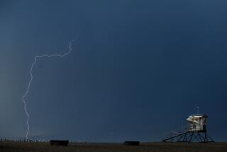
Thunderstorms blustered through the Southland Thursday night in what forecasters said was probably the final onslaught of a three-day storm that is expected to head east this morning, leaving partly cloudy skies and warmer temperatures for the weekend.
Squalls late Wednesday and early Thursday dumped almost half an inch of rain on San Juan Capistrano, the wettest spot in Orange County Thursday, and showers added another 0.04 of an inch to the rain gauge in Santa Ana, raising the total there from the storm to 0.94 of an inch.
Other rainfall totals from the storm by 5 p.m. Thursday included 0.25 of an inch in Newport Beach and 0.09 in El Toro.
Thundershowers fell again throughout Northern and Central California on Thursday, and once again--for the third straight day--funnel clouds were reported, this time near Los Banos, Turlock, Bakersfield and Coalinga, although there were no reports of damage.
Snow continued to fall in the Sierra Nevada, where more than 2 feet have been added to the snowpack this week at some resort locations.
But water resources officials said that despite the prolonged statewide storm, it will still take a lot more rain and snow to erase the threat of water shortages if precipitation falls short again next year.
“While this storm was a problem for some people, it was badly needed across the state,” said Mike Smith, a meteorologist for WeatherData Inc., which provides forecasts to the Times. “It doesn’t break the drought by any means, but it’s a big help.”
The sporadically heavy showers that moved through Orange and Los Angeles counties during the Thursday afternoon and evening rush hour snarled homeward commuter traffic for the third straight day and caused widespread blackouts in Los Angeles County but little trouble in Orange County.
Lightning knocked out electricity to 1,800 customers in La Habra for half an hour Thursday afternoon, although it took another three hours to get power up for 345 of them, said Roger Faubel, a spokesman for Southern California Edison Co.
The Dodgers-Padres baseball double-header at Dodger Stadium was rained out Thursday night for the third rain-out there in as many days.
The squall line that hit the Southland Thursday night had originally been expected before dawn.
“But the thunderstorms, clouds and crud just sat there off the coast for a while. They didn’t get moving inland until Thursday night,” said meteorologist Dan Bowman of WeatherData.
“That stuff should move out east in the morning,” he said. “There’s another storm coming down on Saturday, but right now it looks like it’ll be too weak and stay too far north to affect the southern part of the state.”
Temperatures in Orange County remained chilly Thursday, with a high in San Juan Capistrano of 69 degrees after an overnight low of 49. Santa Ana reported a high of 65 and a low of 51, with El Toro the coldest spot in the county, reporting an overnight low of 47 degrees.
Meteorologist Smith said it will be cool again today, with Orange County high temperatures in the low to mid-60s, but he said it should warm a little during the weekend, with highs pushing into the low 70s.
“It’s going to warm up for the weekend,” Smith said. “Skies will be clear. But with the wet ground, there may be some valley fog.”
And after that?
“Right now, it looks like another storm way out there, west of the Aleutian Islands, could bring some rain to Southern California next Tuesday or Wednesday,” Bowman said. “It’s a little early to tell. But it could.”
More to Read
Sign up for Essential California
The most important California stories and recommendations in your inbox every morning.
You may occasionally receive promotional content from the Los Angeles Times.


