Great Viewing From O’Neill Park Vistas Near El Toro
- Share via
The soldier who lost his firearm while marching in this hilly region with Capt. Gaspar de Portola’s 1769 expedition would no doubt be astonished at the number of Orange County place names inspired by his mistake. Trabuco, which is the Spanish word for blunderbuss, now is the name of a canyon, a creek, a plain, a trail, a road and even a ranger district of the Cleveland National Forest; at one time it was also the name of a rancho.
And if that negligent soldier trekked this way again, he would be even more amazed at the land itself, so drastically has it changed. But perhaps he would recognize Trabuco Canyon, at least that part of it saved from suburbanization by O’Neill Regional Park. Here the modern trekker can explore a small slice of the pastoral Southern California of two centuries ago.
This land of grassy meadows, rolling hills and oak woodland was originally part of Rancho Trabuco, two leagues granted to Santiago Arguello in 1841 by Mexican Gov. Alvarado.
The rancho had various lessees and owners until it was purchased by James Flood, a wealthy businessman, and his partner, Richard O’Neill Sr., a packinghouse owner. O’Neill built up quite a ranching empire here and elsewhere in California. O’Neill’s Orange County property passed to various heirs, who in 1948 gave 278 acres of Trabuco Canyon to Orange County for a park. Today, after various other gifts and purchases, the park encompasses 1,700 acres of woodland and brushy hills, taking in Trabuco Canyon and neighboring Live Oak Canyon.
A good way to learn about the ecology of Trabuco Canyon is to walk the park’s 1 1/2-mile (round trip) nature trail. Trabuco Creek Trail, with stops keyed to a pamphlet available at the park’s entry station, meanders through an oak-sycamore woodland and explores Plano Trabuco, or Trabuco Flat, a level alluvial surface deposited by runoff from the slopes of the Santa Ana Mountains.
Another way to explore a bit of rural Orange County is to hike the park’s various fire roads and trails on a route I’ve dubbed O’Neill Park Trail. The trail ascends to Ocean Vista Point, which offers fine coast and canyon views.
Directions to trailhead: From the San Diego Freeway in El Toro, exit on El Toro Road and drive inland 7 1/2 miles to Live Oak Canyon Road. Turn right and proceed 3 miles to O’Neill Regional Park. The park is open for day use 7 a.m. to sunset. There’s a $2 entry fee per vehicle. Park in the day-use lot near the entrance. O’Neill Park information: (714) 858-9366.
The hike: From the entry station, walk north on a service road that parallels Live Oak Canyon Road. (Children 17 and younger are allowed only with an adult because of the possible presence of mountain lions.) Soon you’ll head left on another paved road that ascends toward some water tanks. After a quarter of a mile, leave the pavement and turn right on a dirt road on your right (an optional return route from the top).
Continue your ascent along a ridge. Over your shoulder are two scenes typical of rural Orange County: red-tailed hawks circling over classic Southland ranching country when you look in one direction, and suburbs-in-the-making in the other.
Continue on a last steep ascent toward what appears to be a “Star Wars” movie set but is actually Ocean Vista Point, sometimes known as Cellular Hill. As the name implies, it’s a communications installation that helps car phoners complete their calls.
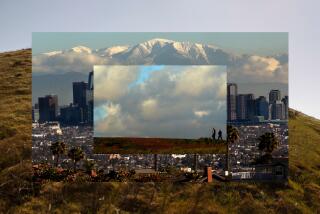
From the 1,492-foot summit you’ll enjoy--on at clear day, at least--coastal views from Santa Monica Bay to San Clemente, with Catalina Island on the horizon.
For a different return route, head back 200 yards and make a left at the first fork. Descend to an unused kids’ camp, then follow the park’s service road back to the trailhead.
O’Neill Park Trail
Trabuco Canyon to Ocean Vista Point: 3 miles round trip; 600-foot elevation gain.
More to Read
Sign up for The Wild
We’ll help you find the best places to hike, bike and run, as well as the perfect silent spots for meditation and yoga.
You may occasionally receive promotional content from the Los Angeles Times.


