Ice Sensors Cometh : New Computer Helps Caltrans Keep Freeway Open
- Share via
As snow and ice frosted the Golden State Freeway early Thursday, Caltrans officials for the first time had a computerized edge against Mother Nature in keeping the mountainous route through northern Los Angeles County open to traffic.
Electronic sensors installed along the freeway’s perilous winter route over the Tehachapi Mountains fed measurements of temperature, precipitation and other roadway conditions to a command center in Lebec. A computer identified areas where the freeway was icing and where to best deploy Caltrans plows and sand trucks.
The specific information from the so-called “Scan-cast” computer allowed Caltrans officials to concentrate its efforts, rather than spread its fleet out over 30 miles of freeway--as would be the usual routine.
“We stayed ahead of the game this way. We were able to keep the road open,” said Tony Fletcher, a computer operator who monitored the sensors.
Though Caltrans officials said Thursday’s freeway icing was slight compared to what may still be ahead this winter, they were optimistic that the new system may help ease an annual commuter nightmare.
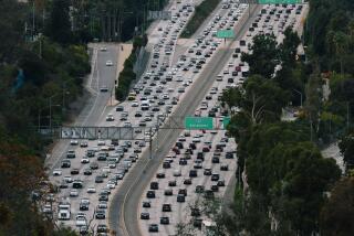
In previous winters, the Golden State Freeway--California’s main north-south artery--has often been choked off by snow and ice on the mountain ridge route. The traffic problems were often monumental, causing motorists to wait out closures for hours at truck stop coffee shops and motels or take long detours.
Though the new computer system is not expected to prevent all closures of the freeway, Caltrans District Director Jerry B. Baxter said, “It is going to give us a jump-start. We can mobilize quicker and it should cut down on the amount of time the highway is closed.”
Baxter said the Scan-cast system--short for surface condition analyzer and forecast--was installed last summer by a St. Louis company after Caltrans received $300,000 in federal highway funds to test the project. Similar systems have been used since the 1970s on runways at airports across the country, and in recent years several states have added the systems to freeways.
On the Golden State Freeway system, 11 road surface sensors and four atmospheric sensors are spotted along a 30-mile stretch between Castaic Lake and Ft. Tejon.
The sensors act as small weather stations, providing up-to-the-minute readings on pavement temperature, precipitation, wind velocity, humidity and chemical factors such as the amount of salt or oil on the roadway. The system also can use the data to provide 24-hour weather forecasts for the freeway area.
On Thursday morning, the computer showed freezing temperatures on the freeway surface in the Frazier Park-Tejon area, but temperatures were well above freezing to the south. Fletcher said 15 Caltrans trucks--all but one of the available fleet--were sent to the freezing area to plow snow and drop sand and salt on the roadway. The crews were able to prevent the freeway from icing over and all lanes remained open.
“It was amazing,” said California Highway Patrol Sgt. Mark Rhoades. “They were able to tell exactly when the pavement was going to freeze and get to it.”
Fletcher said the days when Caltrans planned their efforts against freeway icing using a map with pins signifying the location of available trucks may soon be over.
“We are no longer playing it by the seat of our pants,” he said. “We have an exacting instrument that can tell us what is going on out there.”
More to Read
Sign up for Essential California
The most important California stories and recommendations in your inbox every morning.
You may occasionally receive promotional content from the Los Angeles Times.


