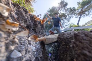
GETAWAYS : A Walk on the Edge : Devils Punchbowl is wedged between the San Jacinto and San Andreas faults. Rifts in rock record the San Gabriels’ violent past.
- Share via
One of the San Gabriel Mountains’ finest hikes begins on the Antelope Valley side at Big Rock Creek.
There, at 5,000 feet, the air is bracing, though warm on a sunny afternoon. Forested high country rears 3,000 feet above, its snowmelt feeding splashing streams. White yucca, yellow Fremontia and the desert’s orange-red Mariposa lily are in bloom. But the great fascination is to walk along an honest-to-goodness earthquake fault, the San Jacinto, its violent past recorded in rock right beside the trail.
The goal is Devils Chair, a promontory that looks down from an awesome height over Devils Punchbowl. Three miles long by a mile wide, that grand but hardly satanic outcrop of dun and pinkish sandstone and other soft rock stands out against the dark desert slopes all around. It is wedged between two major, roughly parallel rifts that define the San Gabriels’ north edge: the San Jacinto and San Andreas faults.
Then 30 miles east, the same rock reappears on the north side of the San Andreas as the Cajon Beds, beside California 138 near Interstate 15. Once joined, the two outcrops now provide striking evidence of surface movement along the fault.
You see more such geology as you approach the Punchbowl from Pearblossom. From a hilly stretch of Valyermo Road, you glimpse its tilted strata cradled in mountains ahead. Down the hill, you drive right through the flat, mile-wide San Andreas trough and spot the formation again beyond green farm fields.
South on Big Rock Creek Road, you follow a woodsy stream bed that widens into a bouldered canyon-bottom wash. Soon you reach a graded road to the trail head, where signs direct you west across the South Fork of Big Rock Creek. You may have to wade until the snow above is gone.
Climbing two ridges before reaching Devils Chair, the trail follows the San Jacinto Fault, a clear line marked by abrupt changes in rock. South of the line appear patches of rock, stark white or a marble-cake swirl of white and gray, then yellow, green and purple tints farther along. North of the line, the chaparral-covered mountainside displays occasional rock outcrops.
Because it’s in the fractured, easily eroded rock of a fault crush zone, the trail has places where gravel and small slides make walking tricky. Make sure you wear shoes with good traction.
At ridge top, you see where you’ve been and where you’re going. From the first saddle, you look back to the South Fork. Above and beyond, you can trace the fault line in outcrops and crush-zone notches eroded in mountain ridges. To the west, you look into Holcomb Canyon and across at rocks again different on either side of the fault.
On down, Holcomb Creek creates a linear oasis of alders and sycamores, big-cone spruce and incense cedar. Pick your way across and look upstream for the trail, which promptly ascends to the second saddle. Now the view east adds the first saddle’s notch to the long visible fault trace. To the west, you are tantalized by a first hint of the Punchbowl.
That provides motivation for a steep climb on switchbacks up across rock fractured into gravel loose as Rice Krispies. At the top is a junction with a trail to the Devils Punchbowl County Park visitor center, two miles away. Take the right-hand branch to Devils Chair, close at hand on a gentler trail.
Now you walk the precipice edge of the fault’s work: rock in hues of dark red and green, light gray and pink, great boulders almost detached from their matrix, rock so decayed that it falls apart at a touch, thick blankets of white rock draped over dark cliffs. Ahead, a vertical cliff climaxes in the white throne of Devils Chair.
The trail ends atop that dizzying eminence, inside a sturdy steel safety fence. At your feet u nfold the stone slabs and fins of the Punchbowl, less a bowl than a sculptured chasm, evoking a Grand Canyon in impact if not in scale. Below the canyon’s lower end you see a road cross the San Andreas Fault’s broad flatland, then climb the bluffs beyond. In the three miles between here and there, the geology map is black with no fewer than 12 fault lines.
If you seek big scale, this should do: the Pacific and North American tectonic plates in dramatic action. The lofty Chair is a ringside chair.
WHERE TO GO
Getting there: The graded access road is 8.5 miles southeast of Pearblossom. From Valyermo Road, go south 2 1/3 miles on Big Rock Creek Road to reach it. Ford the creek if water is low enough and a gate beyond is open; if not, park and walk one mile to the Punchbowl Trail. From there, the Devils Chair hike is five miles round-trip. Allow three to four hours.
More to Read
Sign up for The Wild
We’ll help you find the best places to hike, bike and run, as well as the perfect silent spots for meditation and yoga.
You may occasionally receive promotional content from the Los Angeles Times.


