Top Views in Marin County
- Share via
From Barnabe Peak, you get a fire lookout’s view: Point Reyes, National Seashore, Mt. Tamalpais, as well as lots more of central Marin County.
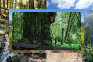
Samuel P. Taylor State Park preserves 2,700 acres of tan oak and madrono woodlands, creek-side redwoods and grassland.
Directions to trail head: From U.S. 101 in San Rafael, exit on Sir Francis Drake Boulevard and travel about 15 miles to the park. The park entrance is about two miles past the hamlet of Lagunitas. Park in the picnic area lot.
The hike: From the picnic area, cross the bridge over Lagunitas Creek and turn left onto the bike/horse trail. The level path continues along the north bank of Lagunitas Creek, and is soon joined by a riding-hiking trail. A half-mile from this junction you’ll come to another--with signed Ridge Trail. Turn left and begin a steady ascent on Ridge Trail.
A bit more than a mile from the summit, the fire road offers a parallel trail alternative; the trail is your best bet for spring wildflower viewing, whereas the road serves up better vistas.
Join Barnabe Trail for a steep descent of a bit over a mile to meet the park’s horse trail. Turn left, continue a short way, and turn right on the path to Madrone Group Campground.
Ridge, Barnabe Trails Distance: 6-mile loop with 1,300-foot elevation gain. Terrain: Steep grassy slopes, redwood-lined creeks. Highlights: Historic retreat, views on Barnabe Peak. Degree of Difficulty: Moderate with some steep sections. For More Information: Samuel P. Taylor State Park, P.O. Box 251, Lagunitas, Calif. 94938; tel. (415) 488-9897.
More to Read
Sign up for The Wild
We’ll help you find the best places to hike, bike and run, as well as the perfect silent spots for meditation and yoga.
You may occasionally receive promotional content from the Los Angeles Times.


