Forecasters Advise Keeping Umbrellas Handy All Week
- Share via
HUNTINGTON BEACH — If it has stopped raining right now, it’s only temporary.
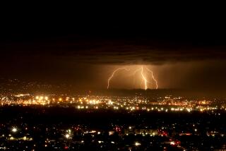
The storm system out of the Pacific Northwest that has been rumbling through the rest of the state all week, bringing gusty winds, heavy showers and floods, finally made it to Orange County Tuesday night.
It didn’t arrive with the gusto that has caused it to drench most of Northern California, but there is a 40% chance of showers today increasing to a 50% to 60% chance on Friday, said Curtis Brack, a meteorologist for WeatherData, which provides forecasts for The Times.
Then, clearing is predicted for the weekend, with warmer temperatures and perhaps sunny skies, Brack said.
“Most of the rain is lingering up around the Santa Barbara area,” Brack said Tuesday. “We are expecting rain [today], maybe some showers on and off during the day. Thursday should only be sprinkles, if anything, but the final wave of the storm should come Friday.”
The rain Tuesday caused an electrical failure in downtown Santa Ana that shut off power to 1,300 houses. All but 22 had power restored with 40 minutes. The remainder were expected to be without power overnight.
Even before its arrival, the storm created heavy surf at Orange County beaches, particularly Huntington Beach where lifeguards reported waves with eight- to 10-foot faces Tuesday. But the winds that accompanied the storm have made the waves nearly useless for surfers, said Claude Panis, a Huntington Beach lifeguard.
“It’s pretty good sized, but stormy, bumpy and walled up,” Panis said. “The shape just isn’t very good.”
Just south in Newport Beach, the swell wasn’t hitting as strongly, said lifeguard Mike Halphide. Newport Beach generally faces south and the storm was coming in from the Pacific Northwest, causing the larger surf to roll past, Halphide said.
The surf was hitting best at a place called Blackies on the north side of the Newport Pier, but again the shape was poor because of the wind, Halphide said.
The news of the approaching storm was being watched closely Tuesday at the Harbor Patrol headquarters in Corona del Mar, said Lt. Dick Olson, the Orange County Sheriff’s Department spokesman for the patrol. Olson said the first storm of any season can be hazardous to boaters who haven’t tended to their moorings in several months.
“We have been keeping our eye on the forecast,” Olson said. “The key is how much wind there is, how much rain and the tide conditions.
Particularly at risk are the offshore moorings where boats sit unprotected from the wind and waves, Olson said.
“Through the summer months, the lines holding those boats get old and frayed, and it doesn’t take much to pop them loose,” Olson said.
Newport Harbor is much more vulnerable to major storms than Dana Point Harbor or Huntington Harbour because of its wide entry channel, he said. Boats docked at the entrance to the channel should be moved if the storm gets rough.
“It appears that some people have already moved out of there and brought them into areas where there are calmer waters during the storms,” Olson said. “We really appreciate that because it means we don’t have to do it during the stormy conditions.”
The high temperatures for Tuesday included 65 degrees in Santa Ana, 64 in Anaheim and 63 in Lake Forest, Brack said. Overnight lows will start in the upper-40-degree range, he said.
The forecast is for much the same temperatures today.
More to Read
Sign up for Essential California
The most important California stories and recommendations in your inbox every morning.
You may occasionally receive promotional content from the Los Angeles Times.


