Faster Ride en Route for Santa Monica Freeway
- Share via
In what is billed as a freeway for the future, transportation officials today will unveil a “smart corridor” that links high-tech traffic systems on the Santa Monica Freeway and surrounding city streets to help fulfill a commuter’s fondest wish: fewer hassles on the nation’s busiest roadway.
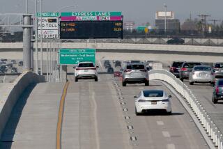
The $48-million federal demonstration project will use an assortment of devices, including electronic roadway sensors, TV cameras, freeway-to-freeway ramp meters and changeable message signs. They are designed to help traffic engineers spot problems faster and take steps to relieve congestion by such tactics as guiding freeway motorists to city streets and then adjusting traffic lights to speed their drive.
And, in a city where radio traffic reports every six minutes don’t seem frequent enough, commuters now will be able to dial a phone number--from home, work or their car--or tune to a radio station for instant road conditions.
Officials say the smart corridor, under development for several years, could serve as a model for the rest of the nation as traffic engineers focus on better managing what they have, rather than building or expanding highways, because of cost and environmental and political opposition.
Although the formal dedication is today, commuters may not notice any immediate improvements in their drive time. While much of the system is in place, some elements still must be installed. And engineers emphasize that the project is geared to solving major problems.
The sophisticated gadgetry will cover a 65-square-mile area encompassing the Santa Monica Freeway (Interstate 10) and Olympic, Pico, Venice, Adams and Washington boulevards between Soto Street and Centinela Avenue, as well as 15 major cross streets.
Brochures on the project talk about it possibly increasing rush-hour freeway speeds by 5 mph and reducing the average freeway trip by 12%, but the traffic engineers are more cautious, considering that the Santa Monica Freeway is the country’s busiest with 335,000 vehicles a day.
But even with its new computer brain, the freeway of the future on some days will still seem like a pain from the past. Officials say the system won’t solve all congestion problems but will cut delays between downtown Los Angeles and the Westside.
Traffic officials say that the smart corridor will benefit commuters most when a big accident or unusually heavy congestion occurs on the freeway.
“For the public, it’s a little hard for them to see the improvement,” said Tom Conner, assistant general manager of the Los Angeles Department of Transportation. But, he noted, traffic would be even worse if not for the new technology.
“We have termed the system the smart corridor because it will use all these electronic intelligence-gathering devices to help keep traffic moving more quickly,” said Larry Zarian, chairman of the Metropolitan Transportation Authority.
Jeff Brooks, deputy regional administrator of the Federal Highway Administration, called the project “the first of its kind in the country. It will help demonstrate the benefits that can be derived from integrating freeway and arterial operations. . . . We think it has a lot of potential not only to reduce vehicular delay but also to decrease energy consumption and pollution.”
This will mark the first time that Caltrans’ traffic nerve center will be hooked up by computer to the city’s Automated Traffic Surveillance and Control war room, allowing the agencies to coordinate their response to problems.
“You have a computer that’s watching you as you drive through this area and looking for problems,” said Conner. “It’s almost like a benevolent Big Brother watching over you.”
Here’s how it works:
When a truck jackknifes on the freeway at Crenshaw Boulevard, sensors in the pavement signal to the control centers--with beeping computers and a red light flashing on a map--that the freeway is slowing.
The incident manager at Caltrans’ center in downtown Los Angeles can rotate the TV cameras and zoom in to check out the trouble. The manager will then put into the computer an estimated duration of the lane blockage.
Within seconds, the computer recommends a course of action, such as advising motorists that they should use the parallel city streets.
Then, with a click of a mouse, traffic engineers at both centers institute countermeasures, which can include making motorists wait longer at freeway onramps to discourage them from entering the freeway and extending the green time on the traffic lights on city streets.
Drivers steered off the freeway will be guided through city streets and back to the freeway by what are called trailblazer signs.
The smart corridor was patterned after the traffic triumph of the 1984 Olympics, when officials used a number of measures to avoid the nightmare of congested streets by installing computer-controlled traffic signals around the Coliseum.
This will be the latest in a string of new transportation projects undertaken in Southern California in recent years, including the nation’s first fully automated toll road on the Riverside Freeway in Orange County, an automated highway test in San Diego County and elevated carpool lanes on the Harbor Freeway in Los Angeles.
Traffic officials will evaluate the smart corridor project for two years before submitting findings to the Federal Highway Administration.
The state is providing $26.4 million, the federal government is contributing $17.3 million and Los Angeles, Beverly Hills, Culver City, Santa Monica and the MTA are chipping in $4.3 million for the project.
Some of the congestion-fighting devices--such as in-road electronic sensors and TV cameras--have been in place on roads for years. Others won’t be up and running for a few months.
The phone number--(213) 89-SMART--and freeway radio station 1620 AM are in service. A radio station providing traffic conditions for the city streets is expected to be in operation in about a month on 1510 AM.
Among features not yet working are the metered connectors between freeways. They will control traffic from both directions of the Harbor Freeway to the westbound Santa Monica Freeway and from both directions of the San Diego Freeway to the eastbound Santa Monica Freeway.
But this feature, already in use on the Century Freeway, has irritated some drivers who say it delays their commute.
Caltrans engineers, however, insist that commuters will benefit from the meters.
“By controlling the amount of people entering from the 405 [San Diego Freeway], for instance, we can control the amount of congestion on that stretch of the Santa Monica,” said Dick Murphy, a Caltrans supervising transportation engineer.
“The time you lose at the meter can be made up by the time you gain from the meter on down the freeway,” he said.
Transportation officials say the intent is not just to shift congestion from the freeway to the streets.
“We are very sensitive to citizen concerns that we are going to put more traffic on the surface streets,” said city transportation engineer Verej Janoyan.
“That will not happen. . . . Right now, we we don’t have control over our surface streets. With this project, we will gain that control. We will know how much extra traffic is coming on the surface street network. We will designate where that traffic goes.”
(BEGIN TEXT OF INFOBOX / INFOGRAPHIC)
The Smart Corridor
A new traffic management system extends along the Santa Monica Freeway and surrounding surface streets. Sensors and cameras feed information to a command center, below left, which then uses a sophisticated computer system to guide motorists to faster routes.
THE SYSTEM INCLUDES:
Metered transitions: Traffic lights will control the flow of cars between freeways.
Radio reports: Special channels (1510 and 1620 AM) give traffic updates.
Special signs: Electronic signs suggest alternate routes and guide motorists through them.
Cameras: Closed-circuit video gives command center instant information.
Smart street corridor: Signs on surface streets will help guide motorists around freeway snags.
Sources: Caltrans, L.A. Department of Transportation, MTA
More to Read
Sign up for Essential California
The most important California stories and recommendations in your inbox every morning.
You may occasionally receive promotional content from the Los Angeles Times.


