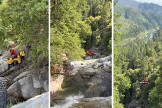
Light as a Feather Falls
- Share via
Feather Falls, a highlight of Plumas National Forest,tumbles 640 feet into a dramatic granite gorge. The falls is the sixth highest in the continental U.S. and the fourth highest in California. .
Feather Falls, a creation of aptly named Fall River, plummets to the middle fork of the Feather River. A lovely trail, shaded by ponderosa pine and incense cedar, leads by frisky Frey Creek to the falls.
Last year, the Forest Service completed a second trail to the falls, enabling the hiker to make a nine-mile loop. The new trail is just an offshoot of the main trail but gives the hiker a more gradual walk.
Directions to trail head: From California 70 in Oroville, exit on Oroville Dam Boulevard (California 162). Proceed 1.5 miles to Olive Highway. Turn right, drive six miles to Forbestown Road and turn right again. After another six miles, turn left on Lumpkin Road and follow this winding road about eight more miles to the signed turnoff for Feather Falls, located just short of the hamlet of Feather Falls. Turn left and drive 1.6 miles to road’s end at the trail head.
The hike: Begin among tall Douglas fir and ponderosa pine, and the standout madron~o, its peeling red bark and bright green leaves distinguishing it from the other trees. A bit more than a mile out, cross Frey Creek on a footbridge. After another quarter mile look left for the two-tiered waterfall and a swimming hole; getting down to Frey Creek is not so easy.
Continuing north, you’ll spot the granite head of Bald Rock Dome. A moderate mile of descent leads to a fork and safety railing at the cliff edge. Stay left, then go left again to reach the overlook and a great view of Feather Falls. Feather Falls Trail continues another mile before fading away at an old homestead site marked by walnut and apple trees. En route are swimming holes and campsites.
Feather Falls Trail
(BEGIN TEXT OF INFOBOX / INFOGRAPHIC)
Feather Falls Trail
WHERE: Plumas National Forest
DISTANCE: To Feather Falls is 7.6 miles round trip with 1,000-foot elevation gain.
TERRAIN: Oak woodland, ponderosa pine forest.
HIGHLIGHTS: Nation’s sixth-highest waterfall.
DEGREE OF DIFFICULTY: Moderate.
PRECAUTIONS: Patches of poison oak.
FOR MORE INFORMATION: Feather River Ranger District, Plumas National Forest, 875 Mitchell Ave., Orville, CA 95965: tel. (916) 534-6500.
More to Read
Sign up for The Wild
We’ll help you find the best places to hike, bike and run, as well as the perfect silent spots for meditation and yoga.
You may occasionally receive promotional content from the Los Angeles Times.


