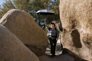
Old Mines, Wildlife at Pinyon Well
- Share via
Water, especially in the desert where there is so little of it, is the very essence of life. A century ago, Pinyon Well was one such life-giving source, a critical water supply for teamsters, miners and their families.
Today, Pinyon Well is a remote hiking destination in south-central Joshua Tree National Park. There is no well, though water still seeps from the ground, attracting wildlife and birds.
During the 1890s, prospectors constructed a crude ore grinder, then a more elaborate stamp mill at Pinyon Well to extract gold from ore dug from the Lost Horse, the Desert Queen and other nearby mines.
Teamsters guided their wagons through Pushawalla Canyon to Pinyon Well.
At the turn of the century, Pinyon Well was a mining hamlet that included women and children--unusual for a mining town.
In later years, Pinyon Well’s valuable water was piped to the Piute Basin, serving mining operations there until the early 1930s.
Pinyon Well put a gleam in the eye of one 1920s developer, who envisioned a resort community rising from the wide open spaces. The well, however, could not provide sufficient water to create another Palm Springs.
This hike, which follows traces of the old road, visits the ghosts of the mining town. Past the seeping water, the trail ascends to Pushawalla Plateau for excellent views of the Coachella Valley and Palm Springs.
Directions to trail head: From the national park visitor center in Twentynine Palms, drive south on Utah Trail eight miles to the Pinto Y and bear right.
Continue five miles to Geology Tour Road. Head south on the dirt road (rough, but passable for two-wheel-drive vehicles with good ground clearance) for 10 miles to the unsigned trail head at the “15 km” post.
The hike: The trail leads up a wash through juniper- and Joshua tree-dotted terrain.
About three-quarters of a mile from the trail head, some cement tanks, rusty pipe and foundations of old cabins mark the site of Pinyon Well. It all seems a bit forlorn now--somehow it’s easier to imagine teamsters swearing at their mules than to envision happy families.
The path continues with the wash, leaving it now and then to avoid gully-blocking rock slides. Nearly three miles out, you’ll reach windy Pushawalla Pass.
Pushawalla Plateau-bound hikers will look for an old mining road about 200 feet east of the pass. The rough, very steep road passes some mining ruins and leads a mile to the 5,200-foot plateau. From atop the broad, pin~on pine- and Joshua tree-covered plateau unfolds a view of Mt. San Jacinto, the Salton Sea, and some of the northern valleys and ranges of the national park.
McKinney’s book “Day Hiker’s Guide to Southern California” is available through The Times for $16.45 (including tax, shipping and handling) by calling (800) 246-4042.
(BEGIN TEXT OF INFOBOX / INFOGRAPHIC)
Pinyon Well Trail,
WHERE: Joshua Tree National Park.
DISTANCE: From parking area to Pinyon well site is 1.5 miles round trip; to Pushawalla Pass is 6 miles round trip with 1,000 foot elevation gain.
TERRAIN: Canyon, Joshua tree dotted Pushawalla Plateau.
HIGHLIGHTS: Historic Pinyon Well; vistas from atop plateau.
DEGREE OF DIFFICULTY: Moderate to strenuous.
FOR MORE INFORMATION: Joshua Tree National Park, 74485 National park Drive, Twentynine Palms, CA 92277; tel. (760) 367-7511.
More to Read
Sign up for The Wild
We’ll help you find the best places to hike, bike and run, as well as the perfect silent spots for meditation and yoga.
You may occasionally receive promotional content from the Los Angeles Times.


