Rugged trail rewards with wildflowers and peak vistas
- Share via
Mt. Dana, Yosemite’s second tallest peak, rises 13,053 feet -- and looms even larger in most hikers’ memory.
Only Mt. Lyell, at 13,114 feet, is higher, and it requires mountaineering skills to reach the summit. Mt. Dana is more accessible, though the grueling path up it was established long ago and is not regularly maintained.
The route is essentially the same one taken by Whitney survey party members William Brewer and Charles Hoffmann, who first climbed Mt. Dana in 1863. The late Carl Sharsmith, a Yosemite botanist who worked in the park for more than half a century, helped design the route to reduce hikers’ impact on alpine flora.
Dana Meadows and the boggy areas around two ponds offer abundant wildflowers, as do the higher, drier slopes. The seasonal sprinkling includes Indian paintbrush, alpine goldenrod, columbine, spreading phlox and lupine. The clusters of blue above 12,000 feet are sky pilot, which blooms in July and August.
To start the hike, drive to Yosemite National Park’s east entrance on California 120, also known as Tioga Pass Road, about 12 miles east of U.S. 395. Park in the lot south of the entrance station on the west side of the road. The trail begins on the east side.
Starting here, at 9,945-foot Tioga Pass, gives hikers a head start toward the summit. Because of the relatively short approach to the peak, Mt. Dana is one of the park’s most popular climbs for experienced hikers.
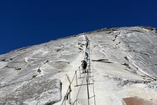
Begin with a moderate ascent through Dana Meadows, often strewn with wildflowers in summer, and walk through a lodgepole pine forest. After half a mile the real work begins. The route gets steeper and rockier, with switchback after switchback. Trail markers help you stay on track.
You’ll need a map to identify all the peaks you’ll see. From the eastern boundary (Mt. Lyell, Mt. Gibbs, Mt. Conness and others) to the heart of Yosemite (Mt. Hoffmann, Tuolumne Peak), this is a panorama to remember. The view also encompasses Saddlebag and Ellery lakes, just outside the park, and Mono Lake and the Mojave Desert to the east.
Past the timberline, you climb to a large rock cairn, about two miles from the trail head and 11,500 feet in elevation.
Here at the towering cairn, get a good view of Mt. Dana’s summit before saying goodbye to the trail.
Choose from a variety of trails and routes for the last mile (a 1,400-foot elevation gain) to the summit.
The upper reaches of the route can be covered with snow late in July, well after other scenic attractions along Tioga Road are accessible to visitors.
John McKinney offers other tips at www.thetrailmaster.com.
More to Read
Sign up for The Wild
We’ll help you find the best places to hike, bike and run, as well as the perfect silent spots for meditation and yoga.
You may occasionally receive promotional content from the Los Angeles Times.


