After some wet weather last month, rain is back to bypassing Southern California

- Share via
After a brief interruption for some rain late last month, the Los Angeles region is back to its regularly scheduled programing. In November, that means little or no rain.
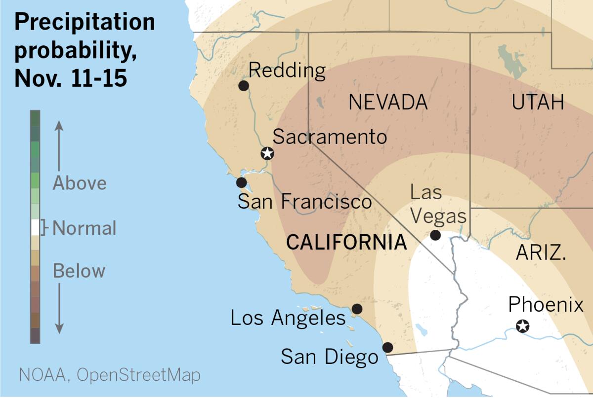
For those hoping for more rain, the prospects aren’t good, as the National Weather Service puts it. The long-range models look dry into early December.
Not that L.A. gets much rain in November. The monthly normal for downtown Los Angeles is 0.78 of an inch. Downtown normally receives 0.58 of an inch of rain in October, but got 0.71 of an inch, putting L.A. less than a quarter-inch above normal so far for the rainfall season.
Unfortunately, the prospects for that continuing are slim. Long-range outlooks from the National Oceanic and Atmospheric Administration favor above-normal temperatures and below-normal precipitation.
The coastal areas have been moistened by blankets of dense fog over the last couple of days, but that’s likely to change next week when gusty north to northeast winds — possibly advisory level — are predicted, along with a significant warming trend. Temperatures could climb into the 90s in the warmer valleys, with mid-80s in places such as downtown L.A.

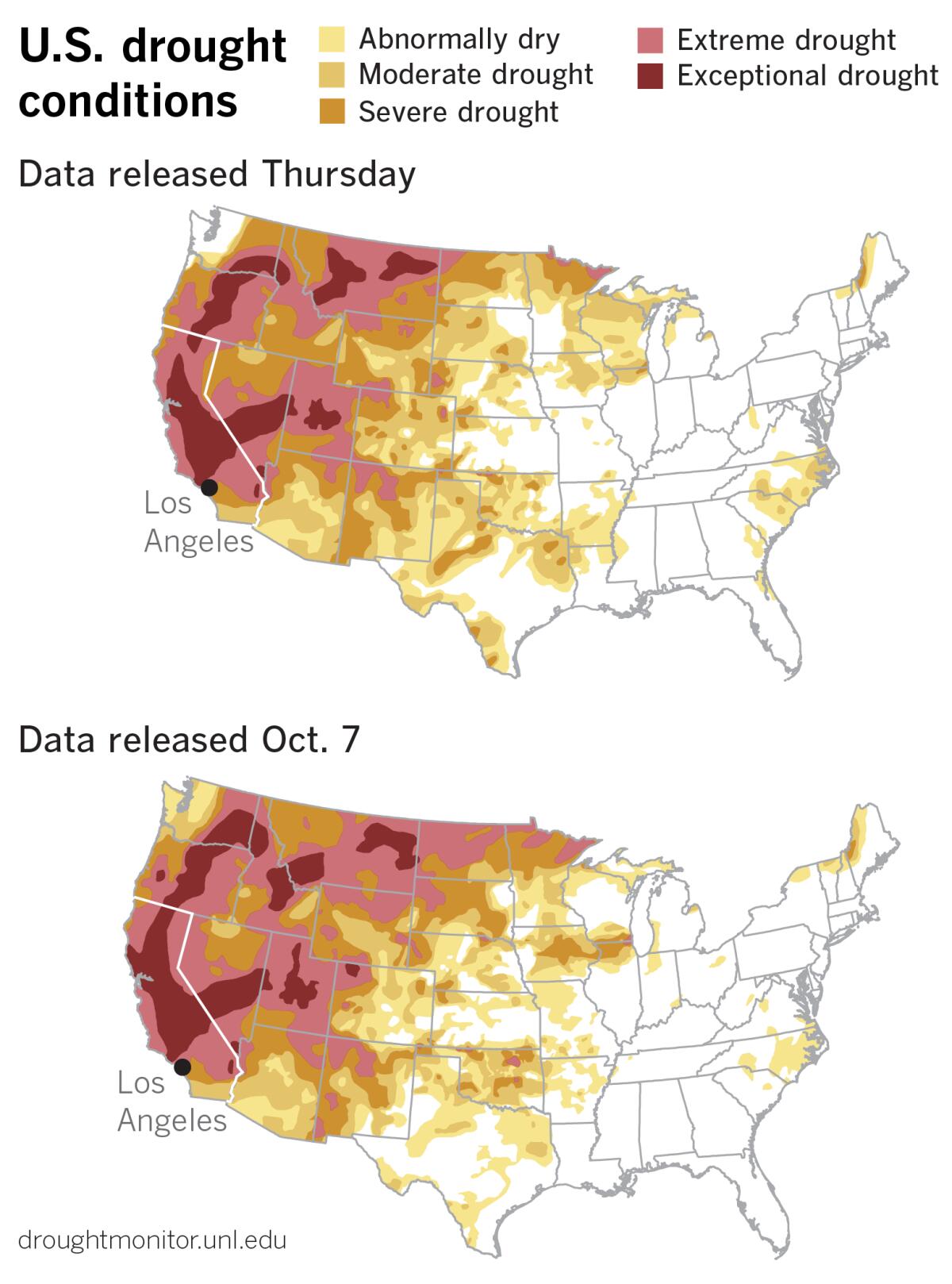
Those conditions won’t help the persistent drought that still grips California. Atmospheric rivers improved conditions in the Pacific Northwest and Northern California with record precipitation in some locations. “However, groundwater and reservoir levels are slow to respond and will need continued above-normal precipitation this season to recharge,” the U.S. Drought Monitor said.
Southern California has a tiny chance for a spritz of moisture in the first half of next week, forecasters with the weather service said, but then “some legit Santa Ana winds could begin Thursday and continue into Saturday, boosting the fire weather potential.”
November, after all, is firmly in Southern California’s Santa Ana season. December, January and February are heavy hitters when it comes to the region’s rainfall. During those months, downtown L.A. normally gets 2.48 inches, 3.29 inches and 3.64 inches of rain, respectively. March could bring an additional 2.23 inches of rainfall before April typically drops off to 0.69 of an inch.
Of course, Santa Anas can continue into the winter, setting up the annual race between the hot dry winds and the rainy season. Southern Californians root for the rains to arrive and wash away the fire season before the devil winds can get out of the starting blocks.
But with La Niña in place for the second consecutive year, expectations may have to be lowered for those normally wet winter months, since La Niña winters typically are dry in the Southwest.
There are no guarantees. But based on records since 1950, some 84% of La Niña winters end up with below-average precipitation in downtown L.A. And odds like that are pretty good in Vegas.
More to Read
Sign up for Essential California
The most important California stories and recommendations in your inbox every morning.
You may occasionally receive promotional content from the Los Angeles Times.


