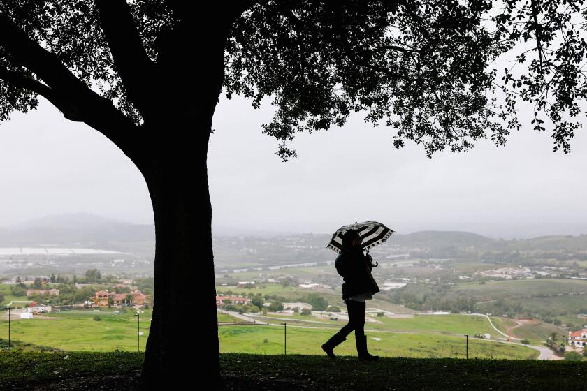
The rain’s not over — a new storm is brewing for SoCal next week. How much rain could we get?

- Share via
Southern Californians should brace for more wet weather next week — a new storm is brewing in the region to cap off a historically wet month.
The National Weather Service predicts that another storm is coming between Sunday night and Monday night. It’s not expected to be as significant as past storms, with the most likely result being between 0.25 and 1 inch of rain. There’s about a 20% chance that the region could see 1 to 3 inches of rain.
Meanwhile, showers were tapering off in the region Wednesday, although they were expected to continue through the day in some parts, especially the eastern San Gabriel mountains, according to Ryan Kittell, a meteorologist with the National Weather Service in Oxnard.
As of 5 a.m. Wednesday, 7.78 inches of rain had fallen in Topanga Canyon, 5.21 inches in Bel-Air, 3.67 inches in La Cañada Flintridge, 2.99 inches in Pasadena, 2.74 in Alhambra, 2.41 in Claremont, 2.26 inches in Burbank, 2.23 inches in Whittier and 1.74 inches at the Los Angeles International Airport.
Authorities, fearing the effect of additional rain on hillsides and creek beds already saturated by a massive storm earlier this month, issued flash flood warnings for a swath of L.A. from Malibu to Griffith Park as well as portions of the San Fernando Valley.
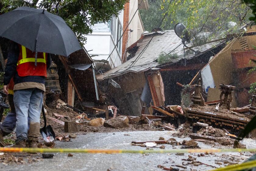
A mudslide Wednesday morning closed a stretch of the Pacific Coast Highway in Malibu, from Corral Canyon and Latigo Canyon roads. A second slide reported by the Los Angeles Fire Department on Wednesday blocked Malibu Canyon Road at Piuma Road, closing both roads to traffic south from that point.
As of 8 a.m. Wednesday, Los Angeles officials had responded to 159 reports of fallen trees and branches, 98 flooding incidents, including blocked catch basins and storm drains, 63 reports of debris and mudflows and 1,725 LADWP customers who were experiencing outages, according to a statement from Mayor Karen Bass’ office.
About 2.69 billion gallons of stormwater had been collected as of 8 a.m., which is enough to supply a year’s worth of water to about 65,200 people across the city, according to LADWP statistics.
In Santa Barbara County, where rainfall totals were even higher than in L.A. County, 100-year-old palm trees that dot the Refugio State Beach have come crashing down during the storm.
Officials say that the back-to-back storms, years of beach erosion, high tides and saturated soils eventually caused the trees to be uprooted.
In Ventura County, video footage captured a funnel cloud swirling over the foothills in Santa Paula. The funnel clouds are caused by “vertical stretching” or “spin” in the atmosphere triggered by winds, KTLA News reported.
Funnel clouds are different from tornadoes in that tornadoes come in contact with both the base of the cloud and the ground at the same time.
Temperatures are expected to warm up over this week, with an offshore Santa Ana wind event forecast for Friday, according to Kittell. Temperatures could warm into the mid- to upper 70s by Friday and Saturday before dipping back into the 60s next week.
L.A. County property owners who suffer more than $10,000 in losses may qualify for a property tax reassessment. They may also get a break on penalties.
Downtown Los Angeles has gotten 12.56 inches of rain during the month of February, making it the fourth wettest February since the weather service started taking records in 1877. With more than a week left to go, this February was already the wettest month in 26 years and is tied for the 7th wettest month ever.
It’s rained 17.79 inches in downtown L.A. since the water year began on Oct. 1, which is about 8 inches higher than the average rainfall by this time of the water year and 3.5 inches more than the annual average.
This latest storm follows the monster storm earlier this month that dropped historic rainfall on the region, destroyed neighborhoods, triggered debris flows and mudslides and killed several people across the state.
Because the ground was waterlogged from the previous storm, there were concerns that some rainfall, no matter how little, could trigger more landslides and debris flows in susceptible areas.
“The concern was because of how much rain fell, the ground was close to saturated and couldn’t absorb much water,” Kittell said.
The picturesque Wayfarers Chapel in Rancho Palos Verdes is one of the top wedding venues in Southern California. But some couples are scrambling to make last-minute plans after it closed due to land movement.
Rock and mudslides were reported on canyon roads through the Santa Monica Mountains, according to Kittell. In the Rancho Palos Verdes area, city leaders have asked Gov. Gavin Newsom to declare a state of emergency. If granted, Newsom would then be able to request federal disaster aid from the White House, and projects to stabilize the affected area would face fewer regulatory hurdles.
The storms have damaged structures along the peninsula, including the Wayfarers Chapel, as a slow-moving landslide complex continues to accelerate.
“I think if the Governor came here and saw the buckling streets, the homes sinking and cracking apart, and the historic Wayfarers Chapel on the verge of collapsing, he would understand the urgency of this request,” Los Angeles County Supervisor Janice Hahn said in a statement. “This is a crisis that is getting worse by the day, and I urge Governor Newsom to visit us and see it with his own eyes.”
More to Read
Sign up for Essential California
The most important California stories and recommendations in your inbox every morning.
You may occasionally receive promotional content from the Los Angeles Times.


