A map, a compass and your wits: the sport of orienteering

- Share via
“OK, start!” calls the man with the clipboard, nodding toward a portable clock. That’s my cue. Compass in hand, I dash out of the starting gate and up a grassy slope to the west of Lake Balboa, on a race toward … well, I’m not sure. Somewhere between here and the lake is an orange-and-white flag that marks my first goal of the course. I’ll have to find my way there by map.
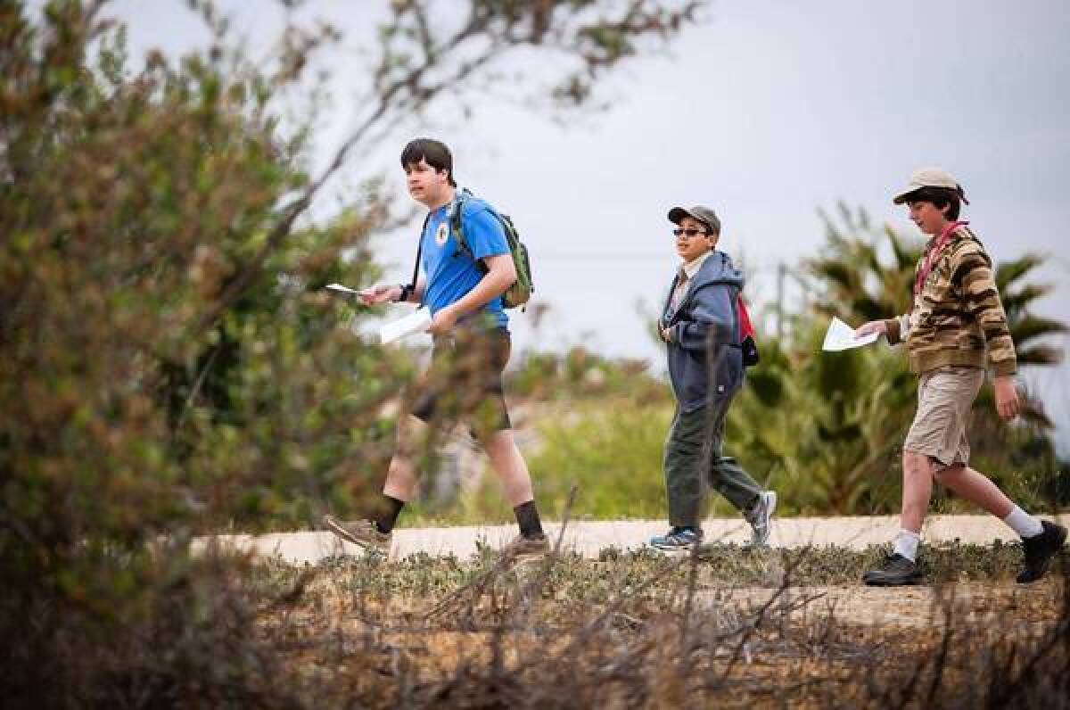
I’m one of about 100 local adventure seekers who have gathered at the Encino park on a cloudy mid-April morning to take part in orienteering, a competitive sport based on outdoor navigation. Clutching maps and compasses, we fan out among the hills, trails and trees and hunt for a series of goal markers, called controls, hidden throughout the landscape. As a trio of Boy Scouts leaves me in the dust, I pray that I get my wilderness legs soon.
Here’s the first thing you learn about orienteering: Where you’re going is only part of the challenge; the crux of the sport is figuring out how to get there. In a typical 5K, runners follow a delineated path. Orienteering, however, leaves the route open-ended. Like a life-scale game of connect-the-dots, you are presented with a field full of controls, numbered in the order you must visit them. But between the controls might be cliffs, boulders, cactus groves and streams. The aim is to get from point A to point B in the speediest fashion, without getting lost.
“This is a thinking sport. It’s not mindless running,” says Gary Dolgin, a founding member of the Los Angeles Orienteering Club (LAOC), which hosts monthly meets at parkland across L.A. County. “The pace and the route are strictly up to you.”
In the age of GPS, orienteering feels like a throwback to a simpler, more low-tech time. Part scavenger hunt and part race, the sport dares urban dwellers to turn off their smartphones and navigate unfamiliar terrain using tools of yore.
The first step is to orient your map — find your position and line up your compass to determine which direction you’re facing. Then study the features of the map to find the location of your next control (brief clues, such as “bridge, southeast corner” or “distinctive tree, north side,” help). At each control, you mark your position by punching a control card or tapping an e-stick, a flash drive worn on your finger. Once you’ve crossed the finish line, you can catch your breath while your time is scored.
At each meet, participants choose from several color-coded courses: white or yellow for novices, red or blue for elite athletes. As the courses get harder, they get longer, include more controls and take orienteers farther off-trail into rugged, often steep terrain.
That’s why orienteering is classified as a sport. The combination of hiking, running and focused map-reading can be exhausting at the competitive level.
But the course is just as enjoyable taken slow, amid the flora, fauna and fresh air. “It’s a competition, but quite frankly, most people are out here for a walk with their dog or kids,” says Rich Hoesly, an LAOC board member.
And because the sport is done at your own pace, it’s a draw for people of all ages. At Lake Balboa, participants included seniors and parents with children.
Orienteering began as a Swedish military exercise in the late 1800s and took off as a recreational activity when cheap compasses became widespread in the 1930s. But orienteering is still a niche sport in the U.S. because permits and mostly flat topography make it difficult to find suitable land, says LAOC President Sue Dekany.
.
Approaching my 12th control, I’m feeling brave. I veer off the paved bikeway to try a more direct route, cutting across an expanse of green. Big mistake. Within 30 seconds, I’m lost in a maze of scraggly pines. Where did the road go? I take deep yoga breaths and orient my map. Somewhere up ahead should be a footbridge. I sprint in that direction, and, just down a leafy incline, there’s the orange-and-white flag. I could kiss the ground it sits on, if that golden retriever hadn’t been sniffing it so intently.
Near the end of the meet, few seem to care about getting to the finish line first. More rewarding, they say, is learning what they are capable of. “You’re relying on yourself,” Dekany explains. “That’s a confidence booster.”
Still, I’m curious how my time stacks up. LAOC board member Scott Schmitz squints at my control card and calculates my score: 34 minutes. “Pretty darn good,” he says.
Now I just have to figure out where I parked my car.
The Los Angeles Orienteering Club will hold its next meet May 19 at Schabarum Regional Park in Rowland Heights. To register or get more information, visit losangelesorienteering.org. A map skills training class will be held on May 11, 9:30 a.m. to noon at Elysian Park. The class will cover terrain types and how to keep track of your location, and will include map exercises. To register, visit: https://losangelesorienteering.org/drupal/elysian-skills-training-class


