So Many Cars, So Little Money
- Share via
Every dime of California’s $116-billion plan to shore up levees, schools and other eroding facilities could be spent on the state’s overtaxed transportation system.
And it still wouldn’t be enough.
California’s highways, the system’s most costly feature by far, were once the nation’s gold standard. But as the interstate highway network celebrates its 50th anniversary and the summer driving season accelerates, the state is known for something else: some of the busiest, most dilapidated and under-financed roads in the country.
Over the last several years, money for highway projects has virtually disappeared, the victim of budget crises, stagnant federal funding and a gas tax that has not been raised in a decade.
When Gov. Arnold Schwarzenegger posed near Interstate 405 earlier this year, proposing to relieve congestion there as part of a statewide public works blitz, it seemed that, finally, some relief was in sight.
But the state’s transportation system -- especially its crumbling highway network -- has a long list of unfunded needs with a price tag of at least $140 billion, said Sunne Wright McPeak, secretary of the state Business, Transportation and Housing Agency.
The state’s planned investment in roads is just “a drop in the bucket,” said Art Brown, chairman of the Orange County Transportation Authority, reflecting the view of many officials.
On the other hand, he said, “we need every drop we can get.”
For now, the state expects to spend $21 billion on road maintenance and improvement over the next five years. Additional money could come from $37.3 billion in bond measures on the November ballot -- the only new money proposed in the state’s $116-billion infrastructure plan.
Of that bond money, about $11.5 billion would go to highway and road projects across the state to patch a system that the California Transportation Commission describes as “a shambles.”
Some of it would be distributed using set formulas, with cities and counties getting at least $400,000 for pavement repair. The rest -- about $7 billion -- is up for grabs.
“I’m convinced that there isn’t enough money,” said Martin Wachs, director of the Rand Corp.’s transportation program. And that, Wachs and others say, sets up some daunting choices.
Where should the state start? To find out, The Times interviewed traffic experts and commuters and analyzed state transportation data.
Seven routes were repeatedly cited as being in greatest need, renowned for their spine-jarring disrepair, omnipresent trucks, deadly collisions or intractable congestion. And problems on an eighth route could soon surpass them all.
*
Top Delays in the State: 91 Freeway
THE ROUTE: California 91, the Riverside Freeway, from Interstate 15 to the Orange County line
THE POTENTIAL FIXES: Adding lanes, a parallel or elevated expressway, an 11-mile tunnel under the Cleveland National Forest
THE COST: Up to $13 billion for all projects
Howard and Mary Monise live in a comfortable, 2,500-square-foot house in Corona, where the neighborhood is pleasant, the schools are good -- and the commute to work is a grueling ordeal.
Although they live only 40 miles from their jobs at Dan Gurney’s All American Racers in Santa Ana, they spend two to three hours a day stuck in traffic on the 91, a bad commute that worsens as the week progresses.
“It’s frustrating,” Mary said. “Every time I see a new housing project out here, I cringe.”
During rush hours, the Riverside Freeway becomes a rumbling parking lot: all idling engines, squeaking brakes and commuter angst. More than 285,000 motorists take to the road each workday.
The most congested stretch is the Corona bottleneck -- eight miles of crowded pavement between I-15 in Riverside County and the Orange County line. Jammed for up to 12 hours a day, the bottleneck has average rush hour speeds of less than 14 mph.
California Department of Transportation statistics show that this single section causes more total delay for motorists than any other highway in the state -- the equivalent of 17,202 hours per day, enough hours to fill up two years.
By 2025, the number of motorists on the Riverside Freeway is expected to reach 450,000 a day. Local planners hope to finance improvements with state and federal money as well as revenue from transportation sales tax initiatives in Riverside and Orange counties. Most of the funding, however, is not yet in hand.
For now, the Monises carefully monitor traffic reports and painstakingly plan their drive to work. When possible, they carpool with friends so they can split fares on the area’s toll roads. They hope for the best but don’t expect much.
“I don’t see it really getting any better,” rued Howard. “You just have to adjust.”
*
Bay Area’s Worst: I-80 to the Bridge
THE ROUTE: Interstate 80, Eastshore Freeway,
from California 4 to the San Francisco-Oakland Bay Bridge
THE POTENTIAL FIXES: Technological instruments, including synchronized lights on frontage roads; auxiliary lanes, which connect on- and offramps and cut down on weaving; a massive new ferry system
THE COST: As much as $1.6 billion for the ferry system alone
Traffic technician Todd Lee squints at his computer screen, trying to figure out what has just gone wrong on a particularly nasty stretch of I-80 one rainy spring morning.
Here in Oakland, at one of America’s most sophisticated traffic management centers, computers, video screens and a huge electronic map flash bad news from throughout the region: Big rig crashes. Out-of-gas pickups. Landslides.
As technicians dispatch tow trucks to fresh accidents and real-time information to drivers, most of the map’s red tendrils -- indicating the slowest traffic -- blink to green. But on this drizzly day, there is no quick fix for the region’s most notorious bottleneck, I-80 between the town of Hercules and the Bay Bridge.
Because nothing extraordinary had happened. “It’s just slow traffic,” Lee said.
I-80 suffers from too little space and too few alternate routes. There is no room to build more lanes and no money to double-deck. Even though the eastern span of the Bay Bridge is being rebuilt to withstand a serious earthquake, it will continue to have only five lanes.
As many as 280,000 vehicles traverse this stretch of I-80 each day. Not only has the route been ranked as the worst in the region every year since 2000 by Caltrans and the Metropolitan Transportation Commission, but its drivers experience nearly twice as many hours of daily delay as the Bay Area’s No. 2 choke point, I-580.
“It really calls for alternatives to car use -- rail, ferry or another bridge,” said Jim Wunderman, president of the Bay Area Council, which is pushing for increased infrastructure investment. “Anything that would take pressure off the bridge would be phenomenal.”
*
I-580: Linking Homes and Jobs
THE ROUTE: Interstate 580 from Interstate 680
to Interstate 205
THE FIX: Adding 14 miles of carpool lanes; dedicating truck lanes; rebuilding the interchange at Interstate 680
THE COST: About $500 million
The commuter bus begins loading at 3:55 a.m. in a church lot turned park-and-ride for the long, dark drive from Stockton to Sunnyvale, from affordable homes to necessary jobs.
On a good day, the morning slog takes around two hours. Along seven highways, through three counties, past countless hills and chain stores, the big white bus is a rolling dormitory, its riders struggling to catch up on sleep.
On a bad day, the drive home can take three hours or more, much of it along the I-580 corridor from the I-680 interchange to the Alameda-San Joaquin County line. Nearly every commuter on the bus has a horror story about the (pick one) accident, storm, flood, SigAlert that pushed the day’s commute to eight hours or more.
One rainy Friday afternoon, the bus ground along at 10 mph. The Mercedes-Benz with the “FSTNFUN” license plate one lane over was obviously neither. The carpool lane proposed for this sluggish stretch is, as yet, a dream.
“You can’t go anywhere or do anything during the week. I spend it all traveling,” says Jess Bravo, a quality engineer in Sunnyvale who awakens at 2:45 a.m. to drive about half an hour from his Modesto home to catch the bus at its second stop.
The evening commute east is the second slowest in the region, according to the Metropolitan Transportation Commission; the morning drive west is No. 3.
As many as 210,000 vehicles a day trundle along the route, up to 10% of them trucks. What makes this route so difficult to fix is that traffic in one region, the East Bay, is largely caused by development in another, the Central Valley.
Another part of the corridor’s problem is the complex nature of traffic. If the interchange is fixed, will it merely move the choke point? If a nearby highway is upgraded, can the interchange be left alone?
The rest of the problem is money. “We have a plan for in excess of half a billion dollars of improvements,” said Dennis R. Fay, executive director of the Alameda County Congestion Management Agency. “We have maybe 40% of the money.”
*
Interstate 710: It’s a Truck Stop
THE ROUTE: Interstate 710, Long Beach Freeway
THE POTENTIAL FIXES: Widening 18 miles of freeway from six and eight lanes to 14; adding new interchanges and four truck lanes; reconstructing California 47 and the Heim Bridge as an alternate route
THE COST: More than $6 billion
Minutes after picking up a 40-foot shipping container in the Port of Los Angeles, Nelson Beltran guides his 1994 Freightliner onto the northbound I-710, heading for a railway terminal in Los Angeles.
Beltran has started work early so he can drive north against traffic for at least one delivery; it is 8 a.m., and the southbound 710 is already clogged.
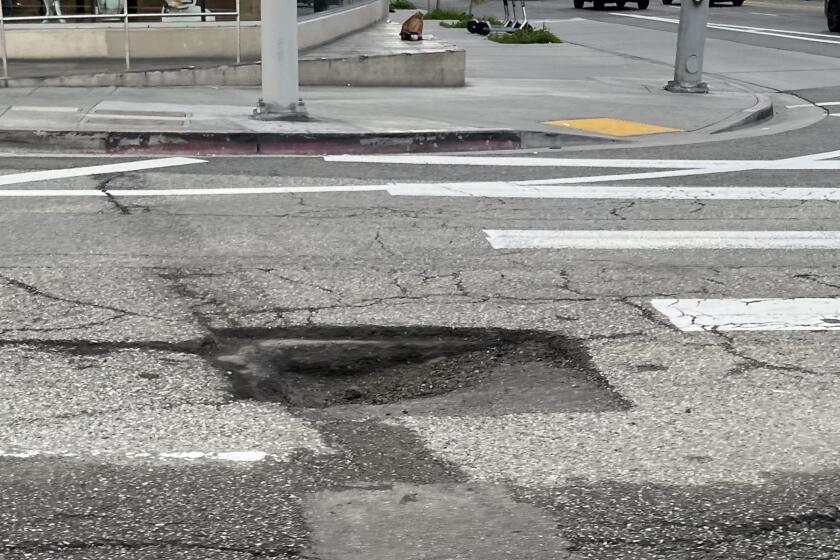
In 18 years as a port trucker, Beltran has never before seen the main artery for the nation’s largest harbor complex in such poor shape. The pavement is heavily cracked and worn. The short 1950s-style exits and onramps are obsolete. The lanes are narrow, and the road lacks emergency shoulders.
Trucks hauling cargo containers regularly line up nose to tail for miles in the two right lanes on each side of the freeway. Diesel fumes pollute the air. The interplay of cars with the largest concentration of truck traffic in the state keeps the 710’s accident rate well above the state average.
“It’s the worst,” says Beltran, who often works 10 to 12 hours a day. “I could make more runs 10 years ago -- one or two more a day. Now, it can take two to three hours just to do one load.”
Trucks make 40,000 to 50,000 trips per day on the 710, 20% of all traffic. By 2030, the number of truck trips is expected to double to accommodate growing freight volume at the ports of Los Angeles and Long Beach, which handle about 40% of the nation’s international cargo.
Heading back to the harbor after dropping off a container, Beltran mulls over the proposed fixes for the 710, which could take 20 to 25 years to complete. Then, the line of big rigs in the southbound lane stops again. Beltran sighs and slaps the steering wheel in frustration.
“I’m not optimistic,” says the 44-year-old driver, shaking his head. “ I don’t think I’ll see much improvement in my day. Maybe my kids will.”
*
I-405 at U.S. 101: 8-Hour Gridlock
THE ROUTE: U.S. 101-Interstate 405 interchange
THE POTENTIAL FIXES: Adding carpool lanes on the I-405, onramp traffic signals, transit options, redesigning connectors, widening portions
THE COST: $500 million to $1.5 billion
It’s next to impossible to get a speeding ticket where the Ventura and San Diego freeways meet in the San Fernando Valley.
“You just can’t go fast through here,” said Kevin Michel, a regional planning director for the Los Angeles County Metropolitan Transportation Authority. “Traffic is congested at both peak periods in both directions on both freeways.”
Nearly every day, more than 550,000 motorists converge where the freeways intersect, earning it the title of America’s worst interchange, according to the American Highway Users Alliance.
Inadequate ramps and short freeway exits to nearby streets cause lines of vehicles to back onto the freeways during commute hours. On the northbound 405, the queue can go from the U.S. 101 connector into the Sepulveda Pass. Signs warn motorists to watch for slow or stopped traffic; they’ll find it for eight or nine hours each day.
The 1950s-era interchange is hemmed in by steep hillsides, a flood basin and a commercial district. That leaves highway planners little room to work with.
Proposals by MTA and Caltrans to unsnarl the interchange could take at least a decade. Some improvements are underway, but more funding is needed, and the work is not without controversy. Neighborhood groups want low-key solutions that don’t involve widening the highway -- which could require extensive condemnation of private property -- or adding a second deck.
“We have no problem with re-striping, clearing bottlenecks and working within the existing right-of-way,” said Gerald Silver, president of Homeowners of Encino. “But we are not going to tolerate anything that adds lots of capacity.”
But Bob Scott, a former Los Angeles planning commissioner and chairman of the Valley Industry and Commerce Assn., says that Caltrans and MTA should do whatever is necessary to fix the interchange, including double-decking and flyover-style ramps.
“We need to work with the community,” he said, “but you can’t let a handful of people stand in the way.”
*
Vasco Road: Peril in Two Lanes
THE ROUTE: Vasco Road in Alameda and Contra Costa counties
THE POTENTIAL FIXES: Widening the route to four lanes; adding a concrete divider
THE COST: An estimated $200 million
The two-lane byway dips and curves along hills as green as an old man’s golf pants. There are the windmills and cows, puffy clouds and the occasional farmhouse. As he drives, California Highway Patrol Officer Steve Creel adds details that belie the beauty.
“We’re in the middle of nowhere. It’s real pretty. Central Valley to your left. Bay Area to your right,” he says. But “on heavy days, there’s a car every 30 feet for 13 miles.... Over there, a woman going south was hit by a trailer going northbound that whipped to the southbound lane and killed her.”
The woman was Patricia Altman, 36, a mother of five. She was among seven to die in 2003 on this country road-turned-rural freeway in three spectacular summertime accidents.
Vasco Road was never designed to carry the 22,000 or so vehicles a day that race from the burgeoning bedroom community of Brentwood to Interstate 580 some 15 miles south.
Most of Vasco Road is in Contra Costa County. It was upgraded in the 1990s to make way for a reservoir but still is mostly two lanes.
Like a growing number of other rural routes, “it just doesn’t have the amount of capacity for the commute traffic,” said Julia Bueren, the county’s deputy public works director. “And drivers do things that are inappropriate.”
They speed. They tailgate. They pass when they shouldn’t. The results are deadly head-on collisions and rampant rear-enders. Accidents continue despite the addition of rumble strips and flexible posts to separate lanes.
In addition to those fixes, stepped-up CHP enforcement and a daytime headlight zone were spurred by a citizens group begun by Jeff Altman in the weeks after his wife’s death. The group now wants the state to adopt and widen the route.
Bueren’s hope is that voters in November will approve Proposition 1A, requiring the state to use certain gas tax funds for transportation projects only. They’ve often been tapped to cover state budget deficits, leaving local governments to tackle big problems like Vasco.
Says Altman: “All I care about is that it gets fixed.”
*
I-880: Deferred Maintenance
THE ROUTE: Interstate 880, the Nimitz Freeway, from the Port of Oakland to California 238
THE POTENTIAL FIXES: New over-crossings, re-pavement, technology to reduce congestion and accidents
THE COST: About $500 million
More than 250,000 vehicles each day ply the busiest segments of this critical truck route as it snakes through the East Bay’s brawny backyard -- past warehouses and rail yards, cheap motels and cheaper big-box stores.
It’s the kind of ride that makes drivers’ hands stray from steering wheels to volume knobs; radios must be cranked up to compete with the tattoo of tires on patched and pitted pavement. But the asphalt’s not the only thing that’s aging. On- and off-ramps also are antiquated.
And a recent Caltrans study of I-880 identified a significant bottleneck between two old and substandard over-crossings, said Dennis R. Fay, executive director of the Alameda County Congestion Management Agency, where trucks slow down because “they don’t want to hit those old over-crossings at full speed.”
Fay figures that I-880 could use half a billion dollars in repairs. Proposed improvements to the corridor are only partly funded. But the route could be a big and early winner if an infrastructure bond measure is passed in November.
Northern Californians are not the only ones who want to fix the I-880; so does Gov. Arnold Schwarzenegger. The strategic growth plan laid out by the governor recommends $100 million in physical improvements and $50 million in new transportation technology to help reduce congestion, at least a third of which is caused by accidents and other mishaps.
“For the past two years, every single day there was an incident” on what has been dubbed the “nasty Nimitz,” said Bijan Sartipi, director of Caltrans’ Bay Area district. “It’s not a reliable corridor. The only thing you can expect is something going wrong.”
*
Trouble Brewing on Section of I-5
THE ROUTE: Interstate 5, the Golden State Freeway, from California 14 to Interstate 405
THE POTENTIAL FIXES: Undetermined
THE COST: Undetermined
Douglas R. Failing heads the busiest region in Caltrans’ vast network, and a map in his office speaks volumes about the problems plaguing his territory -- 640 miles of state highway in Los Angeles and Ventura counties.
Next to I-5 in the north San Fernando Valley, between the Antelope Valley and I-405, is a bright yellow label with an ominous warning: “Worst bottleneck.”
It isn’t yet -- but Failing worries it will be.
I-5 is a major north-south route for motorists and commercial trucks. It also is one of the few routes to Los Angeles for commuters from the Antelope Valley and the Palmdale-Lancaster area.
Several large developments are in the works with tens of thousands of homes proposed. None was included in Los Angeles County forecasts for Southern California’s growth. Planners are worried that traffic on the Antelope Valley Freeway could triple within 30 years and flood I-5.
Caltrans already is installing carpool lanes on I-5 between California highways 118 and 14. The agency also is trying to identify other congestion relief projects and estimate their costs.
“I absolutely want to get ahead of this,” Failing said. “I know it’s hard to do that sometimes when we are behind in so many areas.”
Indeed, this stretch of I-5 is just one of many emerging choke points in a state that is expected to add 9 million new residents by 2025.
Some of the new trouble spots, including I-405 from Los Angeles to Orange County and I-15 from Victorville to Ontario, are already on their way to surpassing today’s most congested routes.
Traffic on the I-15 can be as bad as on the 91 Freeway, especially on Friday nights, when it can take three hours to go from Ontario to the outskirts of Victorville.
“This wasn’t even on the radar five years ago,” said economist John Husing, who focuses in the Inland Empire. “Even with the [bond] investment, we won’t relieve congestion. We will just be treading water. But treading water is important.”
More to Read
Sign up for Essential California
The most important California stories and recommendations in your inbox every morning.
You may occasionally receive promotional content from the Los Angeles Times.


