Cool Summer Fizzles Out
- Share via
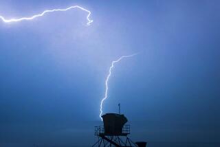
A rare September lightning storm dumped rain across Southern California on Tuesday, capping an unexpectedly cool summer that confounded experts and significantly reduced the risk of brush fires.
Fire officials had been warning of a potential highly destructive brush fire season because of vegetation growth fueled by last winter’s near-record rainstorms. But the summer has turned out to be far from a scorcher: June was 2.9 degrees below normal, July 1.2 degrees below, August 2.1 below and September 5.5 degrees below so far, said Bill Patzert, a climatologist with the Jet Propulsion Laboratory.
“The other ingredient is Santa Ana winds, but basically this summer has been cool and we haven’t had a decent Santa Ana all summer,” he said.
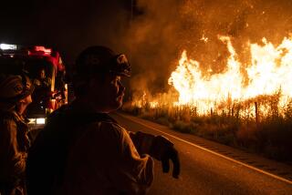
State and local fire officials said Southern California has had significantly fewer brush fires so far this year than in the last several years because of cooler weather and lighter winds.
So far this year, the California Department of Forestry and Fire Protection has fought 4,827 fires in its coverage area. That’s down from last year’s 6,100 fires to date and a five-year average of 5,700 to date.
As of this week, 52,803 acres of chaparral, grassland and woodland have burned, compared with 123,000 at this time last year and a five-year average of 101,509 acres.
But officials stressed that even with this week’s rain, the brush is still dry enough for wildfires if hot Santa Ana winds kick up in October.
“We’ll take all the moisture we can get right now,” said Michael Jarvis, a spokesman for the Forestry Department in Sacramento. “We’re just waiting to see what happens between now and the first week in November.”
The thunder, lightning and shower bursts that occurred overnight were an “anomaly” rather than a preview of things to come, Patzert and other forecasters said.
“I’m still thinking we’re going to have a dry winter, even though I was humiliated this morning with this rain,” he said.
The storm snarled the morning commute, and officials reported several lightning strikes. The Artesia Freeway was temporarily shut when lightning hit a power pole.
Coast Guard searchers were looking for four people who reportedly abandoned their boat Monday night after lightning struck it between Dana Point and Catalina Island. So far, they have found no sign of either the vessel or the people.
County health officials warned people to stay out of the ocean for at least 72 hours after the storm because of pollution from urban runoff. Such discharges often contain high amounts of bacteria.
The storm was the result of a low-pressure system off the coast of California and monsoonal moisture fed by Hurricane Max off Baja California, said Bonnie Bartling, a weather specialist with the National Weather Service in Oxnard.
“All these factors fed in to create instability and added moisture, creating the thunder and lightning,” she said.
Experts said it was unusual to get much rain in September -- historically one of the year’s drier months, with only about 0.23 inches of average rainfall.
During the 24 hours ending at 5 p.m. Tuesday, downtown Los Angeles received 0.29 inches, Santa Ana 0.35, Big Bear Lake 0.75, and Long Beach and Riverside 0.34 inches, according to the National Weather Service.
“Last September we had zero rain, for all practical purposes,” JPL’s Patzert said. “And so this is very similar to what we had last winter, but early. This is the kind of thing we saw in October. Last October, by the time the large lady yodeled, we had 4.56 inches of rain.”
But Patzert said there are significant meteorological differences between this year and last year that would argue against another wet winter.
“Last year we had a tendency for an El Nino, though a weak one,” he said, referring to the weather system that has traditionally brought heavy rains to Southern California. “This year we have a tendency toward La Nina, though again, not a very strong one.”
La Nina cycles keep Los Angeles dry.
“The other thing is that in the historical record, we’ve never seen two wet winters in a row in L.A.,” Patzert said. “And for all practical purposes, last year was a record breaker.”
Last rainy season was indeed the second-wettest on record, with 37.21 inches in downtown Los Angeles. The early rains all but extinguished last year’s fire season. But officials said all that water caused hillside brush to grow much taller than normal this year -- leaving the potential for more fires.
But the lower than normal temperatures and lack of wind have so far resulted in a slow fire season. In Los Angeles County, the three most notable ones occurred around residential areas of the Hollywood Hills, Pomona and the Palos Verdes Peninsula, but none resulted in injuries or serious structure damage.
“There’s huge, dry vegetation out there and a potential for large fires,” said John Mancha, a spokesman for the Los Angeles County Fire Department. “We’re keeping our guard up until the fire season is over. Although we welcome the rain, we’re still treating it as our fire season. We’re not out of the woods yet.”
Ron Meyers, a spokesman for the Los Angeles Fire Department, attributed the low incidence of blazes this year to the fact that residents have been diligent about clearing brush from their property.
Nevertheless, he said, the recent rain could cause cleared vegetation to regrow.
Some of Southern California’s most destructive wildfire seasons have come after heavy rains. The 1992-93 rain season was the ninth-wettest on record, with more than 27 inches falling in downtown Los Angeles. It was followed months later by one of the worst brush fire seasons on record, when hundreds of homes were destroyed in Laguna Beach, Malibu and other communities.
Heavy rains in 1969 were followed a year later by one of the largest brush fires in state history, which burned 435,000 acres from Newhall to Malibu, and a 185,000-acre fire in San Diego County.
Is more rain on the way?
Patzert said farmers’ wisdom tells him this winter will be dry. In 1997 and last year, both wet winters, the acorns on his backyard oaks in Sierra Madre ripened and fell from the trees.
“This year, man, it’s definitely been wimpy for acorns,” he said.
*
(BEGIN TEXT OF INFOBOX)
How lightning strikes
Warm and cold air masses do not often clash violently over the Southland. But on Monday, a fairly cold upper level low interacting with tropical moisture from Hurricane Max produced an electrical storm. Here’s a look at lightning dynamics:
1. As ice crystals and water droplets collide, the storm cloud becomes electrically charged. Its electric field is negative toward the cloud bottom. The Earth’s surface near the cloud gets a strong positive charge.
2. The charges alter the air around the cloud, creating potential lightning paths. On the ground, the positive charge reaches up to the negatively charged paths.
3. Lightning strikes through a path as nature tries to neutralize the electric field’s extremes. The electrical discharge heats the air to three times the sun’s surface temperature, making it expand explosively and give off light.
Thunder is the shock wave that results from the lightning strike.
Sources: Backpacker, www.howstuffworks.com, National Lightning Safety Institute, National Weather Service
More to Read
Sign up for Essential California
The most important California stories and recommendations in your inbox every morning.
You may occasionally receive promotional content from the Los Angeles Times.


