Unstable Air Brings Southland Thundershowers
- Share via
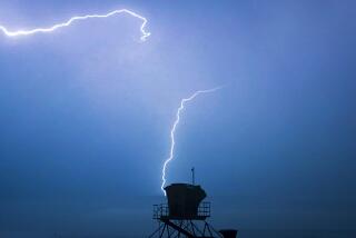
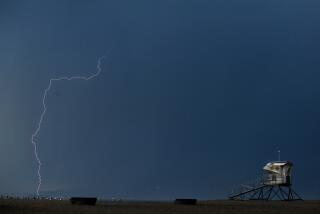
An unstable mass of warm, subtropical air pumped into Southern California from the Pacific Ocean on Monday touched off a series of brief but violent thundershowers from the San Bernardino mountains to the Mexican border.
Nearly 400,000 people went to beaches from Zuma to Newport, as temperatures soared inland--100 in Central Los Angeles, 105 at Monrovia, 102 in Northridge and Ontario--although seaside skies were generally overcast for much of the day.
But inland, the clouds were for real.
The little town of Julian in the mountains northeast of San Diego was drenched by 2.25 inches of rain that fell in just three hours, while Mount Laguna had .52 of an inch, Santee had .40 and Poway reported .34.
Then the storm moved on to Palm Springs, where there were unofficial reports that .31 of an inch of rain fell in 70 minutes. Twentynine Palms gave an unofficial report of .37 of an inch in an hour and lighter showers fell over the mountains near Bakersfield.
No major damage was reported. One road was closed for a time due to flooding in the Cottonwood Pass area north of the Salton Sea, and two motorists said they were stranded for a time by a downpour near Palmdale.
Flash flood watches were in effect at various times during the day for the deserts and mountains of Southern California, and the National Weather Service said unstable conditions might continue today, with a high of 99 degrees expected at Los Angeles Civic Center.
More to Read
Sign up for Essential California
The most important California stories and recommendations in your inbox every morning.
You may occasionally receive promotional content from the Los Angeles Times.


