Brentwood’s Sullivan Canyon a Sylvan Retreat Near the City
- Share via
Sullivan Canyon above Brentwood is one of the gems of the eastern portion of the Santa Monica Mountains. Stately oaks and sycamores shade a seasonal creek and a fine trail travels the length of the canyon.
The canyon also is attractive to its owner--the Los Angeles County Sanitation District--albeit for other than aesthetic reasons. Sullivan and its neighbor, Rustic Canyon, have long been proposed as landfill sites. Protests by environmentalists have thus far derailed the dump, so at least for now, Sullivan Canyon is a beautiful place to roam.
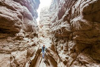
Sullivan’s high and narrow canyon walls display handsome sandstone outcroppings as well as a blue-gray bedrock known as Santa Monica slate. During winter and spring, the steep canyon walls are colored with clusters of blue, white and violet ceanothus.
Casual walkers will enjoy a nearly flat stroll a mile or two along the canyon floor. More energetic hikers will make a loop trip by climbing out of the canyon and traveling Sullivan’s west ridge. Mountain and ocean views from the ridge are quite good.
Directions to trailhead: From Interstate 405 (San Diego Freeway) in West Los Angeles, exit on Sunset Boulevard and head west 2 1/2 miles to Mandeville Canyon Road. Turn right and after a quarter of a mile, turn left on Westridge Road and follow it a bit more than a mile to Bayliss Road. Make a left, travel a quarter of a mile, make another left on Queensferry Road and follow this road another quarter of a mile to its end. Park near the end of the road.
The hike: The trail begins at the end of Queensferry Road, where a frequently traveled equestrian trail, ascending from the wilds of Brentwood, joins the road. Walk down an asphalt road (closed to vehicles) a hundred yards to a cement flood-control apron, then turn right and enter sylvan Sullivan Canyon.
A few minutes of walking will tell you that you’ve entered a very peaceful place. The wide trail meanders near a willowy stream bed, beneath the boughs of antiquarian oaks and across carpets of lemon grass. Occasionally, a horse and rider will prance by.
Three miles of tranquil trail bring you to a couple of eucalyptus trees on your left. This is a good turnaround point for those short on time or energy.
Those hikers wanting to complete this loop trip can continue up the canyon on an old dirt road. After half-mile ascent, the road forks.
The right fork leads to Mulholland Drive, which you can see about half a mile away. You’ll take the left fork and ascend a little farther to an unsigned junction with dirt Fire Road 26. A right turn offers another route to Mulholland Drive, but you’ll turn left and begin descending the west ridge of Sullivan Canyon.
Occasionally, you’ll get a glimpse to the east of Sullivan, but the better views are to the west of Rustic Canyon and the bold slopes of Topanga State Park. If it’s not foggy, the coastal views are pretty good too.
The only shade on the ridge route occurs about halfway down, where there’s a small clump of oaks and a little bench. Farther down the ridge, you’ll reach a yellow gate and a paved road leading down to the Boy Scouts’ Camp Josepho.
A few hundred yards past this turnoff, you’ll walk under some telephone lines--your clue to begin looking sharply to your left for the unsigned connector trail that will return you to the bottom of Sullivan Canyon. As the road bears right, head left for a telephone pole, pass directly under the pole’s two guide wires and join the footpath.
The trail, quite steep but in good condition, drops several hundred feet in a quarter of a mile and deposits you back on the canyon floor. Turn right, down the canyon, and travel half a mile back to the trailhead.
Sullivan Canyon Trail
8-mile loop
1,100-foot elevation gain
More to Read
Sign up for The Wild
We’ll help you find the best places to hike, bike and run, as well as the perfect silent spots for meditation and yoga.
You may occasionally receive promotional content from the Los Angeles Times.


