Rare Conditions Fed Fury of Downpour
- Share via
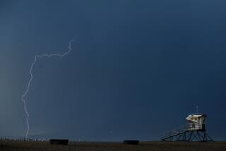
The immense power of the thunderstorm that pounded Los Angeles on Wednesday was generated by temperature differentials of more than 100 degrees and meteorological circumstances that left the system stalled directly over the city, a veteran weather expert said Thursday.
“The result was the kind of rain and hail that probably fall only once every 100 years on Los Angeles,” said Tim McClung, a meteorologist with the National Weather Service office in Oxnard.
About 5.3 inches of rain and hail fell on the central part of the city, most of it in less than three hours. Homes, businesses, schools and a hospital flooded, Los Angeles International Airport diverted flights, and evening commuter traffic drowned in runoff water up to 4 feet deep.
McClung said the storm started as a fairly ordinary low-pressure system, riding along on high-altitude jet stream winds that move generally from west to east north of the equator.
Low-pressure systems generate winds of their own that circulate counterclockwise in the Northern Hemisphere, and somewhere over the Pacific Ocean those circulating winds proved strong enough to pull the system free of the jet stream.
“It was kind of like the jet stream laying an egg,” McClung said.
The egg, a classic “cut-off low,” hovered off the coast of Southern California for three days, gathering strength as it absorbed the warm, moist subtropical air on the surface of the ocean. The counterclockwise circulation of the low-pressure system tossed storm cells into northern Mexico, and a few of them circled back into the deserts of southeastern California and western Arizona, but Los Angeles stayed dry.
Residual drift finally nudged the system ashore over Los Angeles on Wednesday afternoon. The temperature on the ground was about 70 degrees, pretty warm for November, and the temperature at the top of the system, about 40,000 feet, was near 30 below zero, pretty cold for November.
Warm air rises toward colder air, carrying with it the moisture of the storm. “And with a temperature differential like that, everything that was lifted kept on rising,” McClung said. “There was nothing to stabilize it. The air rose feverishly.”
The moisture carried up through the center of the storm condensed into water droplets in the much cooler temperatures at the top. Some fell as rain and some fell as hail.
Hail forms when the rising column of air is so powerful that it catches the falling droplets and pushes them farther aloft, to temperatures where they freeze. Falling pellets of hail can be carried aloft again and again, adding layers of ice each time that make them bigger and bigger. Eventually, they weigh too much for the rising air to support, and fall to the ground.
Normally, thunderstorms move across the ground, propelled by ambient winds. But on Wednesday, McClung said, there were no onshore sea breezes or offshore winds like Santa Anas to move the storm, and for the better part of three hours it just sat there, generating millions of gallons of rainfall and thousands of tons of hail.
“You’re wringing out nearly all the moisture that was in that system,” McClung said. “That storm was really efficient.”
Efficient and compact, he said. A few miles to the north and south, only about an inch of rain fell.
Eventually, as the temperature differentials equalized, the uplift lessened, the rain slackened and the storm dissipated.
Meteorologists said they probably won’t see another event like it in Los Angeles in their lifetimes.
“It all came together just right,” McClung said.
The weather service predicted partly to mostly cloudy weather for the next seven days, with a slight chance of rain Saturday night and again toward the end of next week.
More to Read
Sign up for Essential California
The most important California stories and recommendations in your inbox every morning.
You may occasionally receive promotional content from the Los Angeles Times.


