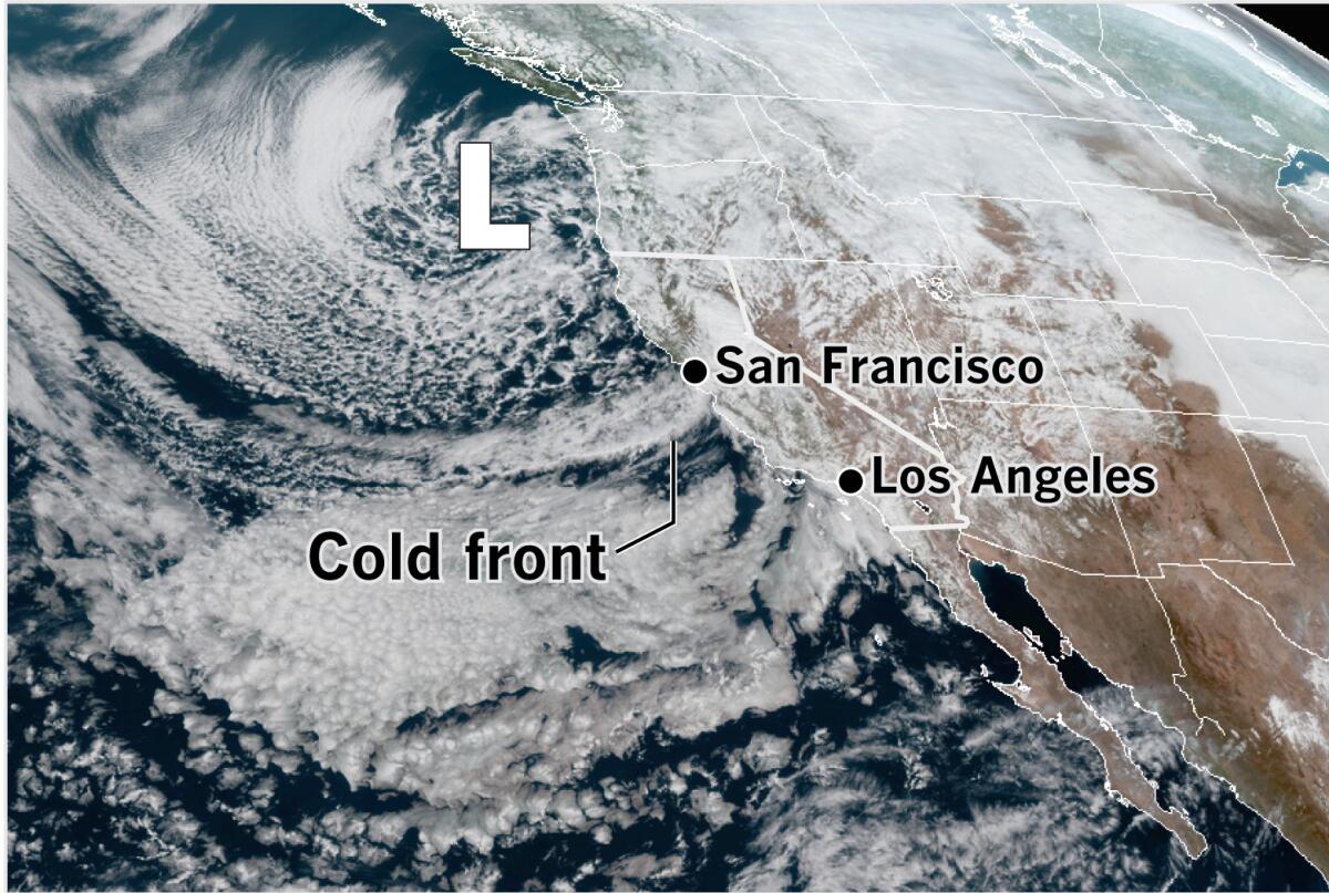
Cold storms are on tap for Southern California as a low system moves down the coast

- Share via
A series of cold Pacific storms is expected to bring significant rain and mountain snow to Southern California beginning Sunday, the National Weather Service said.
The cold front, already bringing showers to the San Francisco Bay Area on Saturday afternoon, was expected to continue its slow march southward, with rain showers spreading to the south and east. Instability behind the front raised the possibility of thunderstorms, and lightning strikes and small hail were reported near Redding.
Rain is expected to begin to arrive in Santa Barbara County Sunday, and spread throughout the Los Angeles region on Monday, with potentially heavy rain at times into Monday night. Rainfall could be heavier over south- and southwest-facing foothills and coastal slopes.
Because of the cold nature of the storm, snow levels will start out at 5,000 feet on Monday and lower to 4,000 feet Monday night. Eventually they will dip to 3,000 feet on Tuesday. Low snow levels are expected to affect travel in the mountains, with road closures possible through major passes, including Interstate 5 over the Grapevine on Tuesday and Wednesday.
Scattered showers will continue Tuesday, with light, isolated showers Wednesday, the weather service said. On Tuesday, the low is forecast to shift farther to the west than originally predicted. Instability in the atmosphere will result in a slight chance for thunderstorms, during which brief, heavy downpours are possible.

On Saturday afternoon, the National Weather Service office in Monterey reported ongoing shower activity and high elevation snow with the system, which was described as slow-moving, allowing rain amounts to add up. According to the weather service, rainfall amounts for the preceding 12 hours of a tenth to a quarter-inch — and as much as a half-inch in a few places — were the biggest rainfall totals in Northern California since late January.
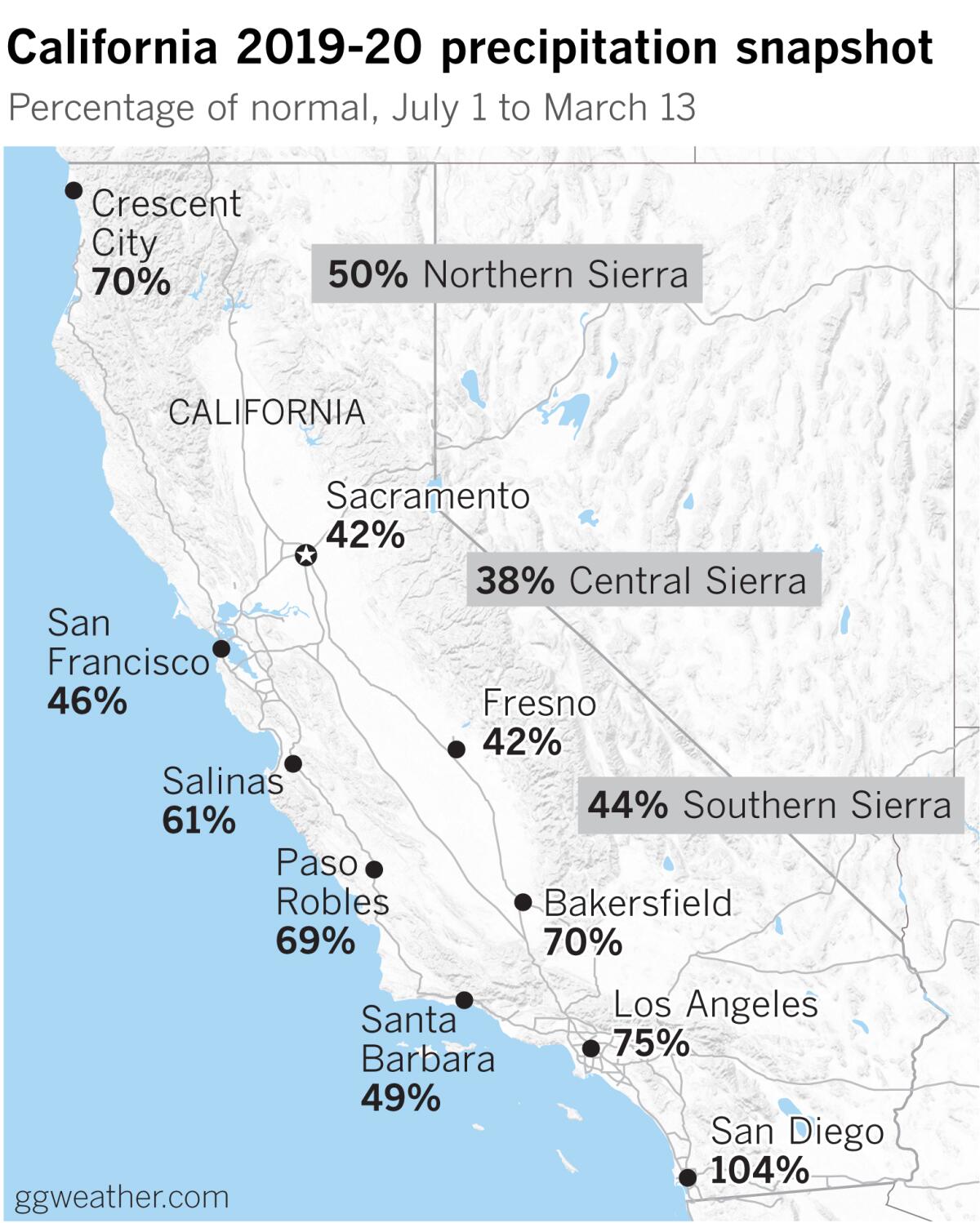
All of this is good news for a dry California. The most recent U.S. Drought Monitor released Thursday shows almost half of the state to be in moderate drought.
More to Read
Sign up for Essential California
The most important California stories and recommendations in your inbox every morning.
You may occasionally receive promotional content from the Los Angeles Times.


![Vista, California-Apri 2, 2025-Hours after undergoing dental surgery a 9-year-old girl was found unresponsive in her home, officials are investigating what caused her death. On March 18, Silvanna Moreno was placed under anesthesia for a dental surgery at Dreamtime Dentistry, a dental facility that "strive[s] to be the premier office for sedation dentistry in Vitsa, CA. (Google Maps)](https://ca-times.brightspotcdn.com/dims4/default/07a58b2/2147483647/strip/true/crop/2016x1344+29+0/resize/840x560!/quality/75/?url=https%3A%2F%2Fcalifornia-times-brightspot.s3.amazonaws.com%2F78%2Ffd%2F9bbf9b62489fa209f9c67df2e472%2Fla-me-dreamtime-dentist-01.jpg)
