First ‘textbook’ El Niño rains provide clues on possible damage to come

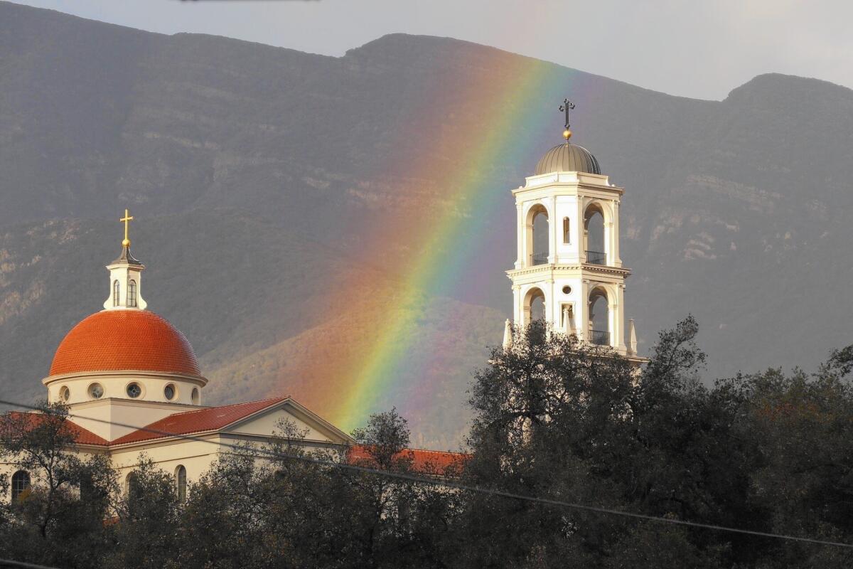
A rainbow appears to rise above Thomas Aquinas College in Santa Paula. Another storm system is forecast to hit Southern California on Saturday.
- Share via
The first major El Niño storm system finished its path through Southern California on Thursday, giving officials a chance to study both the behavior of the storms and how officials responded to them.
The assessments are important because forecasters are predicting a winter of heavy, potentially destructive rain because of the El Niño weather pattern.
This week’s storms caused some flooding of roadways and freeways, with relatively modest mudslides in areas recently burned by fires.
See the most-read stories this hour >>
But overall, the infrastructure held up despite intense downpours in some areas.
“We will be looking at the modeling and how the water actually flowed,” said Stephen Frasher, spokesman for the Los Angeles County Department of Public Works, “but I haven’t heard of any trouble spot locations that emerged as a surprise from the storm.”
This week was marked by three El Niño storms in a row coming in from the Pacific. Another storm is expected Saturday. Officials remain concerned that such frequent storms over time can erode hillsides and cause more mudslides.
L.A. County’s public works agency continues to focus special attention in parts of Azusa and Glendora near where the Colby fire burned 1,952 acres in 2014, Frasher said. Ventura County officials are keeping an eye on several areas there that were recently burned, notably around Solimar Beach. Mudflows from that burn zone created problems Wednesday on the 101 Freeway.
From a scientific standpoint, Bill Patzert, climatologist at NASA’s Jet Propulsion Laboratory, said this week was a “textbook” El Niño system.
He noted the storms’ single-file formation over the Pacific, like jetliners queuing for an airport landing. Once they made landfall, the rain fell at a clip faster than during the two previous big El Niño periods in 1997-98 and 1982-83, Patzert said.
More than 2 1/2 inches of rain fell in four days in downtown Los Angeles this week, according to the National Weather Service. In 1998, it rained only 4 inches downtown for all of January; in 1983, rainfall for the month hit nearly 7 inches, Patzert said.
Based on this, the 2016 El Niño — so far at least — is shaping up to be impressive, he said.
The 1997-98 El Niño was particularly destructive, washing away roads and railroad tracks, overflowing flood control channels and causing 17 deaths and more than half a billion dollars in damage in California. The toll was far worse in Mexico, where Tijuana and other cities faced crippling flooding.
Brett Albright, a meteorologist with the National Weather Service in San Diego, noted that the week’s storms were also colder than predecessors, dropping snow at lower elevations and in a more powdery form.
During the strongest weather Wednesday, snow fell as low as 3,000 feet above sea level, leaving behind more than 2 feet around Big Bear Lake, 30 inches at the nearby Snow Summit ski resort and 6 to 10 inches at Lake Arrowhead. About 8,500 customers experienced outages, according to the Bear Valley Electric Service.
Jim Miller, committee development director for Big Bear Lake, said, “When you get a storm like this, you’re pretty much set for the rest of ski season. This is good through March.... If we get El Niño storms, I could be skiing in April.”
In Malibu, Thursday’s storm passed in the early morning hours, clocking winds at 35 miles per hour and covering homes with pea-sized hail. Sporadic lightning strikes and minor street flooding were also reported.
Join the conversation on Facebook >>
Surfers complained that many of the swells were too chaotic to ride, and Los Angeles County health officials advised against ocean water contact for as long as 72 hours because of elevated bacteria levels — especially near drain pipes, harbors and river mouths.
El Niño is caused by the warming of the equatorial waters of the Pacific, weakening rains in South Asia and bringing heavier downpours to California. The storms peak in January, February and March.
ALSO
Claims in Porter Ranch gas leak could cost utility billions of dollars
NFL wants a team or two in L.A., and owners head to Houston for a vote
3 teens from China will go to prison for a San Gabriel Valley attack on a classmate
More to Read
Sign up for Essential California
The most important California stories and recommendations in your inbox every morning.
You may occasionally receive promotional content from the Los Angeles Times.


