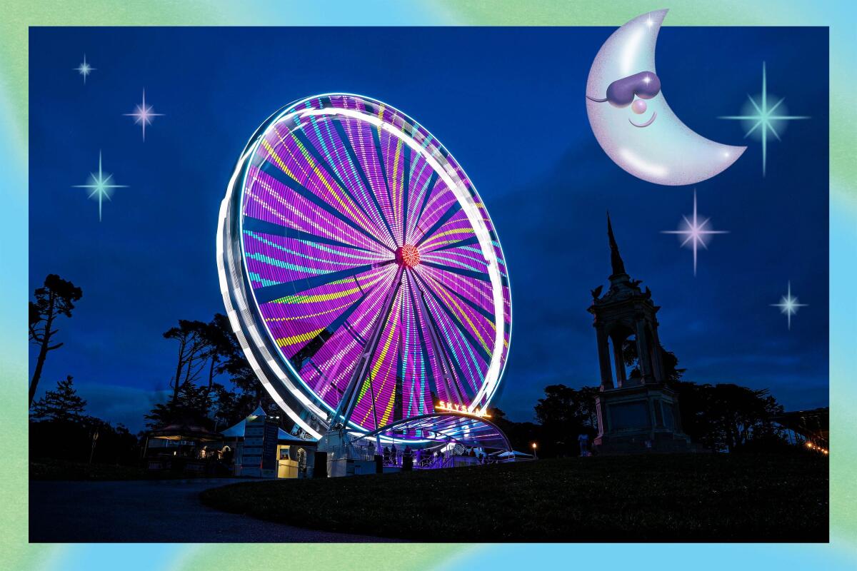
(Illustrations by Grace Danico / Gary Coronado / Los Angeles Times)
25 free things to do in California that will get you in the summer groove
- Share via
This is part of “California 101,” our guide to the best experiences across the state.
With the summer season upon us, thoughts often turn to travel. However, anyone considering a trip these days is likely frustrated by soaring airfares, galloping gas prices and general inflation. Still, there’s some consolation: Twenty-five free things to do in California.
Because there is no such thing as a truly free lunch (or a free road trip), it will still cost you something to get to and from these places. But once you’re there, your wallet may breathe easy.
Showing Places
Meander the lawns and gardens of Balboa Park
San Diego County Park
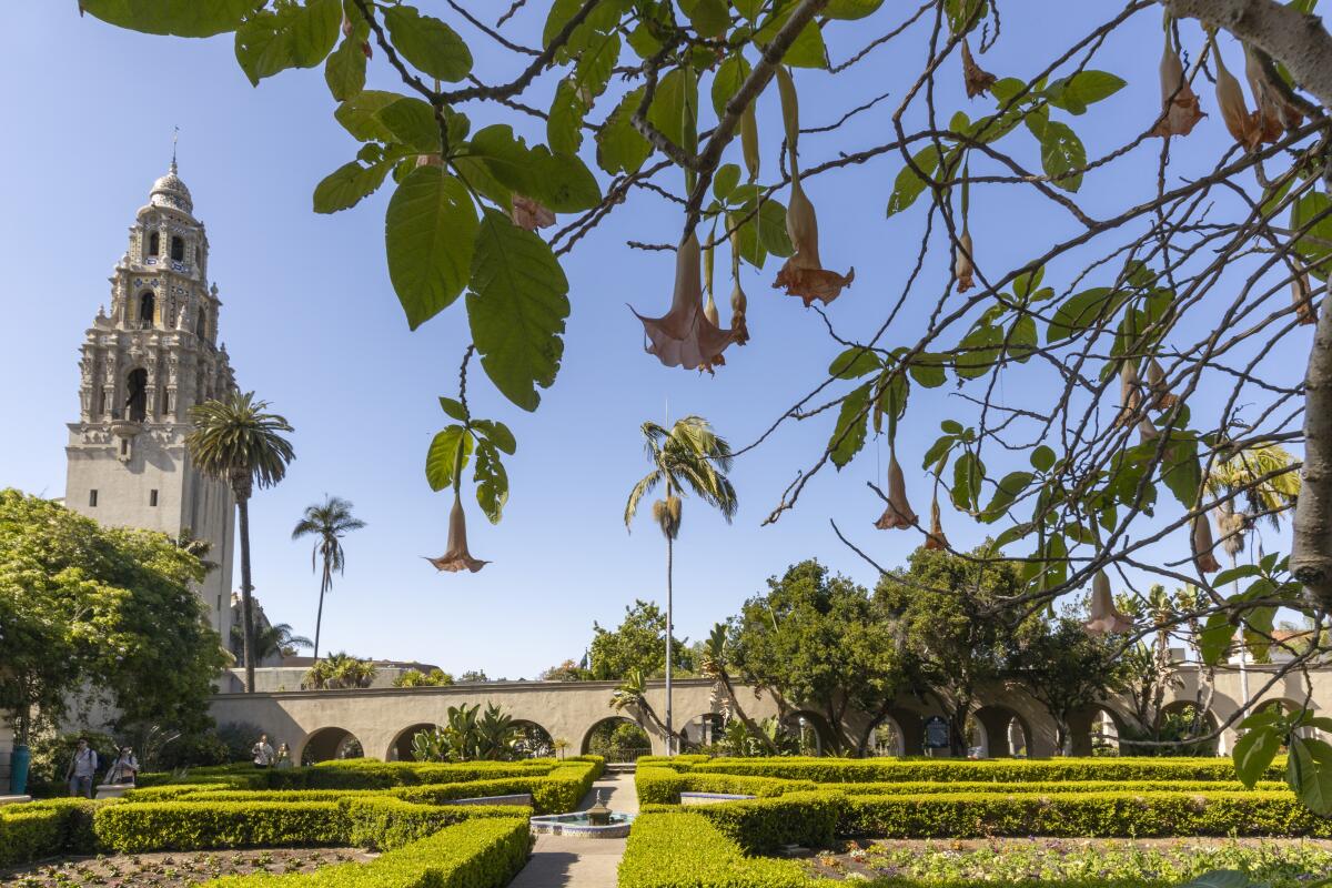
(Allen J. Schaben / Los Angeles Times)
The San Diego Zoo isn’t free.
But it’s less than 10% of San Diego’s Balboa Park, which covers 1,200 acres. The park is also home to 17 museums featuring art, photography, natural history, science, flight, history, model railroading and more, with a new Comic-Con Museum. The Old Globe theater complex includes three venues. Flop on the lawn by the big lily pond near the Botanical Building, browse the gardens. If you’re there at 2 p.m. on a Sunday, you have the option of a free hourlong concert in the park’s Spreckels Organ Pavilion.
But it’s less than 10% of San Diego’s Balboa Park, which covers 1,200 acres. The park is also home to 17 museums featuring art, photography, natural history, science, flight, history, model railroading and more, with a new Comic-Con Museum. The Old Globe theater complex includes three venues. Flop on the lawn by the big lily pond near the Botanical Building, browse the gardens. If you’re there at 2 p.m. on a Sunday, you have the option of a free hourlong concert in the park’s Spreckels Organ Pavilion.
Show more Show less
Route Details
Walk the weird shores of Bombay Beach at dusk
Imperial County Attraction
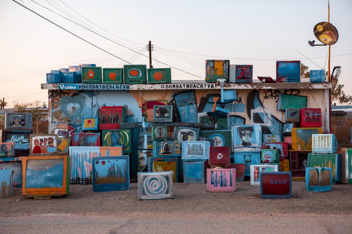
(Madeleine Hordinski / Los Angeles Times)
Stop worrying about the apocalypse. Instead, spend a sunset here, where the end of the world seems to have arrived already, leaving a ghostly collection of newly minted art, weather-beaten ruins and live-in trailers, tidy and otherwise. It’s Bodie meets Burning Man on the Salton Sea.
This was a mainstream vacation destination 70 years ago, when the sea was healthier. Now, it’s a grid of 32 square blocks with perhaps 300 residents. It has a single bar/restaurant, the Ski Inn, a market and about a dozen Airbnb units, but not everyone will want to spend the night. It’s edgy.
Migrating birds love Bombay. As do frugal retirees. And lately, a gaggle of artists: Don’t miss the plane standing on its nose (“Lodestar” by Randy Polumbo) at 1st and H or the painted televisions at 4th and H. Near sunset, cross the 5-foot berm between the community and the seashore (5th and E). From there you can behold assorted sculptures and installations, baking and crumbling amid the miles of gritty sand, salty water and empty sky. Drive through town again once the sun is down, because several installations are lighted after dark.
Show more Show less
Route Details
Check out the murals of Chicano Park
San Diego County Park
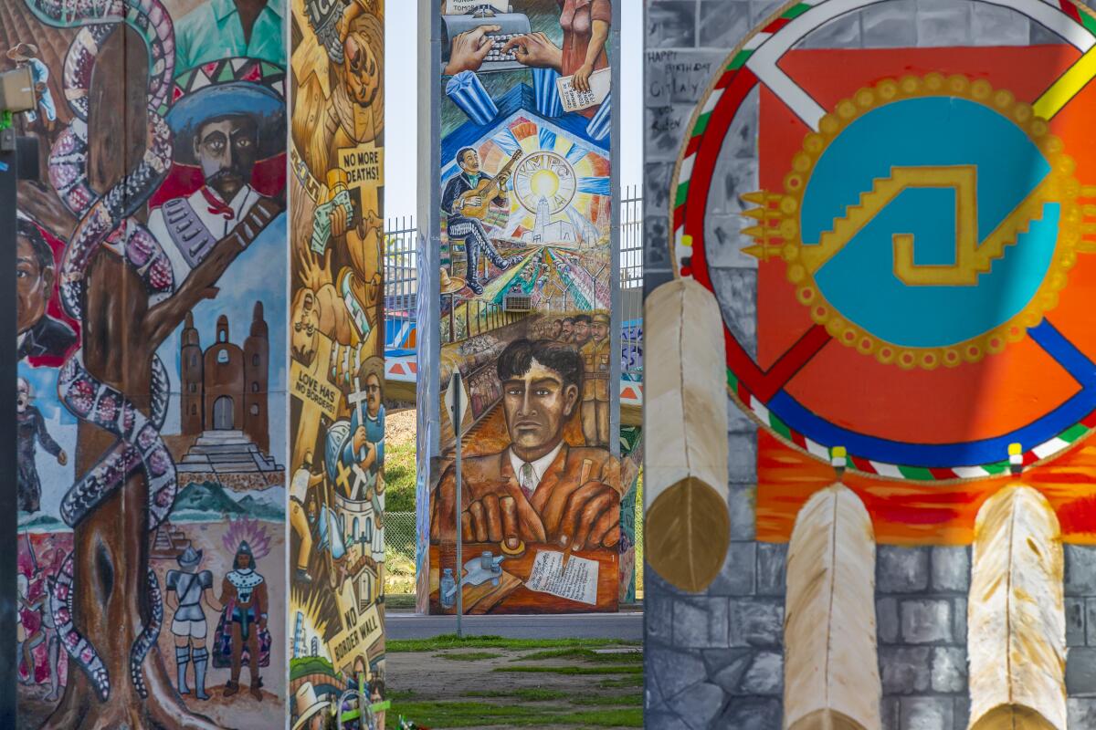
(Allen J. Schaben / Los Angeles Times)
Even with no social context, this would be a striking set of murals, improbably arrayed beneath the Coronado Bridge. But this context matters. When state and local officials expanded Interstate 5 through San Diego and built the Coronado Bridge in the 1960s, they split the longstanding blue-collar neighborhood of Barrio Logan.
Then, in 1970, when the California Highway Patrol started building an office where a park was expected, the largely Mexican American neighborhood rose up and at last got a 7-acre park built. Soon after came the first murals. Now there are 49 murals, some celebrating Mexican icons Pancho Villa and Frida Kahlo. Within two blocks, you can get flautas at Las Cuatro Milpas or tacos at ¡Salud! In 2017, federal officials added the park to the National Register of Historic Places, crediting artists Salvador Torres, Mario Torero, Victor Ochoa and others.
Also, if you’ve never driven across the Coronado Bridge, do it. (It’s free, unlike the Golden Gate Bridge.) Then bear left on Orange Avenue and within a mile you’ll reach the Hotel del Coronado, a red-roofed, beachfront 1888 Victorian resort that served as a setting for the films “Some Like it Hot” (1959) and “The Stunt Man” (1980). A great, wide, sandy beach stretches out next to the hotel, free to all.
Show more Show less
Route Details
Smell the tri-tip at the downtown SLO Farmers’ Market
San Luis Obispo County Farmers' market
(Brian van der Brug / Los Angeles Times)
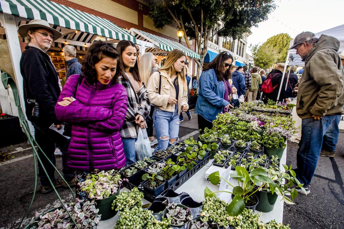
The downtown San Luis Obispo Farmers’ Market dates to the early ’80s. At full strength, the market fills five blocks with more than 120 vendors, assorted artisans and live music. There are farm-fresh chicken, ribs, pulled pork, corn on the cob and that particular crescent-shaped bit of beef, best when grilled over red oak, known as tri-tip.
Also free: a close-up look at downtown’s Bubblegum Alley (it’s just what it sounds like).
Also free: a close-up look at downtown’s Bubblegum Alley (it’s just what it sounds like).
Show more Show less
Route Details
Savor Ferry Building history and waterfront scenery
San Francisco Attraction
(Christopher Reynolds / Los Angeles Times)
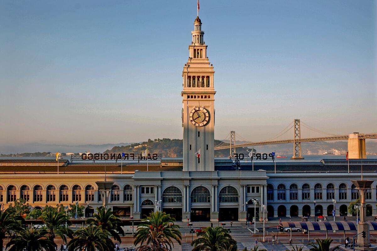
In a food- and view-obsessed city, no venue is foodier than San Francisco’s Ferry Building, and no view beats the Golden Gate Bridge. The real estate that connects them — and Fisherman’s Wharf and the Embarcadero — is the waterfront, a stretch of more than five miles that will feed you, teach you, entertain you and muss your hair (stiff breezes).
Start at the foot of Market Street in the the Ferry Building. From 1898 until the Bay and Golden Gate bridges went up in the 1930s, ferries from Alameda and Marin counties were the heart of Bay Area commuter life. Then, cars and BART took over. Now, the Ferry Building is crowded with artisan shops and restaurants and a farmers market. Just outside, if it’s after dark, there’s a great view of the free nightly Bay Bridge Lights Show. By day, work your you way north and west on the waterfront, and you can admire the sea lions at Pier 39; and the tourist spectacle that is Fisherman’s Wharf. You can also walk to Golden Gate views at Crissy Field, the Warming Hut and Fort Point.
Start at the foot of Market Street in the the Ferry Building. From 1898 until the Bay and Golden Gate bridges went up in the 1930s, ferries from Alameda and Marin counties were the heart of Bay Area commuter life. Then, cars and BART took over. Now, the Ferry Building is crowded with artisan shops and restaurants and a farmers market. Just outside, if it’s after dark, there’s a great view of the free nightly Bay Bridge Lights Show. By day, work your you way north and west on the waterfront, and you can admire the sea lions at Pier 39; and the tourist spectacle that is Fisherman’s Wharf. You can also walk to Golden Gate views at Crissy Field, the Warming Hut and Fort Point.
Show more Show less
Route Details
Make up your mind about ‘Forever Marilyn’
Riverside County Attraction
(Gina Ferazzi / Los Angeles Times)
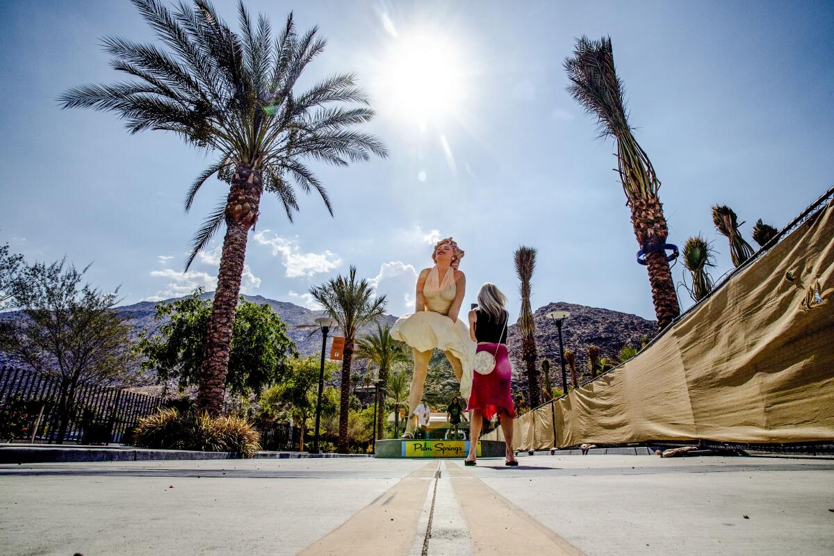
The hoteliers of Palm Springs paid to put up this 26-foot-tall Marilyn Monroe sculpture — which some love and some hate — and it’s positioned on Museum Way to face busy Palm Canyon Drive, flashing her backside at the city’s art museum. If you like this Marilyn, go ahead and grab a few selfies and try to remember the film in which her white skirt billowed like this (it rhymes with “Devon Ear Witch”). As a note by the sculpture says, Monroe was a frequent visitor to the desert; she was spotted in 1949 at Charlie Farrell’s Racquet Club and signed by a William Morris talent agent.
If you’re not so fond of this work by Seward Johnson, get in line behind Los Angeles Times art critic Christopher Knight, who calls it “adolescent sculptural trash.” Or stride ride past Marilyn to the Palm Springs Art Museum (open Thursdays through Sundays), which has placed a few outdoor works of its own. One of them (also selfie fodder) is a 1968 Chevy Malibu balanced on its nose above a reflecting pool. (It’s called “History of Suspended Time (A monument for the impossible),” by Gonzalo Lebrija.)
If you’re not so fond of this work by Seward Johnson, get in line behind Los Angeles Times art critic Christopher Knight, who calls it “adolescent sculptural trash.” Or stride ride past Marilyn to the Palm Springs Art Museum (open Thursdays through Sundays), which has placed a few outdoor works of its own. One of them (also selfie fodder) is a 1968 Chevy Malibu balanced on its nose above a reflecting pool. (It’s called “History of Suspended Time (A monument for the impossible),” by Gonzalo Lebrija.)
Show more Show less
Route Details
Alternate art and the outdoors at the Getty Center
Los Angeles County Museum
(Christopher Reynolds / Los Angeles Times)
This way, please, to Van Gogh, Cézanne, Hockney and the world’s wealthiest art institution.
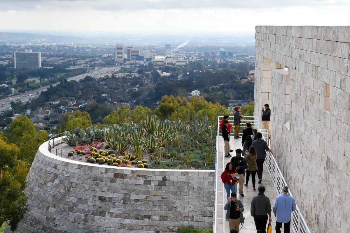
Even by Los Angeles standards, the Getty Center in Brentwood is a young landmark (completed in 1997). But this 110-acre hilltop museum campus of bright, spare buildings is backed by a $9.2-billion endowment. And it gives us access to Van Gogh’s “Irises,” Cézanne’s “Still Life With Apples” and David Hockney’s “Pearblossom Highway” photo collage, along with thousands of other paintings and sculptures, a renowned photography collection, a boldly modern garden and a set of fairly spectacular views toward the Pacific.
Admission is free. (But parking is $20, and you must reserve a timed-entry spot.) It’s closed on Mondays. Take the tram up the hill and head for the West Pavilion, which houses photography and Impressionists. Check out the cactus garden, which seems to float in the sky. And spare a few minutes to read up on the strange life of the notoriously tight-fisted oilman who endowed this place even though he left California in 1951 and never returned.
Show more Show less
Route Details
Stride or pedal through Golden Gate Park
San Francisco Park
(Christopher Reynolds / Los Angeles Times)
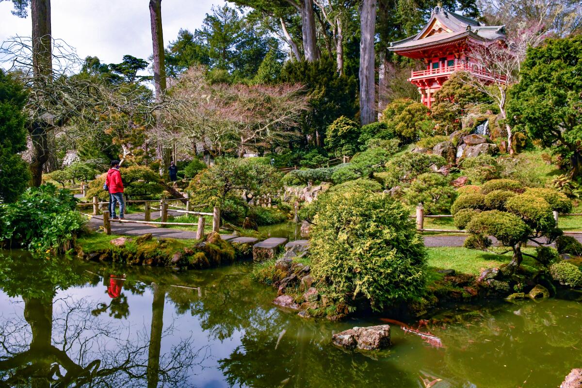
Golden Gate Park has all sorts of cultural, natural and not-so-natural wonders, including the waters of Stow Lake, the heights of Strawberry Hill, the Conservatory of Flowers, the Japanese Tea Garden and the San Francisco Botanical Garden. On the museum front it offers the California Academy of Sciences (the building with the undulating green roof) and the de Young Museum (with an art collection that includes a bit of everything). Explore the park and you’ll find a bison paddock, a golf course and a network of paths and car-free roads that attracts walkers, runners, skaters, cyclists and Segway riders.
Atop the de Young Museum‘s bold, angular building, you’ll find a 140-foot-high observation tower with glass walls and staggering wraparound views. It’s free.
For another angle on the skyline, there’s the park’s 150-foot-high SkyStar Ferris wheel ($18 per adult).
Atop the de Young Museum‘s bold, angular building, you’ll find a 140-foot-high observation tower with glass walls and staggering wraparound views. It’s free.
For another angle on the skyline, there’s the park’s 150-foot-high SkyStar Ferris wheel ($18 per adult).
Show more Show less
Route Details
Sniff the street food at Grand Central Market
Los Angeles County Food Market
(Mark Boster / Los Angeles Times)
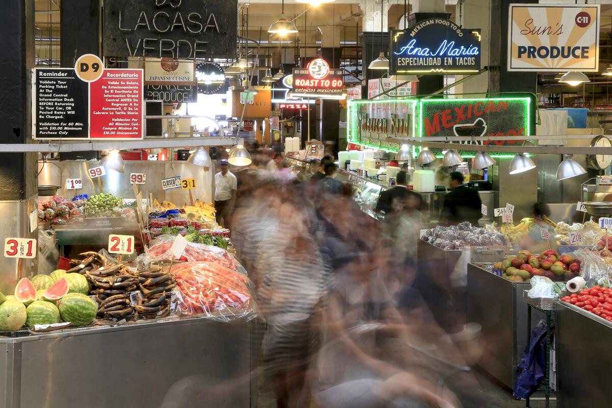
Grand Central Market, which dates back more than a century, gives you a quicker, slicker view of L.A. diversity than just about any address in town. Gentrified in recent years, the space offers quick food from around the world (the food isn’t free, but the scents are) and gives visitors a chance to rub elbows with downtown denizens. It’s a happy, lively place, with about 40 food stalls and several craft vendors in the less-trafficked bazaar downstairs.
Show more Show less
Route Details
See stars and the city grid from Griffith Observatory
Los Angeles County Attraction
(Wally Skalij / Los Angeles Times)
Before you even enter Griffith Observatory on its perch in the Hollywood Hills, it lavishes gifts upon you.
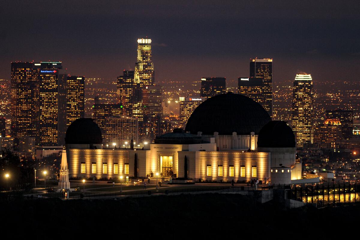
Looking west from the lawn, you see the Hollywood sign from a fetching angle (with James Dean’s bust in the foreground). Looking south at sunrise or sunset, you see Los Angeles at its most orderly: a tidy, twinkling grid of city lights, with Western, Normandie and Vermont avenues stretching straight to the horizon (or so it seems).
And on Fridays, Saturdays and Sundays, when you’re allowed inside — did I mention it’s free? — you can scan distant stars and check your weight on Mars. For snacks on those days, you’ll have the Cafe at the End of the Universe, whose patio tables have commanding city views.
Since 1935, Angelenos have embraced Griffith Observatory as “the hood ornament of Los Angeles,” in the words of observatory director E.C. Krupp. It’s the architectural star of 4,210-acre Griffith Park, with three green copper domes, a startling amount of subterranean space (thanks to a major expansion completed in 2006). And, of course, more than 50 miles of hiking trails, all free.
About parking: The lot fills fast, as does nearby curbside parking (metered at $4 hourly). You might want to catch a DASH bus from the Greek Theatre nearby or the Metro station at Sunset and Vermont. Or hike up from the Greek’s parking lot.
Bonus tip: Hike from the observatory’s Charlie Turner Trailhead to the Tom LaBonge Panorama atop Mt. Hollywood, a roughly 2.6-mile round-trip journey with big views of the Hollywood Hills and the San Fernando Valley. And be sure to read up on the philanthropist-felon who made all this possible, Griffith J. Griffith.
Show more Show less
Route Details
Catch a rehearsal or take a walk at the Hollywood Bowl
Los Angeles County Venue
(Kent Nishimura / Los Angeles Times)
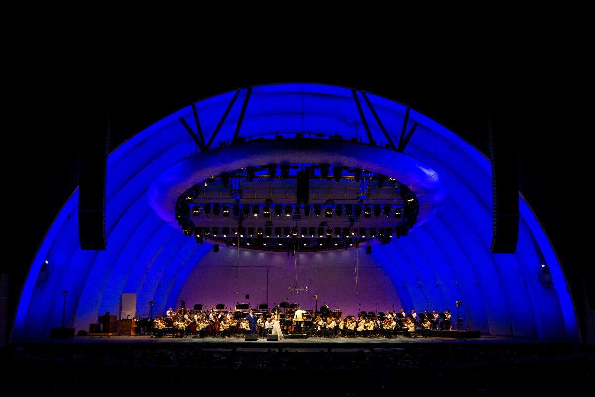
The Hollywood Bowl, summer home of the Los Angeles Philharmonic, turns 100 this year. That makes it older than the Hollywood sign (by a year) and helps explain why so many Angelenos are so fond of it.
Or maybe it’s just the picnics. Most venues would scream bloody murder if you tried this, but at the county-owned bowl, the tradition is that you’re allowed to bring your own food into most shows. If the Phil is playing, you can bring wine and beer. Note that bringing in alcohol is forbidden at some shows. (There’s also a network of walking paths around the bowl.)
And speaking of beloved traditions: Some morning rehearsals at the bowl are free and open to the public, typically on summer Tuesdays and Thursdays between 9 a.m. and noon (seating on side benches in Section D). Rehearsals were closed because of COVID-19 in 2021, but the hope is to open in summer 2022. For the latest information, email information@laphil.org or call (323) 850-2000 (the “hold” music is Holst).
Show more Show less
Route Details
See yesteryear's entertainers (or do yoga) at Hollywood Forever Cemetery
Los Angeles County Attraction
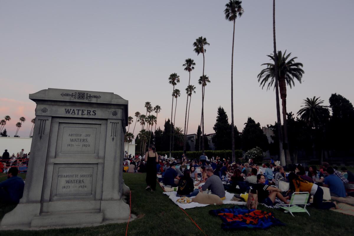
(Francine Orr / Los Angeles Times)
This studio-adjacent graveyard combines film screenings and other pop-culture programming — including popular Día de Los Muertos presentations — with a long roster of show-business gravesites.
Mel Blanc, Cecil B. DeMille, Judy Garland, Johnny and Dee Dee Ramone, Rudolph Valentino, Burt Reynolds and many others repose here. So can you, either long term or on a more temporary basis, while still breathing. Management hosts yoga classes (pay by donation) six mornings per week. There are 2½-hour walking tours ($25) too. Or you can wander on your own.
Mel Blanc, Cecil B. DeMille, Judy Garland, Johnny and Dee Dee Ramone, Rudolph Valentino, Burt Reynolds and many others repose here. So can you, either long term or on a more temporary basis, while still breathing. Management hosts yoga classes (pay by donation) six mornings per week. There are 2½-hour walking tours ($25) too. Or you can wander on your own.
Show more Show less
Route Details
Remember what happened at Manzanar National Historic Site
Inyo County Historical Landmark
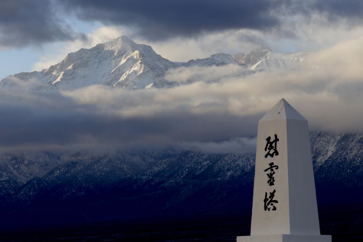
(Francine Orr / Los Angeles Times)
On this barren, windblown patch of the Owens Valley at the foot of the Eastern Sierra, more than 10,000 Japanese Americans endured a painful home-front chapter of World War II.
In early 1942, about 10 weeks after the bombing of Pearl Harbor, President Franklin D. Roosevelt gave military leaders authority to imprison Japanese American men, women and children at 10 internment camps across the U.S. Fifty years later, the National Park Service remade the Manzanar site as a place for contemplation of war, liberty, prejudice and endurance.
Admission is free. Drive the camp’s three-mile periphery, between Lone Pine and Independence, and pause at the cemetery, where a tall monument is etched with Japanese characters. There’s a visitor center, theater, museum and reconstructed barracks, where exhibits explain how families lost property, converted fruit crates into camp furniture and debated whether their mess hall should serve Japanese or American dishes. Don’t miss the 1988 news clip of then-President Reagan declaring the incarcerations “a mistake” and offering compensation for survivors of the camps.
Show more Show less
Route Details
Listen for music and look for street life at Mariachi Plaza
Los Angeles County Attraction
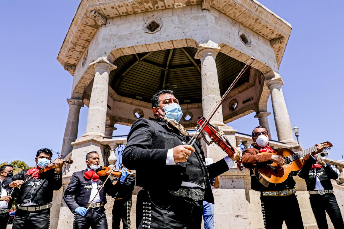
(Gary Coronado / Los Angeles Times)
If Los Angeles has a Mexican heart, this public plaza (and Metro subway stop) must be a ventricle. Maybe both ventricles. It’s where mariachi musicians hang out in hopes of being hired, and you see them lugging their instruments from one corner or another, or practicing a little. All that action slowed during the pandemic, but the plaza is still surrounded by intriguing retail, including the Casa del Mariachi costume shop, La Casa del Musico music store and the Espacio 1839 boutique. There are several tempting casual places to eat and drink, including Santa Cecilia Restaurant and Street Tacos and Grill.
To the west, there’s the historic Boyle Hotel, once a hangout for wayward musicians, now the ground-floor site of a La Monarca Bakery & Cafe and the Libros Schmibros Lending Library. On the eastern side of the plaza rises a bandstand.
Bonus tip: On a warm day, head for the northwestern corner of the plaza, near Boyle Avenue, where the J&F ice cream shop stands. Check out the guys playing cards on the wooden benches, the statue of Mexican singer Lucha Reyes, the umbrella-shaded tables. If there’s music, let out a grito or two. Then maybe get a banana smoothie from Minnie Villa, owner of J&F for the last 11 years.
Show more Show less
Route Details
Tread the boardwalk alongside Moonstone Beach Drive
San Luis Obispo County Town
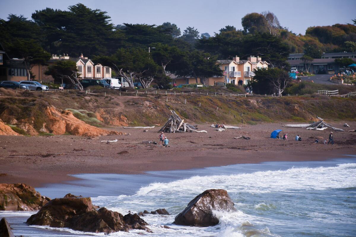
(Christopher Reynolds / Los Angeles Times)
Cambria is a coastal town but not a beach town. The shoreline is rugged and rocky, with pines marching up steep, often-foggy slopes and about 10 inns along Moonstone Beach Drive.
The city’s eastern and western villages sit a bit inland, and Main Street includes art galleries and boutiques but no chain stores.
Stroll the mile-long Moonstone Beach Boardwalk. Hike on the Fiscalini Ranch Preserve’s Bluff Trail. (Both are free.) Sample the eclectic menu at Robin’s Restaurant (a mainstay for more than 25 years), slurp chowder at the Sea Chest Oyster Bar or dig into olallieberry pie at Linn’s Restaurant (more than 30 years).
Show more Show less
Route Details
Mingle and remember at L.A.'s Original Farmers Market
Los Angeles County Farmers' market
(Christina House / Los Angeles Times)
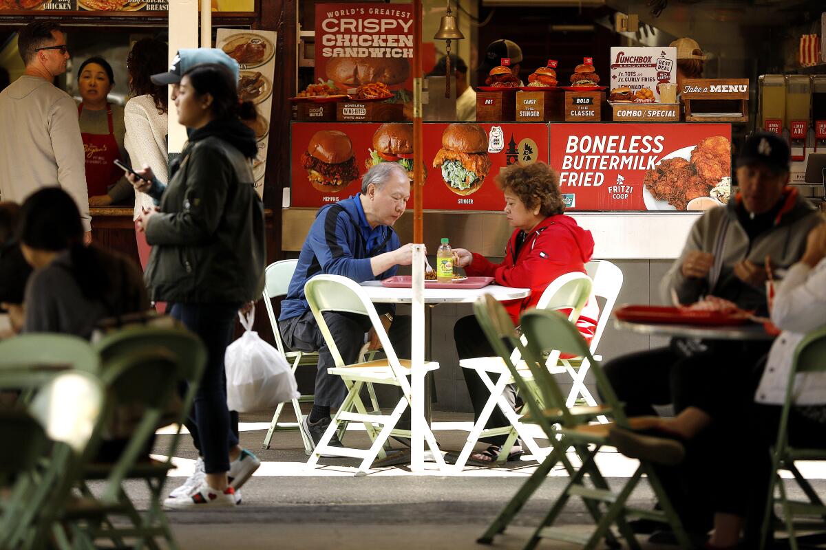
The Original Farmers Market, founded in 1934, is old-school Los Angeles, a place that holds its charm through daily tides of tourists from all over. It includes more than 100 eateries, markets and shops and just as many screenwriters schmoozing on its patios, or so it seems some days. You can spend little and linger long.
Hungry? For all things French, try Monsieur Marcel Gourmet Market. For tacos, Trejos. For pie, Du-par’s (since 1938) is open long hours. If you’re traveling with teens, they’ll probably head next door to the Grove, an upscale mall that opened in 2002 with about a dozen restaurants, 14 movie screens and a dancing fountain.
Hungry? For all things French, try Monsieur Marcel Gourmet Market. For tacos, Trejos. For pie, Du-par’s (since 1938) is open long hours. If you’re traveling with teens, they’ll probably head next door to the Grove, an upscale mall that opened in 2002 with about a dozen restaurants, 14 movie screens and a dancing fountain.
Show more Show less
Route Details
See, hear and smell the blubbery crowd at Piedras Blancas Elephant Seal Rookery
San Luis Obispo County Attraction
(Christopher Reynolds / Los Angeles Times)
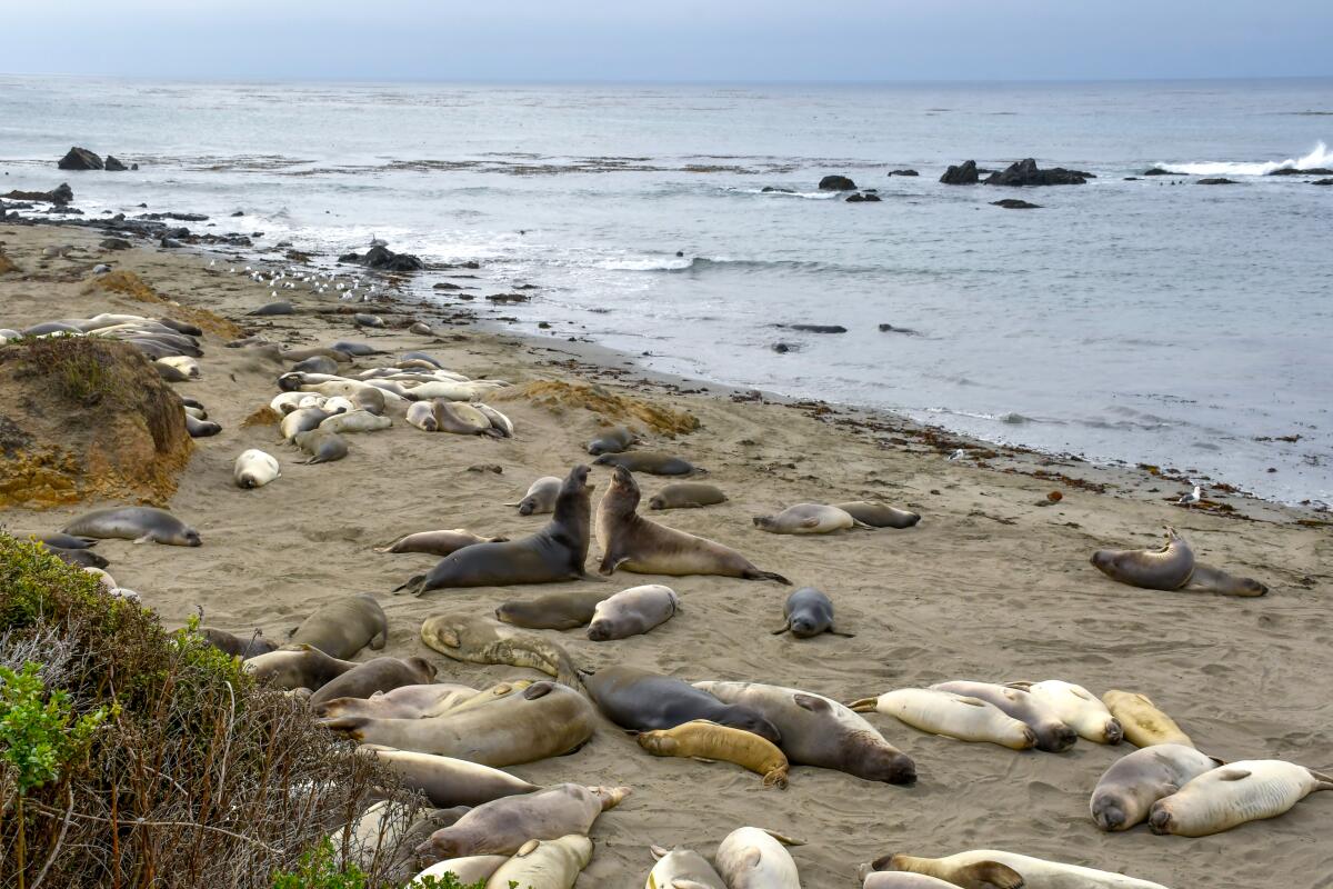
Out of water, the northern elephant seal is as ungainly as a creature can get — thousands of pounds of blubbery, damp, stinky flesh, caked with beach sand, prone to molting, belly flops and mating frenzies.
So of course, you want to see them. And winter is prime time.
This will make more sense once you’ve arrived at Piedras Blancas, where hundreds of these seals at a time bask, spar, give birth and mate on a ridiculously beautiful stretch of state-controlled undeveloped coastline seven miles north of San Simeon.
It’s free and open every day. There’s a parking lot and a boardwalk (wheelchair accessible), usually patrolled by a few volunteer docents in blue windbreakers. You watch and listen, walk the pathway and (as the National Park Service urges) stay at least 25 feet away from the hulking beasts. Keep dogs and drones away altogether.
They’re called elephant seals because of the large proboscis grown by the adult males (which get up to 18 feet long and 5,000 pounds).
In November, thousands of the males begin showing up after months in the open ocean, to skirmish over dominance. In December, pregnant females start gathering in “harems” around dominant males. In January and February, they typically give birth, followed by the resumption of mating a few weeks later.
In March, the adult males are the first to leave, having lost up to 40% of their body weight in fasting, fighting and fornicating. Females and weanlings leave later, but the animals come back to molt in spring and summer.
Show more Show less
Route Details
Explore the strange structures of Poly Canyon
San Luis Obispo County Attraction
(Brian van der Brug / Los Angeles Times)
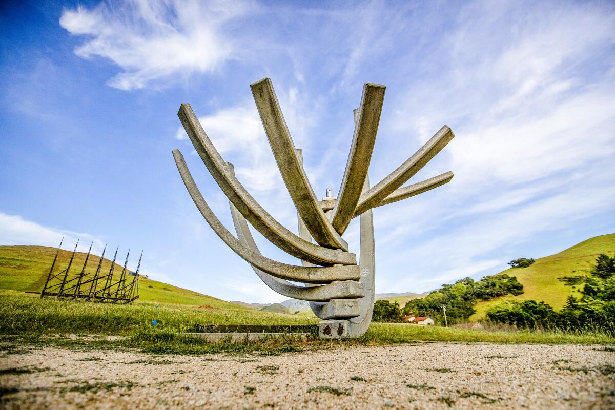
Architecture students usually have to keep their wildest daydreams to themselves. But among the hills of Poly Canyon on the back side of Cal Poly San Luis Obispo, some of those dreams have taken shape. And cows, horses, students and hikers can roam (free) among them.
Here’s what happened: In the 1950s, when Cal Poly was beginning to earn a reputation as a formidable school of architecture, designer and futurist R. Buckminster Fuller gave a stirring lecture about geodesic domes. So five students built one on campus.
In 1963, the university moved the dome out to Poly Canyon on the northeastern edge of campus. Since then, the canyon has become a one-of-a-kind testing ground that now holds more than 20 experimental projects. The idea, Architecture School Dean Christine Theodoropoulos says, is to give students an understanding that comes only “when you touch the materials.” The canyon is busiest in April, when the school’s Design Village event invites competitors to build temporary structures. This year, organizers had to cope with an accumulation of pandemic-era graffiti.
Still, it’s a singular place, and it’s open to hikers. It’s a hike of about 2.5 miles from campus to the first structure and back. Park in Visitor Parking Structure 131. Don’t be surprised if you meet cows or horses or students snoring in hammocks.
Bonus tip: Don’t miss my favorite structure, which looks like a whitewashed Gumby playing Twister. It’s called “Hay Bale Arch,” and it went up in 2004.
Show more Show less
Route Details
Confront the beasts of Borrego Springs Road
San Diego County Attraction
(Christopher Reynolds / Los Angeles Times)
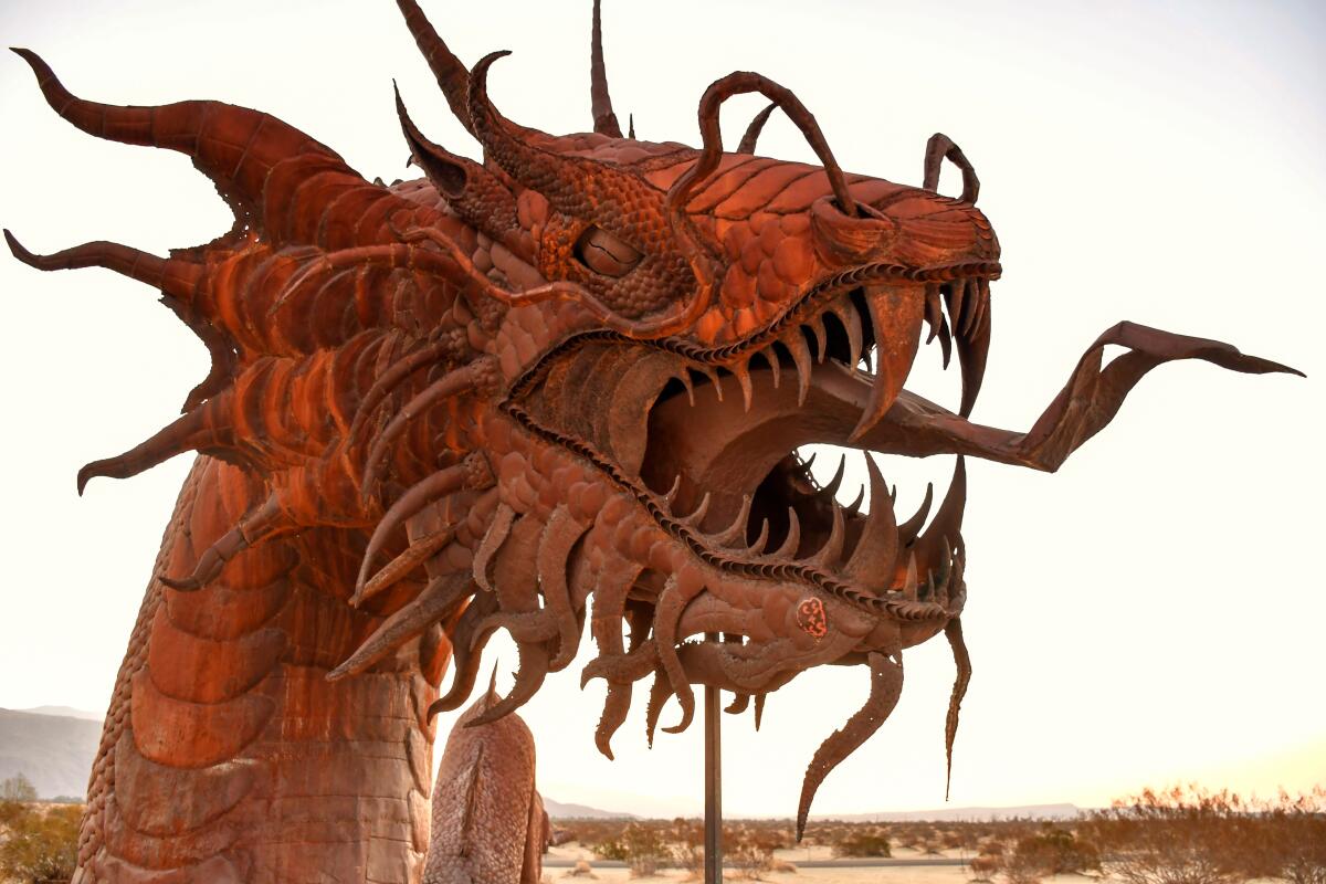
As you cruise along Borrego Springs Road, you’ll encounter the imagination of Ricardo Breceda. That’s a good thing.
Breceda, a Southern California sheet metal sculptor commissioned by local philanthropist Dennis Avery, has placed more than 120 rusty works in the flatlands around the hamlet of Borrego Springs since 2008. The collection includes bighorn sheep, horses, dinosaurs, a lonely Spanish padre, a scorpion the size of a Subaru and an even bigger serpent, a 350-foot-long Loch Ness Monster of the sand. For a detailed map, stop by the Anza-Borrego Desert Natural History Assn. store near Christmas Circle. Before or after beast-hunting, relax at Casa del Zorro, cruise along Palm Canyon Drive (Borrego Springs’ main drag) or get a cool beverage at Carlee’s.
Bonus tip: Anza-Borrego Desert State Park, California’s largest, surrounds Borrego Springs. Its Palm Canyon hike, a 3.25-mile loop, has been a favorite for decades.
Show more Show less
Route Details
Look but don't touch on Rodeo Drive
Los Angeles County Shopping
(Jay L. Clendenin / Los Angeles Times)
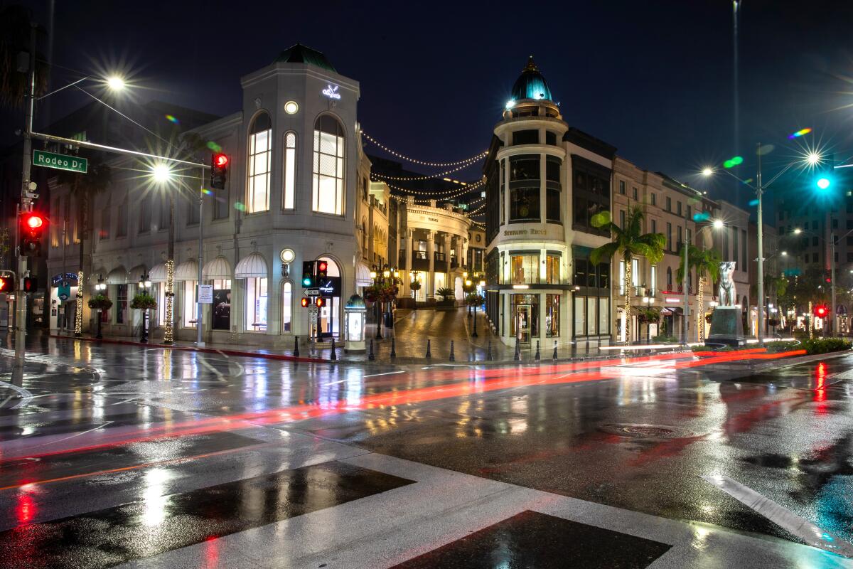
Yes, this is the conspicuous consumption capital of California, but it’s still free to window-shop along the three blocks that make up the Rodeo Drive retail experience. Start at Beverly Gardens Park at Rodeo Drive and South Santa Monica Boulevard. Make your way southwest on Rodeo so that you can browse Cartier, Gucci, Harry Winston, Prada, Burberry, Fendi and friends. Don’t miss Via Rodeo (a.k.a. Two Rodeo), a pedestrian alley that includes Jimmy Choo and the 208 Rodeo restaurant, with prime people-watching on the patio.
At lunchtime at 208 Rodeo, you could linger over an $11 side of fries. (But bear in mind the restaurant’s note to customers: Please move along after 90 minutes.)
Once you reach Wilshire Boulevard, you’ll face the Beverly Wilshire Hotel, where Warren Beatty once lived, Esther Williams taught 14-year-old Elizabeth Taylor how to swim and Richard Gere brought Julia Roberts in “Pretty Woman.”
Bonus tip: Parking can be as tough as making that first $5 million. Street spots are metered at $2 per hour. But there are multiple structures nearby, and many offer free parking for the first hour or two.
Show more Show less
Route Details
Gape at takeoffs and landings at Torrey Pines Gliderport
San Diego County Attraction
(Christopher Reynolds / Los Angeles Times)
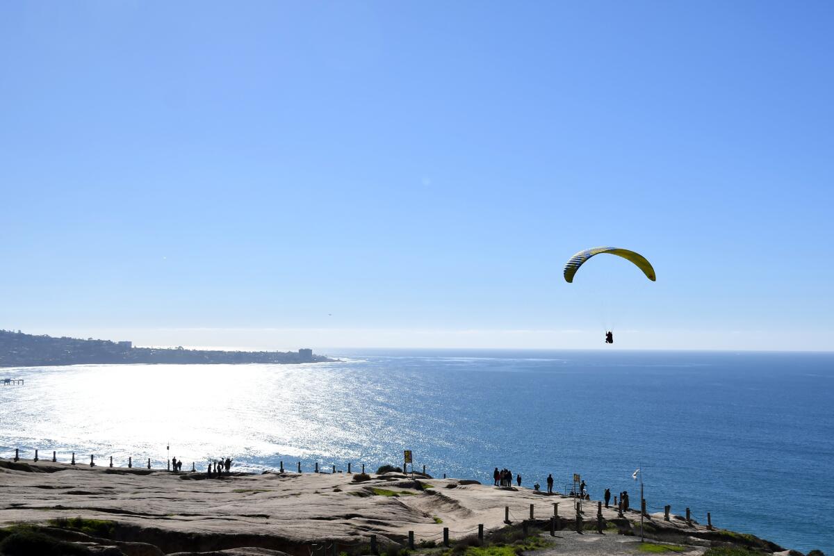
This is the place to see men and women jump off a cliff, then rise on the updraft. The Torrey Pines Gliderport sits between the UC San Diego campus and the sea, sending skyward a steady stream of paraglider pilots and the occasional model airplane. Grab breakfast or lunch at the Cliffhanger Cafe (ham or turkey sandwich: $9.49), settle in at a picnic table and watch the action in the air. (From April through November, the cafe routinely has live music on weekends.)
Sail planes were taking off here as early as the 1920s. In 1930, Charles Lindbergh glided on these winds. Hang-gliders joined in the 1970s, then paragliders, then tandem paraglider flights ($175-$255). See the shoreline about 200 feet below? That’s Black’s Beach, accessible by a steep, half-mile trail. (It has a nude zone.)
Bonus tip: For more free visual stimulation, cross North Torrey Pines Road to explore the outdoor artworks of UCSD’s Stuart Collection and the brutally top-heavy geometry of its Geisel Library.
Show more Show less
Route Details
Travel to 1939, by way of L.A.'s Union Station
Los Angeles County Train station
(Jason Armond / Los Angeles Times)
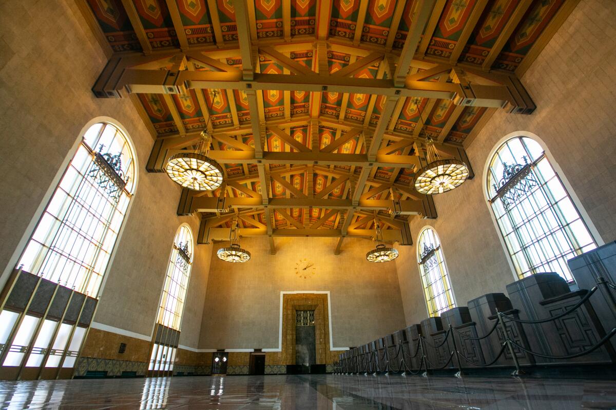
Union Station is a masterpiece, the last of the grand American train stations, a rare marriage of Mission Revival and Streamline Moderne styles that has been a landmark since its 1939 opening.
Once you have arrived (a Metro train probably would be the cheapest way), fell free to gawk at the high ceiling, the grand arches and the 286 built-in mahogany chairs (reserved for ticket-bearing travelers) in the waiting area.
You could get dinner or a drink at intimate Traxx or the cavernous Homebound Brewhaus (in the space where a Fred Harvey Restaurant stood in the old days). If you’re lucky, the L.A. County Metropolitan Transportation Authority has scheduled a performance or exhibition. (Remember the 2021 Oscars? Maybe they weren’t everyone’s favorite, but they were staged right here.)
Bonus tip: Across Alameda Street stands Olvera Street, the mostly Mexican marketplace that was created in the 1930s to add an air of romantic nostalgia to one of the city’s oldest streets. Results: mixed. The pedestrian walkway is lined with souvenir vendors, eateries and a handful of intriguing shops like Olverita’s Village. The street is part of the 44-acre El Pueblo de Los Ángeles Historical Monument, which includes LA Plaza de Cultura y Artes and the Chinese American Museum.
Show more Show less
Route Details
Stroll, skate, pedal, surf or swim at Venice Beach
Los Angeles County Beach
(Christopher Reynolds / Los Angeles Times)
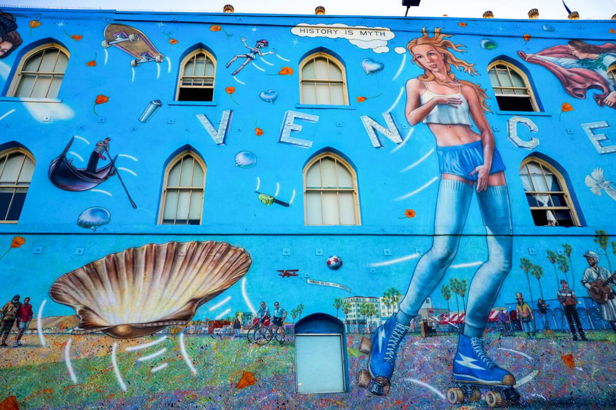
Venice and its Ocean Front Walk are youthful, bohemian, sometimes desperate and reliably squalid around the edges. Of course, it’s free to stretch out on the sand, jump into waves or try the walk. If you’re people-watching along the walk on a weekend morning, it wouldn’t hurt to bring a concealed fistful of dollar bills for tip-seeking street performers. And don’t miss Rip Cronk’s mural of Venus on roller skates (near Speedway and Windward Avenue) or the dangling VENICE letters at Pacific and Windward.
Take in the careening teens at the Venice Skate Park, the cyclists, the busy basketball courts, the fishing pier, the Muscle Beach bodybuilders and quirky Small World Books. Check out the Sunday evening Venice Electric Light Parade. Save time (or another day) for the canals just south of South Venice Boulevard and the upscale restaurants, galleries and shops along Abbot Kinney Boulevard. Depending on the block, and on the latest chapter in the city’s struggles to help house the homeless, you may find many tents or not.
Parking can be tough but there are three nearby county lots. Get there early.
Show more Show less
Route Details
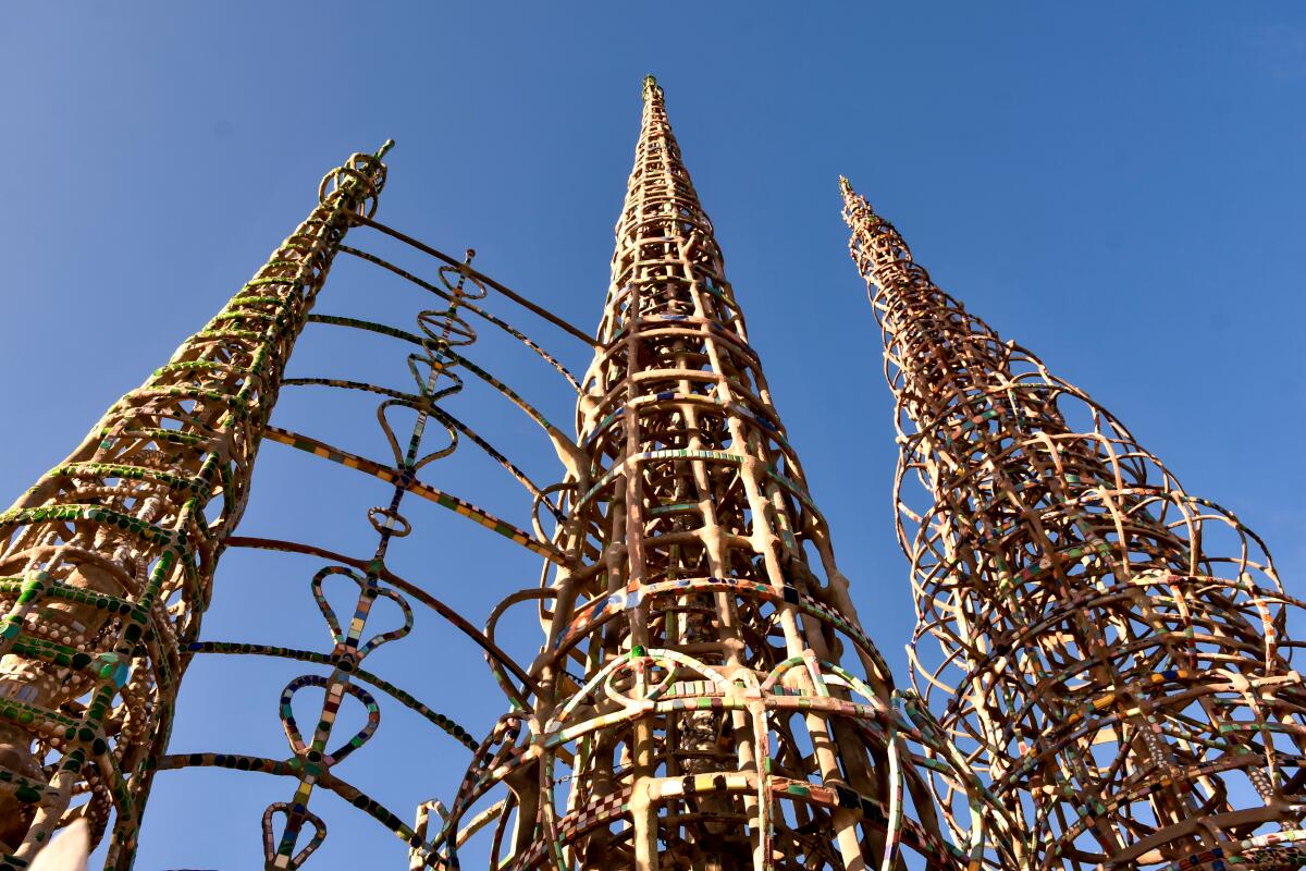
Look up, and look back, at Watts Towers
Los Angeles County Attraction
(Christopher Reynolds / Los Angeles Times)
This 99-foot-tall landmark, built by an Italian American laborer who never really explained himself, is an architectural wonder and one of the greatest acts of recycling California has ever seen.
Sabato (Simon) Rodia, an immigrant from Italy, started this backyard project in 1921 and spent 33 years putting up Watts Towers, using rebar, concrete, cast-off tiles, bottle caps and bits of colored glass. He walked away in 1954 and died in 1965. Yet his towers survive, surrounded by a mostly Latino and Black blue-collar community. The towers endure despite plenty of neglect and incompetence by public agencies over the decades.
Perhaps best of all, the towers have inspired many local children to pursue creative careers (including celebrated assemblage artist Betye Saar, jazz great Charles Mingus and rapper-philanthropist Nipsey Hussle). The site is now protected as a state historic park and neighbored by a community arts center. The area inside the triangular property’s walls is closed indefinitely for restoration work, but you can see plenty from outside the fence.
Bonus tip: To learn more about Black culture in South Los Angeles and beyond, head to the California African American Museum in Exposition Park (eight miles north of the towers) or Eso Won Books in Leimert Park (12 miles northwest).
Show more Show less
Route Details
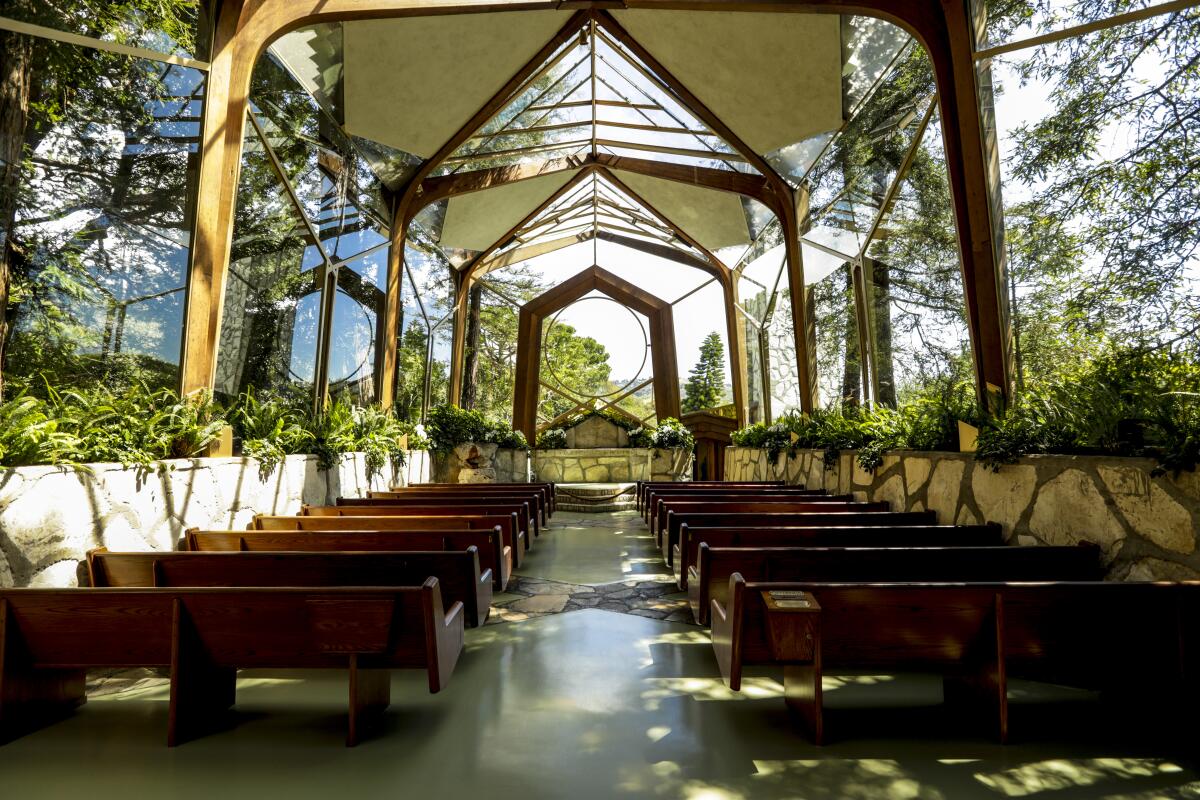
Assess the arbortecture at Wayfarers Chapel
Los Angeles County Chapel
(Katie Falkenberg / Los Angeles Times)
This building merges church and nature in a rare way.
Wayfarers Chapel was designed by Lloyd Wright for the Swedenborgian Church and opened in 1951; its glass walls and ceiling effectively make the surrounding redwoods a part of its architecture. The result is a “tree chapel” that uses locally quarried stone and blurs distinctions between inside and outside, spirituality and nature. Many architects call this style Modern Organic. Others have coined the term arbortecture. Whatever language you prefer, it’s nice to see the sky and greenery from inside the sanctuary. Location scouts seem to agree: The building has shown up on television offerings from “The Bachelorette” to “Lucifer” and “The O.C.”
Want to book a Saturday afternoon wedding in 2022? That’ll be $6,400 for up to 100 guests, if there’s a day still open.
Solo visits are easier. The chapel grounds are open daily from 9 a.m. to 5 p.m.; the visitor center, 10 a.m. to 5 p.m. Thursday to Sunday. Because the chapel books its weddings, baptisms and memorials at 10 a.m., noon, 2 p.m. and so on (especially on weekends), the best way to get inside the sanctuary is to show up at 9 a.m., 11 a.m., 1 p.m. or 3 p.m. — the odd hours — when visitors are allowed for up to 30 minutes. Drones are banned.
Show more Show less
Route Details
No matching entries.
Please reset filters to see all entries.
No matching entries.
Please reset filters to see all entries.
Top
