Coastal Walk
- Share via
Carmel River, on the eastern slopes of the Santa Lucia Mountains, is a river of many moods. Some of its forks, swollen by winter and spring rains, can be capricious, frothy waterways as they course through the Ventana Wilderness before emptying into the sea just south of Carmel.
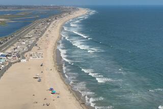
At the northern end of Carmel River State Beach is a brackish lagoon called Carmel River Lagoon and Wetlands Natural Reserve. This walk travels the length of Carmel River State Beach to a point just north of Point Lobos.
Directions to trail head: During the summer and autumn months, the sand berm at the Carmel River mouth provides a fine path between river and sea. Start this walk at the northern end of Carmel River State Beach. From California 1, just south of Carmel, turn west on Rio Road. When you reach Santa Lucia Street, turn left, then proceed five more blocks to Carmelo Street. Turn left and follow this road to the beach.
You can also start at the south end of Carmel River State Beach, easily accessible from California 1.
The hike: Follow the shoreline over the sandy berm. After rounding a minor point and passing some Monterey cypress, you’ll arrive at Monastery Beach.
Carmel River Beach Trail
WHERE: Carmel River State Beach
DISTANCE: 2 miles, round trip.
TERRAIN: Sandbar, river mouth, lagoon.
HIGHLIGHTS: Wild ocean side of quaint Carmel, bird sanctuary.
DEGREE OF DIFFICULTY: Easy.
FOR MORE INFORMATION: Carmel River State Beach, c/o Monterey District, California Department of Parks and Recreation, 2211 Garden Road, Monterey, Calif. 93940; tel. (408) 649-2836.
More to Read
Sign up for The Wild
We’ll help you find the best places to hike, bike and run, as well as the perfect silent spots for meditation and yoga.
You may occasionally receive promotional content from the Los Angeles Times.


