Loping Through Lassen’s Own Lake District
- Share via
Lassen Volcanic National Park is best known as a bizarre “lava-scape”--a mini-Yellowstone of roaring fumaroles, bubbling mud pots and hissing vents. These features, located in the southern part of the park, are for the most part easy to reach by auto and short trails. Park service interpretive efforts in the thermal areas are excellent.
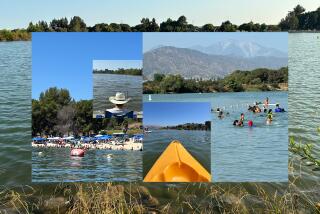
The park’s eastern sector is enchanting--and approachable--in an altogether different way. A chain of lakes extends from Butte Lake in the north to Juniper Lake in the south. Forests of pine and fir and wildflower-sprinkled meadows beckon the back-country adventurer.
With 150 miles of trails, Lassen is very much a hiker’s park. The national park, located where the Cascade Range approaches the High Sierra, has flora and wildlife common to both mountain ranges.
This hike tours Lassen’s “Lake District,” gentler country than the nearby lava lands. The lakes are popular destinations for backpackers and day-trippers.
Depending on your time and stamina, you can visit one, two or even half a dozen lakes in a day. Largest of the lot on this loop is Horseshoe Lake, where there’s a ranger station plus camping.
Other highlights of the area are the meadows, sprinkled in season with lupine, blue penstemon, Indian paintbrush and many more wildflowers.
Directions to trail head: From Interstate 5 in Redding, follow California 44 east to Lassen Volcanic National Park. From Interstate 5 in Red Bluff, follow California 36 to the park. California 89 extends north-south through the national park and provides access to most of its prominent features.
Summit Lake North (Ranger Station, campground) is located on California 89 about in the middle of the park, 13 miles from the visitor center and the junction with California 44. Park near Summit Lake’s north shore.
The hike: From Summit Lake’s north shore, cross the wooden footbridge over Hat Creek and begin a moderate ascent through a mixed forest of hemlock, lodgepole pine, red and white fir. Best views are behind you: Chaos Crags over your left shoulder, Lassen Peak over your right.
A mile out, pass a left-forking trail that leads to Little Bear and Big Bear lakes. A modest 0.8-mile descent takes you to Echo Lake. Skirting the north shore, the trail soon leaves the lake behind and travels through meadows and past green ponds to Upper Twin Lake, 3.2 miles from the trail head.
The path meanders past the lake’s campsites almost a mile to a signed junction. The left branch travels along the west shore of Lower Twin Lake. Bear right on the short connector trail leading to the Pacific Crest Trail, which you join, heading south.
You’ll soon pass Swan Lake just east of the trail; it’s your basic little back-country lake and offers limited camping. The path climbs a low divide and reaches a junction.
Those opting for a longer hike will leave the PCT here and head for Horseshoe Lake. On the way to the lake. you’ll spot 7,267-foot Crater Butte,
A three-quarter-mile descent brings you to another junction. Bear left and continue an easy mile to Horseshoe Lake.
After enjoying the lake’s many charms, double back a mile to the trail junction and fork left, following the creek-side trail a short half-mile back to the PCT. Head south again, descending Grassy Swale alongside Grassy Swale Creek. Clouds of mosquitoes have been known to swarm along this stretch of trail.
After a mile, PCT crosses the creek, passing through the southern part of the swale, wet meadows and a forest of red fir. The trail reaches a confluence of creeks--Grassy Swale and Summit. After the merger, the two creeks continue under a new name--Kings Creek, which flows southeast. Cross Kings Creek. At some inviting west bank campsites, you bid adieu to Corral Camp and the PCT, then join the signed trail heading to Summit Lake.
Ascend fairly steeply at first, then more moderately. After two creek crossings, you’ll reach a junction, three-quarters of a mile from Corral Camp. Bear right.
Two more miles of modest ascent take you from forest to meadow to the Summit Lake campground road. Head north to the lake, then follow either the east or west shore trails back to the north shore trail head.
(BEGIN TEXT OF INFOBOX / INFOGRAPHIC)
Lassen’s Lakes
WHERE: Lassen Volcanic National Park
DISTANCE: Summit Lake to Upper Twin Lake is 6.4 miles round trip; loop is 11.2 miles round trip with 800-foot elevation gain; loop via Horseshoe Lake is 14.5 miles round trip.
TERRAIN: Lake shore, meadow, forest.
HIGHLIGHTS: Inviting lakes, wildflower sprinkled meadows.
DEGREE OF DIFFICULTY: Moderate.
PRECAUTIONS: Aggressive mosquitoes.
FOR MORE INFORMATION: Superintendent, Lassen Volcanic National Park, P.0. Box 100, Mineral, CA 96063; tel. (916) 595-4444.
More to Read
Sign up for The Wild
We’ll help you find the best places to hike, bike and run, as well as the perfect silent spots for meditation and yoga.
You may occasionally receive promotional content from the Los Angeles Times.


