Sepulveda, Sherman, Tarzana: The most interesting stories behind the Valley’s street names
- Share via
It can be quite the heady sensation to drive through the San Fernando Valley, along those wide boulevards named for history’s great men — Isaac Newton, Moses, Vasco Nunez.
Oh, my mistake. Those are their first names. The full names are Isaac Newton Van Nuys, Moses Sherman, and Vasco Núñez de Balboa, and their surnames are the streets’ names: Van Nuys, Sherman, Balboa.
Balboa was the first European to lay peepers on the Pacific Ocean. Van Nuys and Sherman were owners of acres of Southern California land so vast they could be measured not just in acres but in square miles.
Los Angeles history website waterandpower.org declares with substantial truth that “if you want to know the history of the San Fernando Valley, read the street signs.”
The names on the blue and white city signs rarely memorialize the Native Americans whose lands these were, nor the Spanish missionaries and ranchers who divvied them up into demesnes more enormous than dukedoms.
Mostly, they are the names of the Yankee Californians who claimed these horizons of land, sold it and bought it and bartered it, cultivated citrus, wheat, barley, peaches, sugar beets, walnuts and that one-time-yield crop, suburbs.
For Subscribers
Who are the people behind the L.A. places you know and love?
If L.A. had boroughs like New York’s, the San Fernando Valley would be the largest, accounting for about half of L.A.’s heft. The Valley — and it is always the Valley — is itself about the size of the whole of the city of Chicago. It’s so big that its many named neighborhoods, like Encino and Pacoima and Canoga Park, are sometimes mistaken for incorporated towns themselves, even though they are just more territory in the all-embracing city limits of L.A.
A great number of its great streets are unlike many roadways elsewhere in L.A., where they are curved or oddly angled to conform to the dip-and-turn contours of hills, or the ghosts of arroyos.
Instead, they fan out like airport runways. An “obsessively perpendicular grid of streets,” is the way “Valley Guy” Kevin Roderick describes it in his wise book “The San Fernando Valley, America’s Suburb.”
“Long, straight boulevards, most of them too wide for your grandmother to walk across in the span of one green light, are spaced across the plain reliably a half-mile apart,” and “hundreds of feeder streets branch off at right angles from the main arteries to complete the grid.”
Mulholland Drive
At the summit is the spine, the crest, the southern rim of the Valley, Mulholland Drive. Its name is owed to William Mulholland, who changed the character of the Valley and of L.A. with the immense water project that stuck an engineered siphon into a lake 233 miles away and brought its water south to the city of thirsting angels.
On its bend-and-twist miles, principally between the Cahuenga and Sepulveda passes, are a coronet of houses as handsome and costly as jewels, atop slopes and canyons. To the south are Beverly Hills and Bel-Air and the Hollywood Hills; to the north, Studio City, Sherman Oaks, and the broadening Valley fan out across the Valley floor from Calabasas to Glendale and Burbank.
Generals and outlaws, heroes and villains: L.A.’s parks are named for a colorful cast of characters.
Burbank Boulevard
Speaking of. Burbank and Burbank Boulevard, as we never tire of reminding a world which never tires of ignoring it — I’m talking to you, History Channel — was named for a dentist, David Emory Burbank. His principal Valley pursuit was grazing sheep, not teeth; nonetheless, there are, fittingly, dental offices here and there along the length of Burbank Boulevard.
Doc Burbank came thisaway just after the Civil War, from San Francisco, and bought more than 9,000 acres of land for $9,000, flipping it almost 20 years later for a cool quarter-mil sale to a land development syndicate he owned part of. He plowed some of that money into his hobby, building the Burbank Theater on Main Street in L.A.
Canoga Avenue
A north-south route far to Burbank’s west is Canoga Avenue, its name just like the Canoga Park neighborhood. “Canoga,” according to a 1905 place-name explainer from the U.S. Geological Survey, is very likely a Native American name — but not a California one.
Its origin is probably the Cayuga people and the onetime Iroquois village of “Ganogeh” near the Finger Lakes of New York. I’d lay good money that some early migrant from that neck of the New York woods brought the name with him. The 1905 listing says “Ganogeh” means “the place of floating oil.”
Canoga Park’s original name was Owensmouth, where the plundered waters of the Owens Valley poured forth from the L.A. Aqueduct. In 1931, locals ditched that name, per the Canoga Park Gazette, as “calling forth unfavorable comment.”
It’s just about Lummis Day. But who, or what, is a Lummis? Well, both — Lummis was a person and is the name of a house. In L.A., you may not know the names behind many landmark buildings. So here are a few important ones.
Tujunga, Topanga and Cahuenga
Three names from California Native Americans remain on big Valley streets — Tujunga, Topanga and Cahuenga. Tujunga is a tidy avenue from Universal City to Sun Valley, its name altered from the Tongvan language “tuhuunga,” meaning “place of the old woman.” This was per UCLA’s emeritus linguistics prof and Native American languages whiz Pamela Munro. A Times story of three decades ago says the word was thought to mean “big thunder” in the Tataviam language of a tribe of Valley Native Americans.
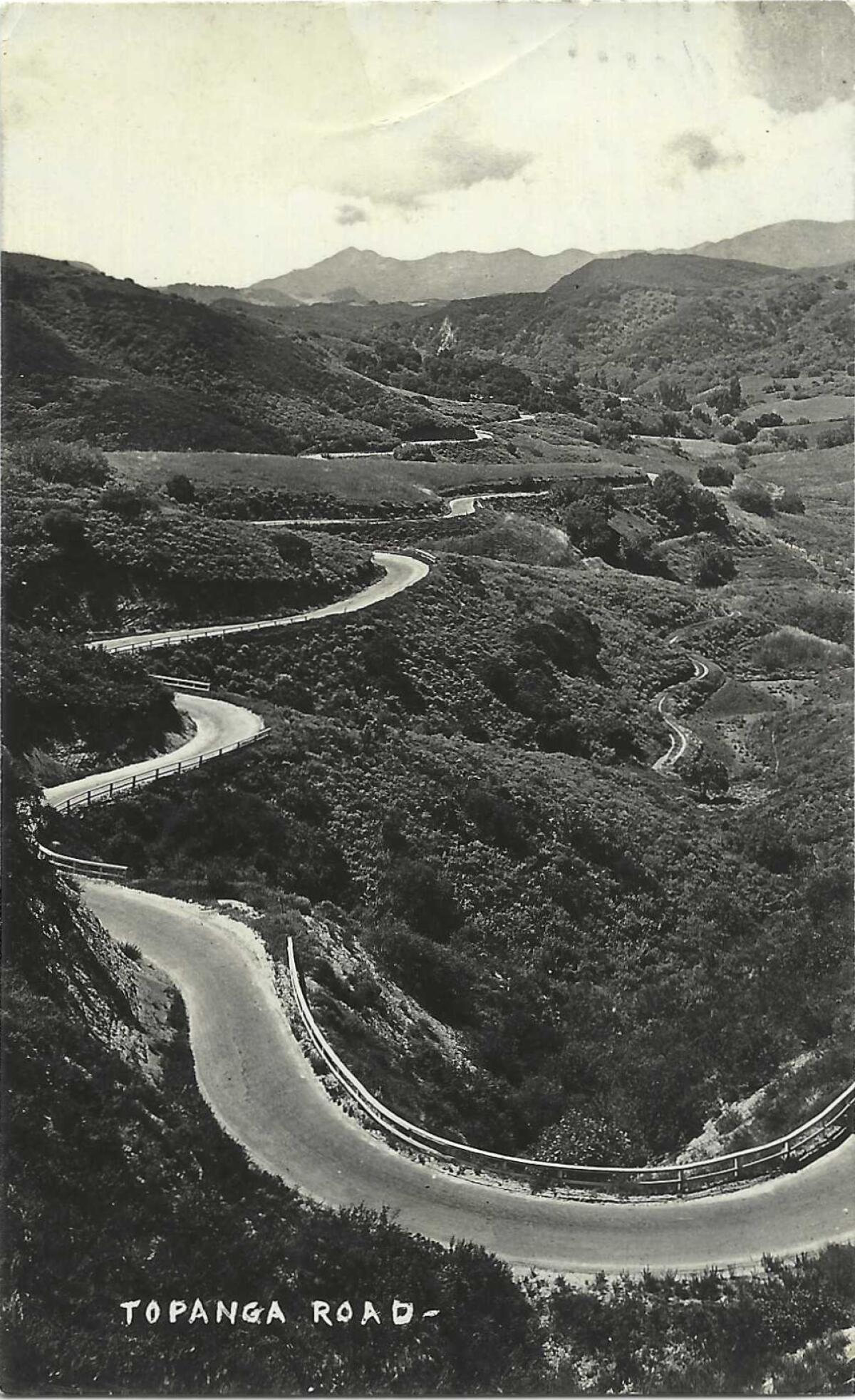
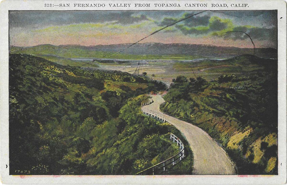
Munro had found no translation for Topanga, “Topaa’nga,” the name of the enchanting canyon and the road that runs through it, which is on the books as State Route 27, from the Pacific Ocean to the Ronald Reagan Freeway. I can’t think of anyone who would call it that, except maybe the bossy recorded voice on GPS. (The site babynames.com puts it out there that Topanga means “where the mountain meets the sea,” and then notes soberly that Topanga “is not in the top thousand names” bestowed in the last 20 years. So, new L.A. parents, if you want a real break from the glut of Olivias, Emmas and Charlottes, Topanga should do the trick.)
We’ve turned “Kawee’nga,” Munro’s “the place of the fox,” into “Cahuenga,” the centuries-old pathway and now modern boulevard through the hills between North Hollywood and Melrose Avenue. (Other versions translate Cahuenga as “place of the mountain.”)
Rancho Cahuenga is the site of the adobe ranchhouse where Andres Pico, the head of the Californio forces against the Americans in the Mexican-American war, surrendered to the explorer, engineer and military man John C. Fremont. Fremont had cleared a path into this moment of history by assuming the authority to sign the Treaty of Cahuenga, which flipped California from Mexican rule to American. He was later court-martialed over California’s wartime chain-of-command cock-up.
Diggers were excavating for the Red Line in 1997 when, six inches below the light and hubbub of the present day, they found the foundations for the original ranch house where the treaty was signed — right down to the floor tiles.
Lankershim and Van Nuys boulevards
The adobe is right across from Universal Studios, on Lankershim Boulevard, which brings us to another of those Yankee-named roadways.
As a two-fer Valley pair, Isaac Lankershim was the elder, and his son-in-law, Isaac Newton Van Nuys, the junior. They had the same first name, as well as an eagerness to own and cultivate a whole lot of land, and they turned tens of thousands of acres first to sheep ranching and then to growing wheat and barley that was sold around the world.
Each now has his name on a big Valley boulevard — although the son-in-law gets the bonus of a neighborhood with his name on it. The settlement once called Lankershim is now NoHo.
If you have reason to hate the 405 Freeway, put it down to Lankershim, who made a wagon road through the pass to get his wheat to export ships, and then, when the railroad came to the Valley, converted his wagon path into a toll road.
Lankershim was a Bavarian-born farmer who came south from Sacramento and joined up with other Jewish immigrants to buy scores of square miles across the southern stretch of the Valley from Pio Pico, the last governor of Mexican California. (He has his own Don Pio Drive in the Valley.)
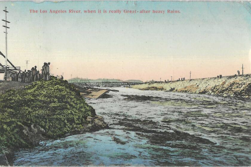
After one too many floods, L.A. turned its river into a concrete channel. Today and in the future, the river could be part of the answer to some of the city’s problems.
De Celis Place
The Valley’s enormous northern half belonged to the de Celis family. The lands of the San Fernando Mission had gone up for grabs when the missions were secularized. Pico kept it in friendly hands when he sold it to the de Celises right before the treaty of Cahuenga made California an American possession. De Celis Place parallels Hayvenhurst Avenue north of the Sepulveda Basin.
The de Celises were hard up when they sold their property in the 1870s to a man named Charles Maclay. A Methodist history describes how Maclay began his adult life intent on being a “humble missionary.” Once, as he was preaching in San Francisco, a “rowdy” interrupted him, and Maclay shot the man dead — but he then did “the right thing” and took up a collection for the man’s family.
Maclay also belonged to a San Francisco vigilante group, and became a state legislator as well as a self-dealing opportunist who bought up the de Celis land on behalf of his patron, the railroad bigshot Leland Stanford. Maclay put in a huge street he called Stanford Avenue, but the name it bears now is San Fernando Mission Boulevard. Maclay has his own street — not a boulevard or avenue, though — and it’s not far from the county’s San Fernando courthouse.
Eulogio de Celis the younger died broke in 1903. A year before he died, the San Francisco Chronicle found him a blind old man whose wife was crippled by rheumatism and whose 3-year-old son had never walked. The family that had once owned land on a baronial scale now needed charity to eat.
Otis Avenue and Chandler Boulevard
Our second father/son-in-law street-name duo was the redoubtable Otis/Chandler pairing. Harrison Gray Otis, The Times’ owner-publisher, was a master operator who had licked his chops when he laid eyes on Southern California, “the fattest place I ever was in.” He too owned tracts in the Valley, and helped to engineer the aqueduct taking of the Owens Valley water to make those tracts even more valuable. His name remains on Otis Avenue.
His son-in-law was the savvy Harry Chandler, of Chandler Boulevard, who succeeded his father-in-law and if anything thought even bigger, joining a syndicate that bought up almost 75 square miles of Valley land, and naming the group for exactly what the Valley became: the Los Angeles Suburban Homes Company.
Bing Crosby sang about it. “Chinatown” immortalized its centrality to L.A.’s water story. And in any other metropolis, the San Fernando Valley would probably stand on its own. Patt Morrison explains the Valley.
Sherman Way
Another name-that-street partner in the company was Moses H. Sherman. He was one of those digit-in-every-dealing businessmen: law, mining, water, railways, and real estate.
Sherman Way is named for him, and not for the Civil War General William Tecumseh Sherman. That Sherman served in uniform in California beginning in 1847, and he visited again often. On an 1886 trip here, he reminded Angelenos of what he had said in 1847: that “no man was considered really wealthy unless he owned at least 44,000 acres of land.”
The Moses Sherman Way zips way yonder across the Valley. As Roderick’s book points out, it’s always been a major here-to-there thoroughfare: a country road that soon had a streetcar line on one side and a paved road on the other, straight and flat enough for staging a renowned auto race in 1912. Sherman also double-dipped: Hazeltine, his middle name and the name of his daughter, is also up there on a street sign.
Brand Boulevard
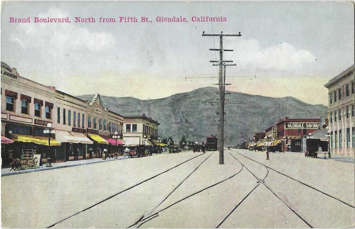
Glendale’s Brand Boulevard could be no other than Leslie C. Brand, the 5-foot-tall landowner, promoter and philanthropist who quite truly did put Glendale on the map. Officially, he had no children, but a dozen or so years ago, The Times pursued rumors of extramarital offspring, using DNA tests whose “clear and unambiguous” results that showed that Brand’s legitimate nephews and his non-legitimate grandson “are close cousins who share the same Scottish ancestor.” That ancestor would be Brand.
Sepulveda Boulevard
And the longest street in L.A. County, Sepulveda Boulevard, 40 miles from Mission Hills to Long Beach, named for Francisco Xavier Sepulveda, the propertied pioneer rancher and paterfamilias to the influential founding family.
The L.A. area has long been home to ostentatious houses. Pasadena had Millionaire’s Row over 100 years ago. These days Bel-Air has “The One” and the “Starship Enterprise.”
If you have had enough of the solid-citizen streets, here are a few fanciful ones.
Edward Everett Horton Lane
The very abbreviated Edward Everett Horton Lane abutting the Ventura Freeway in Encino was named for the comic character actor who bought his Valley acres in 1925. He named his estate “Belleigh Acres” — say it aloud — and he bore the grand title of honorary governor of the state of the San Fernando Valley.
He cultivated succulents and let friends stay in his guest houses; like half of Hollywood’s writing stable, F. Scott Fitzgerald did rewrites of the “Gone With the Wind” script and worked on “The Last Tycoon” there. Fan magazines wrote of Horton’s mother and other relatives living at Belleigh Acres but didn’t mention Gavin Gordon, Horton’s longtime companion, the delicate code for a gay partner, and an actor who once played opposite Greta Garbo.
A 1940 Time magazine profile reported that Horton’s film contracts stipulated that he wouldn’t have to play a married man, kiss a woman, or have any children, which maybe was just about as “out” as you could be in Hollywood then.
Devonshire Street
Explaining L.A. With Patt Morrison
Los Angeles is a complex place. In this weekly feature, Patt Morrison is explaining how it works, its history and its culture.
Two Valley streets — Devonshire and Chatsworth — are the names of an English peer and his historic estate. A duke is at the top of the aristocratic tree; the monarch addresses him as “our right trusty and right entirely beloved cousin.” There are stories that the names were conceived when the duke himself visited the Valley and said it reminded him of Chatsworth — unlikely — and that a worker on the duke’s estate visited and had the same impression — more probable — or maybe it was just California aspirational branding, naming things for what you wish them to be.
Tarzana Street
Yes, Tarzana Street in Encino is named for the wild-child apeman created by Edgar Rice Burroughs, who bought Mil Flores, the 540-acre Encino ranch of Harrison Gray Otis with the fortune Tarzan made.
Marbro Drive
Marbro Drive in Encino is named after the Marx Brothers for reasons that pass understanding, unless it’s because up in Northridge, Zeppo Marx and his wife, and actress Barbara Stanwyck, bought a horse-breeding ranch they called “Marwyck.”
Where’s Portola?
I am surprised that not a yard of asphalt in the Valley is named for Gaspar de Portola, the Valley’s first European visitor. He and his soldiers had clambered to the top of Sepulveda Pass in August 1769, and then down into the Valley itself, camping somewhere near present-day Encino. L.A.’s Portola Avenue is in El Sereno, not too far from where Portola noted the juncture of the L.A. River and the Arroyo Seco.
Perhaps the Spanish explorers’ fondness for sonorously rolling names kept them off the map. “Portola” is short enough, but his expedition christened the San Fernando Valley El Valle de Santa Catalina de Bononia de Los Encinos. Try getting that onto a street sign.
L.A. is a place like no other. You’ve got questions. Patt Morrison probably has answers and can definitely find out.
More to Read
Sign up for Essential California
The most important California stories and recommendations in your inbox every morning.
You may occasionally receive promotional content from the Los Angeles Times.

