SoCal sees record rainfall as storm brings flooding, evacuations and power outages in NorCal
- Share via
[UPDATE: California deals with surging rivers, sliding rocks, flooded towns as storm passes]
California’s 11th atmospheric river storm of the season barreled through a beleaguered state this week, dropping more rain and snow, sending thousands scrambling for higher ground and leaving more than 300,000 without power.
The rain was expected to continue into Wednesday across Southern California, which saw rainfall records Tuesday. Los Angeles International Airport, downtown L.A., and the Santa Monica and Long Beach airports all recorded new daily rainfall totals. Santa Barbara Airport’s record was the biggest, with 2.54 inches of rain.
Officials say showers will decrease during the day and give way to cloudy skies by Thursday.
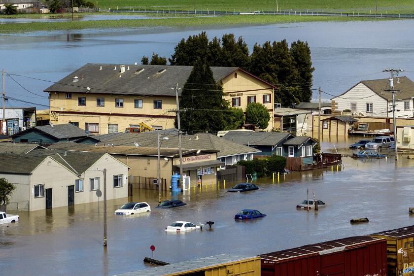
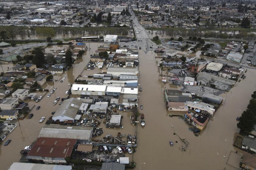
More than a dozen locations along major rivers were overflowing as the high-impact storm moved south through the state, including areas along the Salinas, Sacramento and Merced rivers. The Pajaro River, which suffered a levee breach from a similar storm last week, continued to spill water onto neighboring farmlands and communities.
At least 90 flood watches, warnings and advisories were in effect statewide, as were avalanche warnings in portions of Mono and Inyo counties and the Lake Tahoe area, according to the National Weather Service, which said the storm would “create considerable to locally catastrophic flooding impacts below 5,000 feet elevation.”
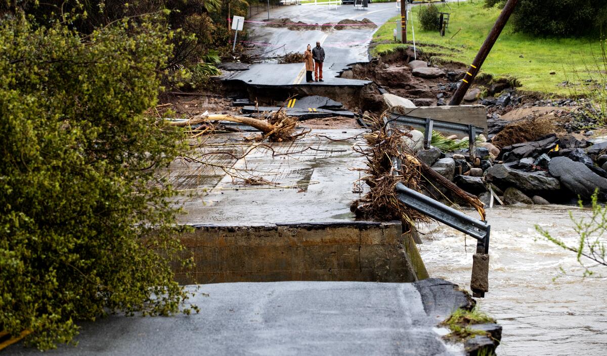
California continues to deal with damage from March storms: surging rivers, mudslides, breached levees and displacement in flooded towns.
About 336,000 households across the state were without power as of Tuesday afternoon, according to data compiled by the California Governor’s Office of Emergency Services. The majority of those households were in Santa Clara County, which had about 128,000 customers without power.
In the San Francisco Bay Area, the storm was causing minor urban flooding, road closures, downed trees and gusty winds of up to 50 mph, said Eleanor Dhuyvetter, a weather service meteorologist. Because of strong winds, about 40% of flights out of San Francisco International Airport experienced delays, and 72 had been canceled as of Tuesday afternoon.
In downtown San Francisco, a shelter-in-place order was instituted for the area around a 52-story skyscraper at 555 California St. One window was blown out amid winds of up to 50 mph and another was damaged on the 43rd floor of what was previously called the Bank of America building.
Fire officials said the gusts might have contributed to the dangerous situation.

The migrant town of Pajaro, Calif., was flooded last week during powerful storms that caused a levee to break. Now, another storm is moving in.
In Baldwin Hills, several mudslides were reported early Wednesday, including one that trapped two cars.
In Monterey County, where a farm town was already inundated by the Pajaro River, more than 10,000 residents were under evacuation warnings and orders because of the surging Salinas River. County officials feared that more flooding could lead to significant crop loss in the heavily agricultural region.
Up to 6 inches of rain was expected to fall before midnight in the Santa Lucia Mountains, which includes part of the Salinas River watershed, Dhuyvetter said.
The Pajaro River levee failure points to hazards that California has yet to address in many areas where communities are vulnerable, experts say.
On Tuesday afternoon, officials were considering how to address near-overflowing levees protecting Watsonville, where evacuation orders were expanded to include the area of Corralitos Creek. All schools in the area were closed.
“The real question today is about manually breaching a section [of the Pajaro River] to relieve pressure,” said Zach Friend, a Santa Cruz County supervisor whose district includes Watsonville.
The breach would occur at the Highway 1 bridge, which is downstream from the city and surrounded by farmland.
Only about half of the 350-foot section that was breached upstream of Pajaro late Friday had been stabilized as officials attempted to prevent it from widening.
Despite the threat, some residents in the migrant town of about 3,000 people chose not to evacuate.
“I know some people criticize us for not leaving, but the flooding danger isn’t here, it’s somewhere else,” said Dora Alvarez, 54, pointing south toward Salinas Road, which was submerged.
But officials said flooding wasn’t the only risk in the area. Major utility lines run through the levee under Highway 1, and a wastewater treatment facility is downstream.
“If the water continues to erode through the levee such that it reenters the river system … it could overwhelm the river system downstream of Highway 1,” where the wastewater treatment plant for Watsonville sits, said Mark Strudley, executive director of the Pajaro Regional Flood Management Agency.
If the water overtops or seeps through the levee, Strudley said, “we stand to destroy parts of the plant and may end up releasing untreated sewage to the floodplain, to the river and then ultimately to the Monterey Bay.”
Meanwhile, in the Sacramento area, officials warned of high winds and heavy precipitation, with the heaviest rain likely in Shasta County and over the foothills and northern Sierra Nevada.
The Tres Pinos area in San Benito County was rattled by a 3.4-magnitude earthquake as the storm pounded the region, according to the U.S. Geological Survey.
An incoming storm threatens to overflow the swollen Salinas River, imperiling the lives of farmworkers and crops and triggering evacuations.
Farther inland, flood advisories were in effect from Bakersfield to Yosemite National Park, with a high risk of flash flooding east of the Fresno area, said Jim Brusda, a weather service meteorologist in Hanford. Up to 1.5 inches of rain was possible across much of the Central Valley.
“The soil just can’t absorb all the new rain that we’re going to get, and that’s the problem,” Brusda said. “The rainfall might be a little bit less than last week, but the impacts are going to be the same, if not more, because the rivers and creeks are already so high, and the ground is already saturated.”
Rain is beginning to hit Southern California as another atmospheric river storm moves through the state. Here is what to expect.
Rivers of concern in the area include the Merced at Stevinson, Bear Creek at McKee Road, and the east-side bypass of the El Nido, all of which are “right at flood stage,” he said.
The San Joaquin River in Friant, just below Millerton Lake, was also high Tuesday, with some visible flooding in low-lying areas. Residents said water levels at the lake and in the river were much higher than usual.
One farmer who declined to give his name said his fields in Auberry were flooded.
“They won’t let us use the water, and now we’ve got too much,” he said, referencing contentious water use issues for Central Valley farms.
Precipitation totals will increase significantly east of Highway 99 — including up to 4 inches of rain in the southern Sierra and more than 2 feet of snow in mountain areas around 7,000 feet, Brusda said. Areas at 8,000 feet or higher could see more than 6 feet of snow.
The atmospheric river storm, which is drawing moisture from Hawaii in a phenomenon sometimes referred to as a “pineapple express,” was rapidly moving south, raising concerns of flooding in burn scars and more snow on Southern California’s already covered mountains.
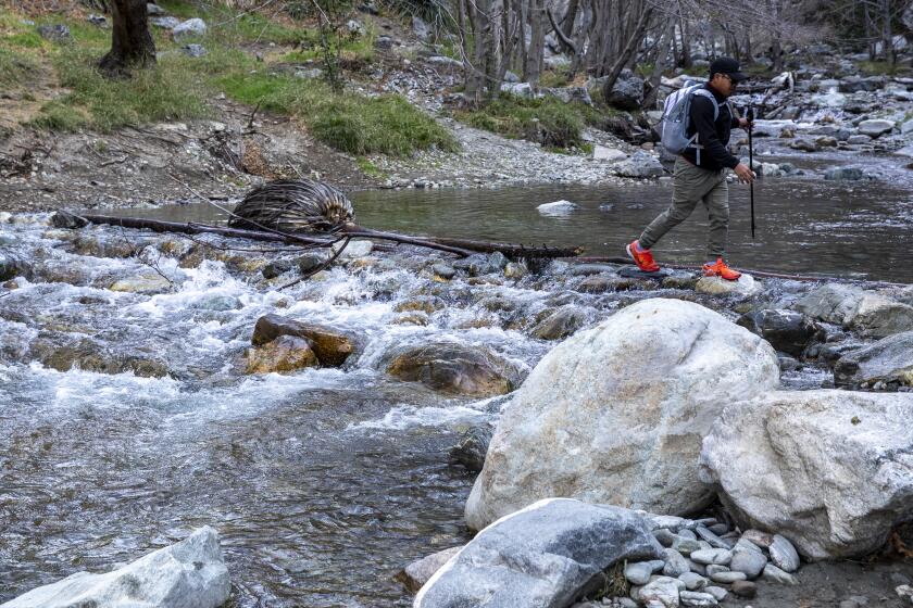
Three of the people swept in the fast-moving waters of the San Gabriel River were hoisted by helicopter. Eight dogs were also rescued.
Flood watches are in effect in San Luis Obispo, Santa Barbara, Ventura and Los Angeles counties through Wednesday morning. Up to 4 inches of rain could fall in Santa Barbara and western Ventura County, said Ryan Kittell, a weather service meteorologist in Oxnard.
Santa Barbara County officials have issued a mandatory evacuation order for residents in areas around the burn scars of the Thomas, Alisal and Cave fires, advising residents to leave immediately. Burn scars are known to be waxy, water-repellent and highly vulnerable to debris flows and other hazards.
The worst of the storm occurred in Santa Barbara and Ventura counties Tuesday afternoon and into the evening. Los Angeles was expected to bear the brunt of the weather later Tuesday night. The National Weather Service in Los Angeles said rain would probably increase in intensity later in the day, with roadway flooding and rock slides and mudslides possible.
There were moderate threats for river flooding in the region, including along the Ventura, Sisquoc and Santa Ynez rivers, Kittell said. The San Gabriel and Los Angeles rivers “will definitely have a lot of flow, and that usually will result in swift-water rescues, especially in homeless encampments.”
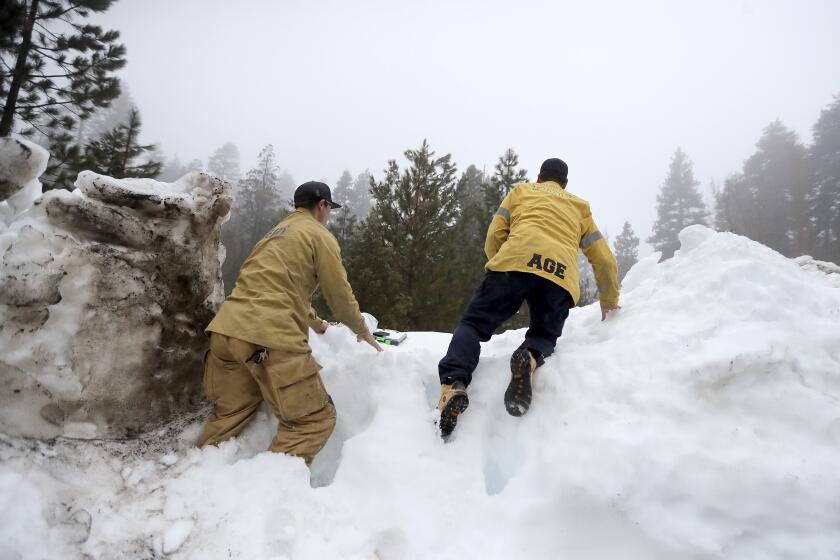
Many residents in San Bernardino County’s mountains are still far from back to normal, more than two weeks after the historic snowstorms brought unprecedented snowfall.
Residents in the San Bernardino Mountains also braced for more rain and snow — even as some people remain trapped from previous snowstorms. At least a dozen people were found dead after those storms blocked roads and left residents stranded and unable to dig out from their homes.
“Significant” rainfall totals are expected above 3,000 feet, said Philip Gonsalves of the weather service in San Diego, which covers the San Bernardino area. “We’re looking at anywhere from 2.5 to locally 5 inches,” he said. Snow is expected around 8,000 feet or higher.
“The bad news is that this event is going to dump a lot of rain on the remaining snowpack, and the snowmelt is going to contribute to the threat of flooding, or debris flows and rock slides and whatnot over the next 18 hours,” Gonsalves said.
Flood watches were in effect across the San Bernardino, Riverside and Santa Ana mountains, as well as portions of the Inland Empire “in close proximity to the foothills” and inland Orange County until Wednesday afternoon, he said.
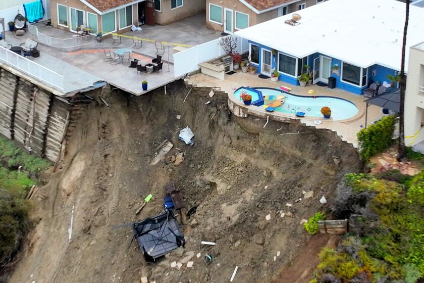
Orange County Supervisor Katrina Foley declared a local state of emergency to support storm responses in the area, prompted in part by a hillside collapse in Newport Beach that threatened some homes and sent a chunk of bluff tumbling down.
“My hope is that there is no further sliding on the shore, but if these three homes fall, a cascading effect may happen to the 50 other homes on the bluff and we must be prepared in case that happens,” Foley said in a statement.
A state of emergency from Gov. Gavin Newsom remains in place in 40 counties statewide.
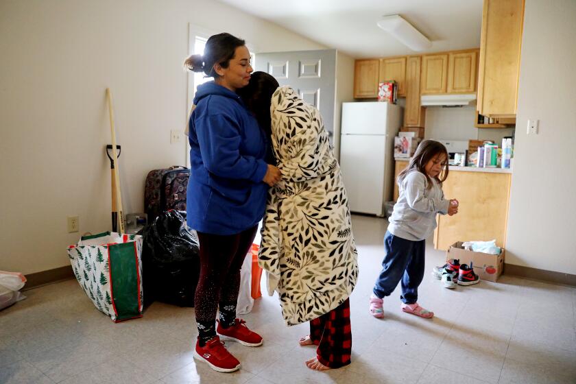
After the town flooded and about half its homes were damaged, residents of this farming community struggle to find temporary housing and rebuild.
The storm arrives amid near-record snowpack and one of California’s wettest winters in recent memory. Nine back-to-back atmospheric river storms hit the state in late December and early January, and a 10th deluged the state last week.
Though conditions are expected to clear after the storm, the relief will be short-lived as yet another atmospheric river has set its sights on California next week, forecasters said — just in time for the first day of spring.
There’s been little reprieve for residents in communities that are only now beginning to recover from inclement weather earlier this winter. El Gallito bakery in the community of Planada in Merced County has stayed open through a handful of storms.
The bakery was flooded along with the town in late January. Now the store’s doors are protected by sandbags and tarps, and the family who runs it plans to take measures to flood-proof their home as well. A pantry at the front of the store is notably top-heavy, with the bottom shelves mostly empty. Every day at closing time, they “grab everything from the bottom shelves and put it on the counters,” wary of losing inventory again.
Keeping the business going is essential, said Leonardo Villagomez, the son of owners Luis and Estella.
The family needs the income.
“We don’t have a choice,” he said.
Vives reported from Pajaro, Castleman from Fresno, Rust from Menlo Park and Smith from Los Angeles. Times staff writer Benjamin Oreskes in Los Angeles contributed to this report.
More to Read
Sign up for Essential California
The most important California stories and recommendations in your inbox every morning.
You may occasionally receive promotional content from the Los Angeles Times.
