California faces rapid snowmelt from heat wave; flood fears in Yosemite, elsewhere
- Share via
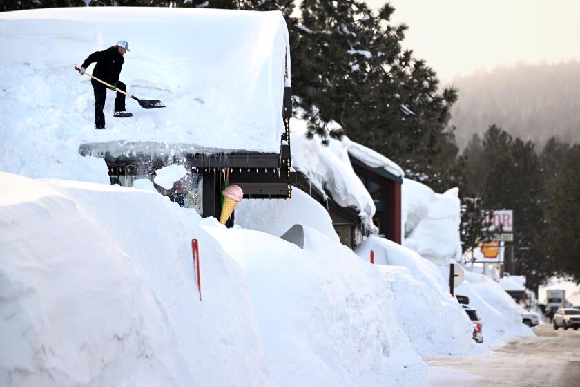
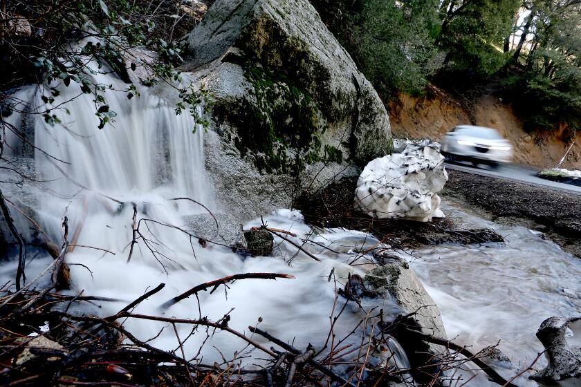
After weeks of uncertainty, forecasters say an incoming California heat wave will trigger rapid snowmelt on the slopes of the Sierra Nevada and cause more flooding in portions of the San Joaquin and Owens valleys this week.
Temperatures in Central California are forecast to climb into the high 80s and mid-90s beginning Wednesday and into the weekend, with the potential for some areas to approach daily records.
Nighttime temperatures are also expected to be warmer than usual — around 40 degrees — meaning Sierra snowmelt could start to happen 24 hours a day, UCLA climate scientist Daniel Swain said.
“The ‘big melt’ is now here,” Swain said. “We said there would eventually be some week between about March and May when the rate of snowmelt dramatically increased, either due to a heat wave or late-season warm storm. I think this is probably that week now.”
The snowpack is so deep that it currently contains roughly 30 million acre-feet of water — more water than Lake Mead, the nation’s largest reservoir.
The warmth will descend upon some of the state’s deepest snowpack ever recorded, with the southern Sierra still measuring 256% of normal for the date. The average snow water equivalent — or the amount of water contained in the snow — is about 56 inches, according to state data.
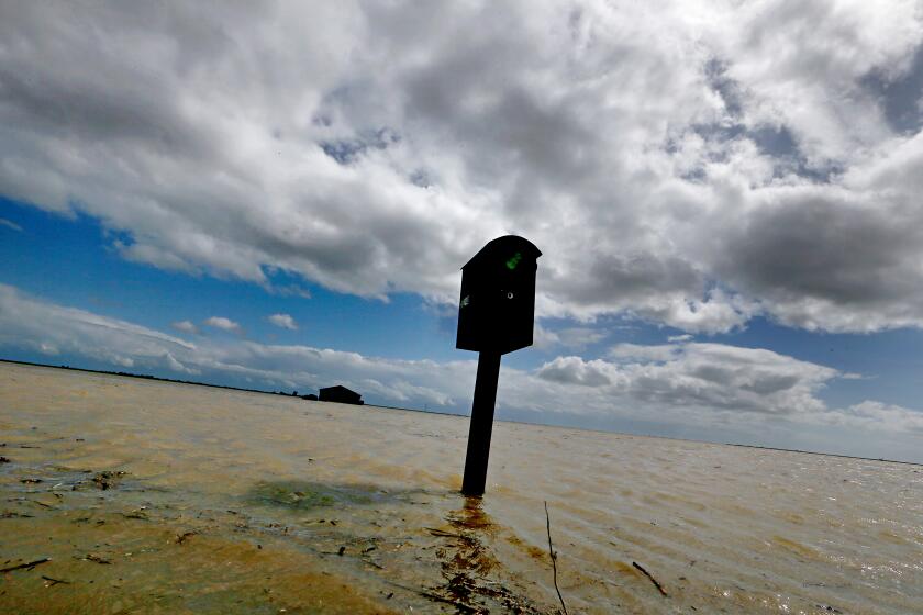
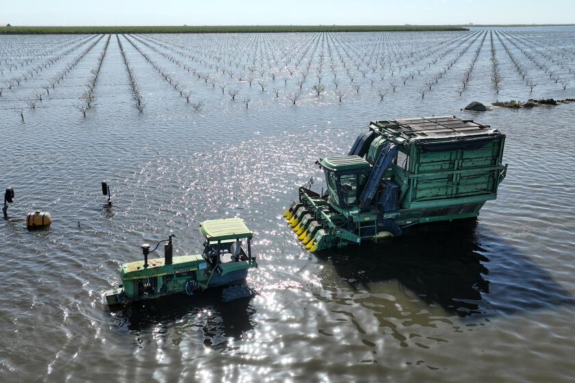
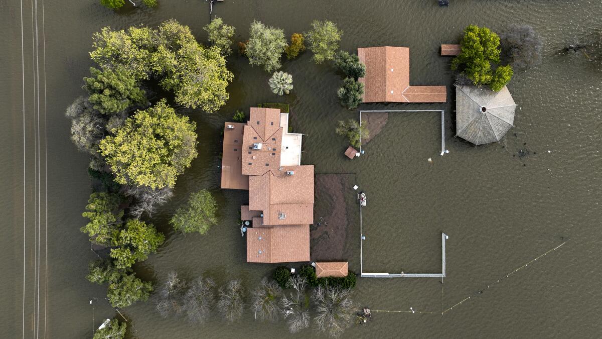
Many of the areas most likely to be threatened by the runoff are those that have already experienced inundations this year, including the Tulare Lake Basin, where the once-dry lake reemerged in recent weeks and left some ranches and farmlands underwater.
“A lot of rivers that are currently fairly high, but well within their banks, might exceed flood stage by later this week,” Swain said.
That includes the Merced River at Pohono Bridge in Yosemite National Park, which is expected to exceed its flood stage, 10 feet, by Thursday evening, according to the National Weather Service.
“It does look like there’s a pretty good chance of there being a flood through Yosemite National Park by Thursday through possibly even Monday of next week,” said Andy Bollenbacher, a meteorologist with the weather service in Hanford.
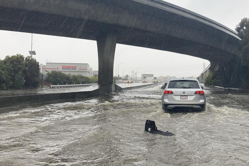
California’s snowmelt is leading to flooding and erosions. The Central Valley and Yosemite are dangerously affected, but the water can benefit drought-battered farmers.
The river site is currently measuring around 7.5 feet. At 10 feet, the east end of Yosemite Valley will begin to flood, and at 12.5 feet, major roads in the valley will be flooded and closed to traffic. The weather service has issued a flood watch in the park from early Thursday until Tuesday morning.
Several other river locations were at the monitor stage on Monday, indicating a potential for minor flood conditions in the coming days. Among them were the Merced River at Stevinson, the San Joaquin River at Newman, Patterson and Vernalis, and the Tuolumne River at Modesto.
Bollenbacher said the heat wave will be driven by a ridge of high pressure that is expected to build rapidly over the San Joaquin Valley. While the valley floor will be warmest, elevations as high as 7,000 and 8,000 feet could see temperatures in the mid-60s during the day and upper 30s at night, above freezing.
“That’s going to allow for some of that snowmelt and runoff to continue through the night,” he said.
The weather service has also issued a flood watch in portions of California and western Nevada along the eastern Sierra, including the Lake Tahoe area. The East Fork Carson River at Gardnerville is expected to surpass its flood stage, 14 feet, around Saturday morning, and the agency is warning that streams, creeks and rivers will run high, fast and cold.
The Los Angeles Department of Water and Power is particularly concerned about flooding along the eastern Sierra, as it threatens to erode portions of the Los Angeles Aqueduct — the city’s water lifeline to the Owens Valley.
The ‘phantom’ Tulare Lake returns
State officials on Monday said thousands of emergency personnel have been deployed across California in response to this year’s flooding, and resources will continue to be made available to respond to local conditions. Such efforts may include pre-positioning firefighters and emergency response crews, readying shelter beds for evacuation centers or laying rocks and sandbags, said Brian Ferguson, deputy director of crisis communication for the Governor’s Office of Emergency Services.
“Our goal right now, while the sun is outside, before the water comes down the mountain, is to take early proactive steps to really mitigate against the runoff from this historic snowpack,” Ferguson said.
The state is working closely with local officials in Kings, Kern, Tulare and Fresno counties, which are “certainly the area of concern for this particular disaster,” Ferguson said, although he noted that other parts of the state are still dealing with flood risks, debris flows and other secondary impacts from this year’s storms.
The state’s dam operators have also been making strategic releases from reservoirs to make room for incoming flows and are expected to face more challenges as the snowmelt begins in earnest.
State climatologist Mike Anderson said many reservoir outflows could double over the course of the coming week.
The Pine Flat Dam along the King’s River — the largest of the dams in the Tulare Lake Basin — has been making flood releases for the last month and is at 46% capacity, he said. Its current outflow of 12,500 cubic feet per second is expected to double with the heat.
The only thing preventing floodwaters from inundating the city of Corcoran is an aging, 14-mile-long wall of dirt. Can it hold?
Though Anderson said reservoir management should help “mitigate the consequences downstream,” local officials said levees will continue to be stressed, and upstream releases could put pressure on lower systems.
“We are urging residents to stay clear of the rivers because we are still releasing a lot of water from our local reservoirs in preparation for the snowmelt,” said Carrie Monteiro, spokeswoman for the Tulare County Emergency Operations Center. “We’re trying to get that water through the channels, so that if we do have a fast, rapid snowmelt, we have capacity in the reservoirs prepared and ready to capture that.”
The county has ordered residents to stay off the Tule, St. John’s and Kings rivers, she said. Officials are also asking residents to leave sandbags in place and stay vigilant for the foreseeable future.
“We want people to remain alert. We have high flows on our waterways, and these are not normal flows that we have seen in any other years,” Monteiro said. She encouraged residents to register for the county’s emergency alert system, AlertTC, to be notified in case of an immediate threat.
Be in the loop when disasters — like extreme heat or a hurricane this week, or earthquakes, tsunamis and wildfires at other times — are headed California’s way.
State officials said they are also working to minimize downstream impacts by diverting more flows into recharge basins, or allowing more water to seep into the ground to help replenish groundwater supplies.
“It’s not going to eliminate all the flood risks downstream, but it will minimize and actually hopefully alleviate some of the stress along the water bodies,” said Paul Gosselin, deputy director of sustainable groundwater management at the California Department of Water Resources.
Officials have diverted about 55,000 acre-feet of water since March, he said. (An acre-foot is about 326,000 gallons). The department has also initiated an emergency effort to provide additional pumps to local agencies that have already reached their capacity for such diversions.
The effort is “hopefully going to provide some additional recharge, but again, the primary emphasis is to reduce the risk to downstream communities,” Gosselin said.
An emergency declaration from Gov. Gavin Newsom and a presidential disaster declaration signed by the White House in early April remain in effect and will continue to enable additional assistance for disaster preparation, response and recovery, officials said.
Ferguson, of the Office of Emergency Services, said some parts of the state are in all three phases of that process simultaneously, which is “very unique in the history of our state.”
“This has been a very active and challenging emergency response that we’ve been underway with since January,” he said. “It really will continue to be ongoing, because of the snowpack, well into our summer months.”
When an evacuation order reaches you, you need to leave. Now. Here’s how to prepare and what to have ready to go if you may need to evacuate during the rainstorms hitting California.
More to Read
Sign up for Essential California
The most important California stories and recommendations in your inbox every morning.
You may occasionally receive promotional content from the Los Angeles Times.
