Forecasters say triple threat heading for SoCal: Thunderstorms, dry lightning, rip currents

- Share via
There is a trio of risky weather conditions in the forecast for the Los Angeles area starting Tuesday — thunderstorms, dry lightning and rip currents.
A low pressure system will skim the Southern California coast Tuesday through Wednesday, bringing an up-to-30% chance of thunderstorms across the region, with the San Gabriel Mountains, the Antelope Valley and the interior mountains of Ventura and Santa Barbara counties at greatest risk of being hit, according to the National Weather Service. The most likely window for storms is 2 through 10 p.m. Tuesday.
“With dry air near the surface, any thunderstorm that forms will likely produce downburst winds up to around 50 mph and the potential for dry lightning, especially for the foothills and lower mountains,” stated the Weather Service. “Higher elevations have less of a risk for dry lightning and a higher risk for brief heavy downpours, with rain rates up to around 0.75 inches per hour.”
Dry lightning occurs when there is enough moisture in the atmosphere to cause a thunderstorm, but the air near the ground is so dry that any possible precipitation evaporates, explained Weather Service meteorologist Rose Schoenfeld. This dangerous weather event is the leading natural cause of wildfires.
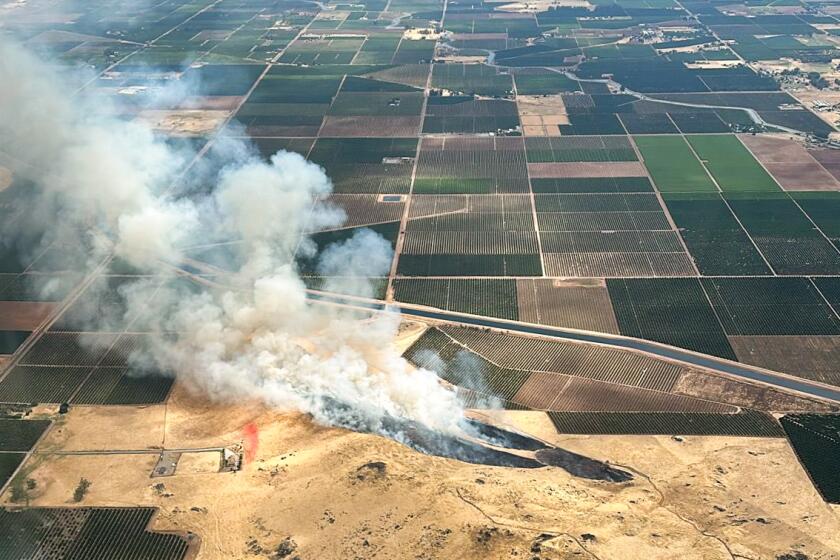
Remnants of Tropical Storm Alberto produced hundreds of dry lightning strikes across California’s Central Valley on Monday, sparking several wildfires in the area.
“A lot of times, if you have lightning, it’s raining as well and there obviously wouldn’t be a fire start because the ground is wet,” said Schoenfeld. “What we’re messaging here is that there is potential for the storm clouds to really not rain at all, which would mean that we could get lightning that hits the dry ground and can start a fire.”
Higher elevation areas are at lower risk of experiencing dry lightning because the rain has a shorter distance to travel to the ground and, therefore, less time to evaporate, she said.
Although this decreases the odds of a fire starting in mountain regions, rainstorms do come with the chance of flash flooding and, in areas previously burned by wildfires, a chance of mudslides. In particular, the Weather Service has identified the Bridge fire burn scar in the Angeles National Forest and the Eaton fire burn scar in Altadena as being at risk of debris flows Tuesday.
Along the coast, a different danger is lurking — a south swell bringing with it elevated surf up to 6 feet high and rip currents. The National Weather Service has a beach hazard advisory in place through Tuesday afternoon at Ventura County beaches, along the Malibu coast and at Los Angeles beaches.
“There is an increased risk of ocean drowning,” stated the Weather Service. “Rip currents can pull swimmers and surfers out to sea. Waves can wash people off beaches and rocks, and capsize small boats near shore.”
The Weather Service also announced Monday that it was officially entering fire weather high-season operations and would start issuing fire weather forecasts for Southern California twice a day.
By the time evacuation warnings come, you may not have a lot of time to think. That’s why it pays to prepare in advance.
“We do want people to start thinking about our next fire season,” said Schoenfeld. “It’s important the public start thinking about what they need to do to prepare their homes, their family, their go bags, learn evacuation routes and sign up to get emergency notifications.”
With the last heavy regional rain event having taken place in March and weather starting to heat up, vegetation is drying out and creating fuel beds for fires, she said. Fire weather danger will increase in the summer, when Southern California typically sees scant rainfall and high temperatures.
More to Read
Sign up for Essential California
The most important California stories and recommendations in your inbox every morning.
You may occasionally receive promotional content from the Los Angeles Times.


