A hiker’s heartbreak on returning to L.A.’s fire-ravaged mountains

- Share via
Imagine if, every so often, a cataclysmic storm washed away a mile of beach. One year, the Santa Monica Pier — gone. Five or 10 years later, the cliffs overlooking Lunada Bay fall into the ocean. The scale of our climate emergency would be achingly clear to the legions of Angelenos who treasure our coast.
Something similar is happening in our mountains, where massive firestorms year after year are turning shaded trails into ashen hellscapes, permanently altering forests that have adapted over thousands of years to survive fire, but not this kind of fire. A few weeks ago, I got my first intimate glimpse of this destruction on a trail that opened to hikers April 1, following a 16-month closure by the U.S. Forest Service after the last fire.
I’m talking not about the Sierra Nevada and its giant sequoia groves — though the destruction there is grave — but rather the humble San Gabriel and San Bernardino mountains, right on our doorstep. These mountains, which top out at more than 11,000 feet, make people who live in Los Angeles and love to hike in thin air extremely lucky folks.
We hikers are a cheerful bunch. But the sense lately that our forests have been pushed beyond their ability to recover has turned many into anxiety-stricken doomsayers, ever worried that the next cloud of smoke rising over the mountains on a hot, windy day means the fire has finally come for their spot.
And the last fire did indeed come for my spot — or I should say our spot, since it was a place I enjoyed with my three young children only months before the Bobcat fire stripped it of its foliage. That fire, from September to December 2020, scorched roughly 115,000 acres; it was the second-largest wildfire on record in Los Angeles County, occurring only 11 years after the 2009 Station fire, which burned more than 160,000 acres (about the size of the city of Chicago). In fact, some areas of the forest were still recovering from the Station fire when the Bobcat fire devastated them again.
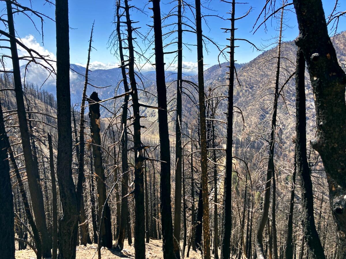
Now, I know burns are often beneficial to forests, but what came through much of the trail I hiked two weeks ago, high in the San Gabriels off Angeles Crest Highway, was cataclysmic. The dense forest was reduced to burned trunks that from a distance looked like blackened toothpicks. The nearby highway, once hidden from view by healthy trees, was almost always visible, as if to remind hikers of the fossil-fuel consumption driving this destruction.
Still, about halfway into the hike, there were signs of survival and renewal. An area that I feared had been damaged looked almost unscathed. Other hikers were enjoying this section of the trail, perhaps thankful as I was. This contrast — between being utterly unprepared for the destruction I saw and pleasantly surprised by what remained — prompted me to check in with an expert about this forest and these mountains, just to see if I was being alarmist.
“Sadly, no,” said Alan Coles, a 30-year U.S. Forest Service volunteer who spends most of his weekends working on public trails. “Because it’s the plants that adapt to the climate, not the climate that adapts to the plants.”
I knew of Coles from his letters to The Times about forest management and his contributions to an online trail guide. He has scouted some of the areas hit particularly hard by the Bobcat fire, working with trail restoration crews to allow for safe public access to the forest in time for the April 1 reopening (parts of the Bobcat fire burn area remain closed). He told me the area I saw, about 6,700 feet in elevation, was hit hard, so the pines and firs there were almost completely killed off, leaving little chance of recovery.
Over the coming years, he said, the dead trees will fall, probably to be replaced by lower-lying chaparral. He pointed out places where this is already happening, in areas burned by the 2009 Station fire and previous disasters. Throw in global warming and the droughts and wildfires to come that will surpass what we can imagine now, and it’s hard to imagine future wanderers enjoying the generous tree canopies that shade our mountain climbs on sunny days.
My conversation with Coles felt at times like an impromptu grief counseling session. We traded stories of places permanently changed, animals and plants disappearing from the forest, and our experiences with the dreaded poodle dog bush (it’s a “fire follower” growing everywhere now, and under no circumstances should you touch it).
With much of the Bobcat fire burn area reopened and the summer hiking season about the begin, Coles and other trail workers want visitors to understand the forest is still in recovery: So stay on the trail, pack out trash, keep dogs leashed and — for the love of God — avoid starting the next fire.
As we were leaving the San Gabriels recently, I told my three children to look around and try to imprint on their memories what they were experiencing at that moment — the smells, the breeze, the rocky ridgeline trapping the last rays of daylight. Remember it, because every visit to the mountains could be your final goodbye to the forest you know.
More to Read
A cure for the common opinion
Get thought-provoking perspectives with our weekly newsletter.
You may occasionally receive promotional content from the Los Angeles Times.


