Firefighters Try to Bulldoze Palomar Blaze : They Hope to Cut Path That Will Stop Spread of Persistent Flames
- Share via
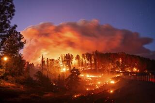
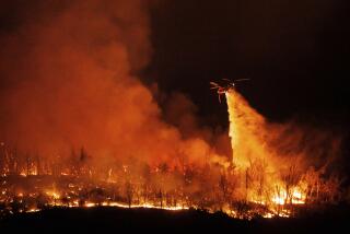
Firefighters used bulldozers Wednesday to cut a swath through dry chaparral and timber that have fueled a relentless fire, which has been burning out of control for five days in about 13 square miles of rugged wilderness near Palomar Mountain.
U.S. Forest Service spokesman Dick Marlowe said firefighters hope to bulldoze a wide enough path through the vegetation and timber to stop the spread of the fire. On Wednesday, Marlowe estimated that the fire has burned 10,000 acres within 13 square miles. He put the cost of fighting the blaze at more than $900,000.
“Looks like we’ve got two or three days of hard work to (bulldoze) a line completely around the fire,” Marlowe said.
Significantly cooler temperatures and higher humidity Wednesday helped firefighters restrict the fire’s movement and allowed them to start getting the upper hand on the blaze, which Marlowe said is 50% contained. Wednesday’s temperatures were reported in the high 70s and low 80s, more than 20 degrees cooler than the 102-degree temperatures reported on Tuesday.
However, firefighters still do not know when the fire will be completely contained.
“The 50% that we have contained is in the area where the fire originally started,” said Marlowe. “Barring a good rainstorm in the meantime, our best guess is that it will be early next week before we can even begin to talk about estimated containment.”
Uninhabited Area
The fire began at 3 p.m. Saturday near Quail Road and Rincon Ranch Road, southwest of Palomar Mountain near California 76. Authorities say that they are still investigating the cause of the fire. However, some California Department of Forestry officials said the fire may have been started by someone burning leaves or other debris.
The fire is burning in a rugged, uninhabited area characterized by jagged peaks and steep canyons. Officials have reported four residences and four detached buildings lost to the fire.
On Wednesday, fire officials reported the northern boundary of the fire as stretching from Agua Tibia Creek to Eagle Crag on the Pala Indian Reservation. The fire’s eastern boundary ran roughly from west of Webber Ranch, then south through Doane Valley, along the western slope of Palomar Mountain. The western edge stretched roughly from the southern tip of Doane Valley northwest to an area near the small community of Agua Tibia.
California 76 remained open Wednesday, but the California Highway Patrol kept San Diego County road S-6 closed to all traffic and S-7 to all but local residents.
The fire has burned much of the Pala Indian Reservation, including an area that was commercially logged about 15 years ago.
“We’ve got some dead logs up there that are feeding the fire and, sadly, we had some pretty good (saplings) that are being lost,” said Marlowe. “ . . . Some of the other forest timber that is being lost has been there for about 250 years.”
According to Marlowe, the brush in the area of the Cleveland National Forest that is known as the Agua Tibia Wilderness has not been touched by fire in 95 years. The timber that has been lost to the fire in the higher elevations includes Douglas fir, Jeffrey pine, white fir and oak. The fire is burning in elevations between 3,200 and 5,000 feet.
The number of firefighters battling the blaze increased to about 1,800 on Wednesday, Marlowe said, as more out-of-state firefighters arrived to help. Twenty-seven injuries, all of them minor, have been reported among firefighters since Saturday.
Wilderness Areas
Firefighters are using 12 air tankers, 3 helicopters, 15 bulldozers and 163 engines to fight the fire. In order to conform with federal environmental laws, the firefighting crews have to obtain U.S. government permits before using bulldozers in the designated wilderness areas, Marlowe said.
California Department of Forestry and federal Forest Service officials began meeting Wednesday to discuss the damage done to vegetation on both state and federal land.
“We have an interagency team already working to assess the damage and discuss how to best rehabilitate the area. The more important issue at hand, with winter just around the corner, is deciding which areas need to be reseeded first,” Marlowe said.
California and U.S. Forest Service officials are concerned that if the burned areas are not reseeded quickly, winter rains could produce disastrous mud slides.
Times staff writer Billie Sutherland contributed to this story.
More to Read
Sign up for Essential California
The most important California stories and recommendations in your inbox every morning.
You may occasionally receive promotional content from the Los Angeles Times.


