Trouble Blows In on 100-M.P.H. Santa Anas
- Share via
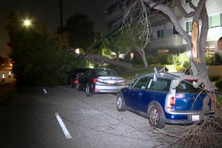
Chill, dry Santa Ana winds howled down Southern California’s mountain passes and canyons at speeds of up to 100 m.p.h. Monday, toppling trucks, shredding Christmas decorations and kicking up dust storms that triggered traffic accidents and forced the temporary closure of three freeways.
In addition, power was knocked out to thousands of residential and business customers in widely scattered areas, and arcing power lines, downed by the hurricane-force gusts, ignited several small brush fires.
The flames were quickly extinguished, but officials said the winds, generated by a vast complex of weather systems over the Rockies, were parching the already dry Los Angeles Basin, increasing the danger of additional fires.
The powerful winds prompted the Orange County Fire Department to call a “red flag alert,” an extra high state of readiness to protect against the threat of wind-whipped fires. But department spokeswoman Kathleen Cha said that firefighters handled only a few brush fires. At nightfall, firefighters had contained most of a four-acre blaze that had started Monday afternoon on Bonita Canyon Drive in Sunny Hills.
While most of the wind damage was confined to San Bernardino, Riverside and Orange counties Monday morning, forecasters said the Santa Anas should begin moving into the Los Angeles area before dawn today.
The winds are threatening the second Medfly pesticide spraying in Orange County history, scheduled for tonight at 9 p.m. over an 11-square-mile area that includes parts of La Habra, Brea and Fullerton. State agriculture officials said they may not be able to spray if the winds exceed 5 m.p.h., for fear of spreading the pesticide mix beyond the target area.
But meteorologists were optimistic that the winds wouldn’t interfere with the aerial spraying. Sunny skies and temperatures ranging from the mid-60s to mid-70s have been forecast for today.
The strongest winds reported Monday were gusts of 100 m.p.h. near the Grapevine in southern Kern County, 85 m.p.h near Devore at the base of Cajon Pass, and 80 m.p.h. on the hilltops above Point Mugu in Ventura County.
As is often the case with Santa Anas, communities below the Cajon Pass in the San Bernardino area were among the hardest hit Monday, with portions of three freeways there closed by opaque clouds of wind-whipped dust and sand.
“The traffic is heavy; the visibility is poor and down to zero in some stretches,” California Highway Patrol Officer Marty Bell reported Monday morning from San Bernardino. “It’s best to just stay out of the area altogether if possible.”
The winds prevented about 60 sixth-graders at Trabuco Elementary School from venturing on a weeklong trip to the Arbolado Science Camp in the San Bernardino Mountains. School officials canceled the trip after CHP officers warned that it would be dangerous to travel in buses to the camp, which is located at the 6,500-foot level. The 6th-grade class will try again today.
By noon, at least four big rigs, a number of travel trailers and several motorcycles had been blown over by the heavy winds, most of them on California 60 and Interstate 15, east of Ontario.
No serious injuries were reported, but one unidentified driver was scraped and bruised when the winds toppled his truck.
A CHP officer said the back window of his patrol car was blown out by a strong gust. Several motorists took refuge on the lee side of embankments and overpasses to wait out the fiercest of the winds.
“It was blowing like mad,” said John Anderson, a CHP spokesman in Riverside. “And the dust. Whew! What a mess. A lot of people were just waiting out the storm.”
Anderson said one travel trailer was ripped from the pickup truck towing it and tossed over the guardrail of an overpass above California 60, east of Ontario. He said the driver “probably got to Indio, looked in his rear-view mirror and then wondered where that son of a gun was.”
A section of Interstate 10 near Ontario International Airport also was closed for a time, but the airport was able to maintain normal flight operations.
At John Wayne Airport, gusts were clocked at up to 35 m.p.h., forcing aircraft to take off in an inland direction rather than over the ocean.
The CHP reported no wind-related troubles on most Orange County highways. Dust storms, however, limited visibility to about a mile on the Riverside Freeway in Anaheim.
Outdoor Christmas decorations took a beating, especially in western San Bernardino County, and trees blew over at Christmas tree lots throughout the Southland.
The gusts churned up waves during some unusually high tides along the coast. Several stretches of Pacific Coast Highway in Orange County were sporadically awash with seawater Monday morning. Forecasters said similar conditions could occur today.
Power lines were downed across a broad swath of the Southland, knocking out service to at least 16,000 homes and businesses in Orange County and causing scattered outages in other areas.
Southern California Edison Co. crews were kept busy restoring electrical service during the morning. Edison spokesman Steve Nelson said most of the outages were momentary, although some areas were without power for considerably longer periods.
Downed lines started several small brush fires that were quickly brought under control in the Glen Avon area of Riverside County.
But fire officials said the low humidity that accompanied the arid Santa Ana winds was drying out the already-parched chaparral in the foothills and was threatening to whip any blazes that started into major fires.
Rick Dittmann, a meteorologist with WeatherData, said the strong winds resulted from the interaction of two major weather systems over the Rockies.
The first system, a cold and vigorous high-level storm system, pulled a strong and arid high-pressure system in behind it, Dittmann said, generating a chilly stream of dry, down-slope winds that rapidly invaded Southern California.
Orange County escaped the hurricane-force winds because “the surface low pressure area was not far enough south and west,” he explained.
Temperatures and humidity dropped as the winds rattled into the Southland.
Thermometer readings in the chilly mid-40s were common Monday morning, with a low at the Los Angeles Civic Center of 47 degrees. The humidity in downtown Los Angeles dropped from a high of 86% to a low of just 16%.
National Weather Service meteorologists said they expect the high-pressure system to stay in place long enough for a resumption of strong winds before dawn that will not ease until sometime this afternoon.
WeatherData meteorologists said they expect the high pressure to begin moving east a little sooner, with lesser winds diminishing earlier.
Forecasters agreed that today’s high temperatures should be mostly in the 70s.
Warren reported from the Riverside-San Bernardino area; Malnic reported from Los Angeles. Times staff writers Davan Maharaj, Chris Woodyard and Ted Johnson contributed from Orange County and Carol McGraw from Los Angeles.
More to Read
Sign up for Essential California
The most important California stories and recommendations in your inbox every morning.
You may occasionally receive promotional content from the Los Angeles Times.


